Winter weather returns bringing drastic temperature drop Tuesday

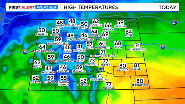
Today will be windy and warm before our next storm system arrives.
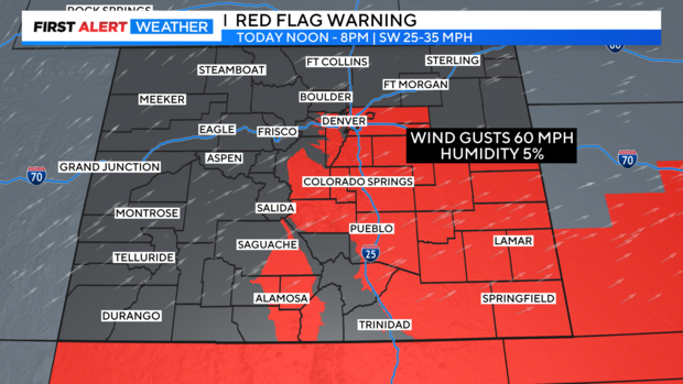
A Red Flag Warning is in place from 12 p.m. through this evening. We could see gusts up to 60 miles per hour.
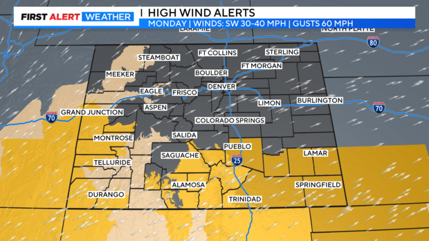
Today, in southern Colorado, High Wind Warnings, Watches, and Advisories are in place for strong winds.
Snow showers will start in the mountains this afternoon and this evening with the heaviest snow expected tonight in the mountains prompting a Winter Storm Watch and Winter Weather Advisory.
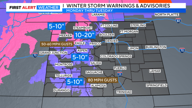
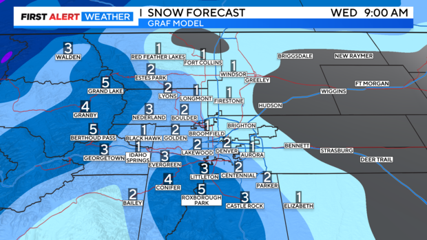
Tuesday will be a First Alert Weather Day thanks to the snow and cold set to blow in. The cold front will push through the Front Range around 3 a.m. and behind the front snow will develop. There will be little accumulation for the morning commute, but roads could be wet. In the Denver metro area we could pick up 1 to 2 inches of snow by early Wednesday morning.
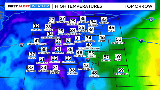
The big change will be the drastic drop in temperatures. It will be 30-35 degrees colder compared to today, with daytime highs in the 30s.
The winter-like weather doesn't stick around long; a warming trend starts Thursday. Opening Day for the Colorado Rockies looks to be on the mild side with temperatures in the low 50s.

The warm-up continues through the weekend with temperatures in the upper 60s and low 70s by Easter Sunday.