Winter Storm Watch Posted For Wednesday
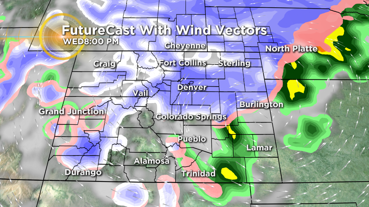
DENVER (CBS)- We are tracking a big storm system that is forecast to blast into the central Rockies on Wednesday with strong wind, rain and snow. There are several Winter Storm Watches that are posted for this midweek weather maker. At this time, the Denver Metro Area does have the potential for 3 to 6 inches of snow. However, we need to stress models are not yet in agreement on the exact track so that snow amount can and probably will change as we move into Tuesday and Wednesday.
The Winter Storm Watches are for a big blast of wind and snow for Wednesday through Thursday morning. The eastern plains from Castle Rock north and east into Nebraska and Kansas have the potential for 4 to 7 inches of snow and wind gusts up to 70 mph!
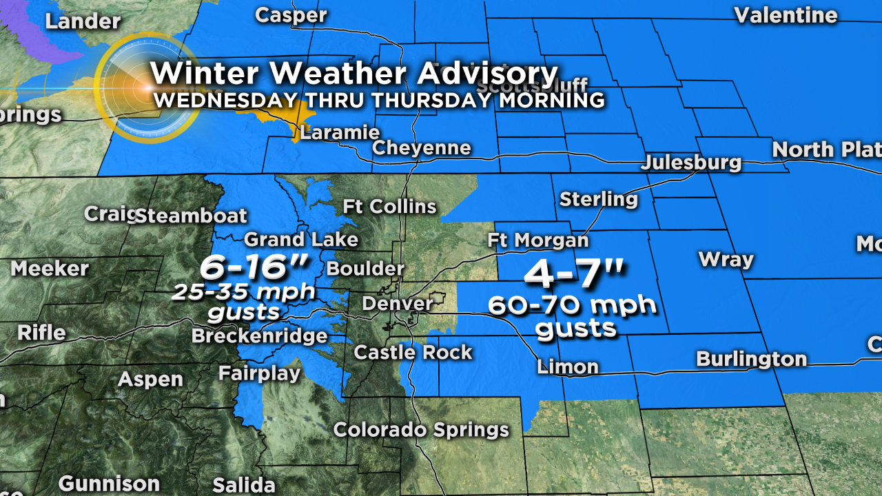
There is the potential for blizzard or blizzard-like conditions to hit this part of the state Wednesday into Thursday. With that being said there is a chance this storm may be strong enough to force the closure of many of those eastern roads and highways leading toward Kansas and Nebraska. If you are planning to travel east midweek check with CBSDenver.com and CDOT for the latest road conditions.
As we get closer to mid-week the Denver Metro Area may get included in the advisory areas.
There is also, a winter weather advisory for the central mountains for 6 to 16 inches of snow and gusts up to 35 mph once the storm system ramps up.