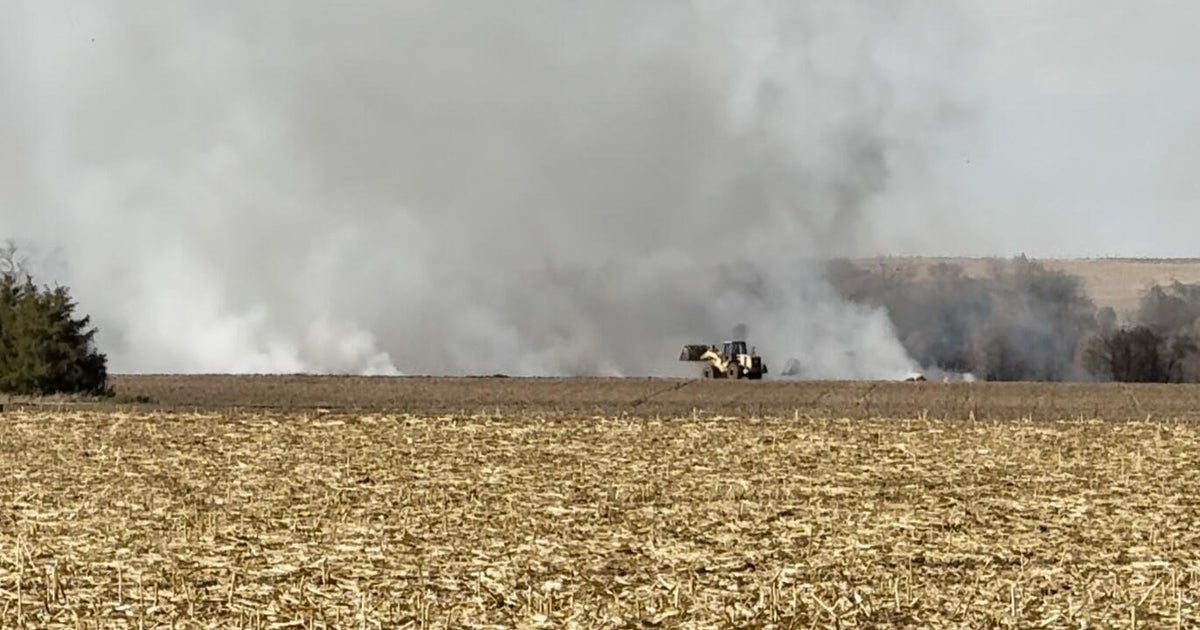
Wind On Tuesday Similar To What Flamed The Marshall Fire, Fortunately Fire Danger Is Now Almost Nonexistent
DENVER (CBS4) - The higher terrain west of Denver, Boulder, and Fort Collins is under a High Wind Warning through 5 p.m. Tuesday. Hurricane force wind gusts are likely as the latest winter storm to hit Colorado arrives.
The strongest wind on Tuesday should stay west of the Superior and Louisville areas where more residents were allowed to return home on Monday. But even lower elevations in Boulder County as well as most of the Denver metro area could experience wind gusts up to at least 45 mph.
Meanwhile, areas above 6,000 feet in Jefferson and Boulder Counties will have gusts up to 80 mph while all of Larimer County including Fort Collins and Loveland could experience wind gusts up to 65 mph.
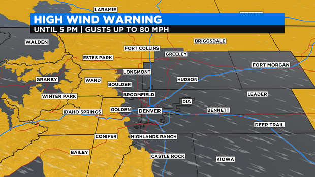
The same is true in far northeast Colorado where there is also a High Wind Warning for the Sterling, Julesburg, and Holyoke areas for gusts reaching over 60 mph at times.
In the mountains, Summit County and the Winter Park area could also have wind gusts up to 80 mph along with snow gradually developing throughout the day. The heaviest snow and worst driving conditions will wait until Tuesday night into Wednesday when travel along some mountain roads will become impossible with near zero visibility.
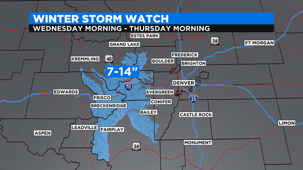
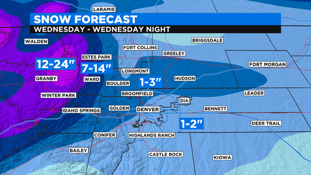
There is a Winter Storm Watch for the I-70 mountain corridor from Georgetown to Copper Mountain for 7 to 14 inches of snow from Wednesday morning through Thursday morning.
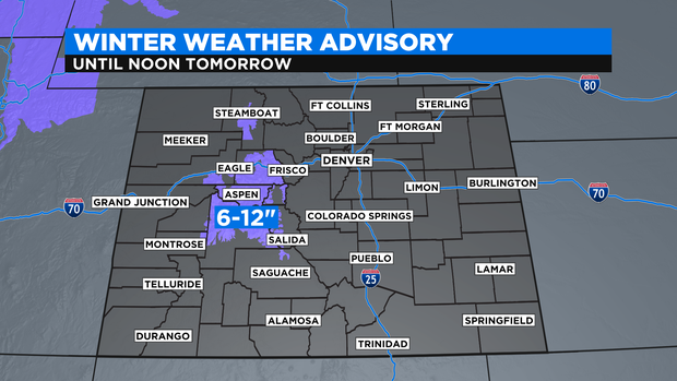
Farther west there is a Winter Weather Advisory from Vail Pass to Eagle and south into Aspen, Snowmass, and Crested Butte for 6 to 12 inches of snow.
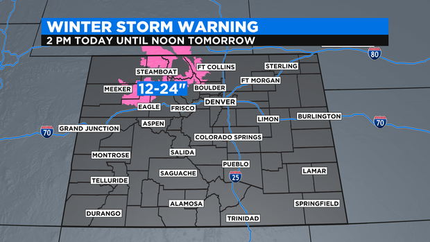
And to the north of I-70 the National Weather Service has issued a Winter Storm Warning from 2 p.m. Tuesday until 12 p.m. on Wednesday for 12 to 24 inches of snow around Steamboat Springs, Rabbit Ears Pass, The Flat Tops, and the Rocky Mountain Nation Park region.
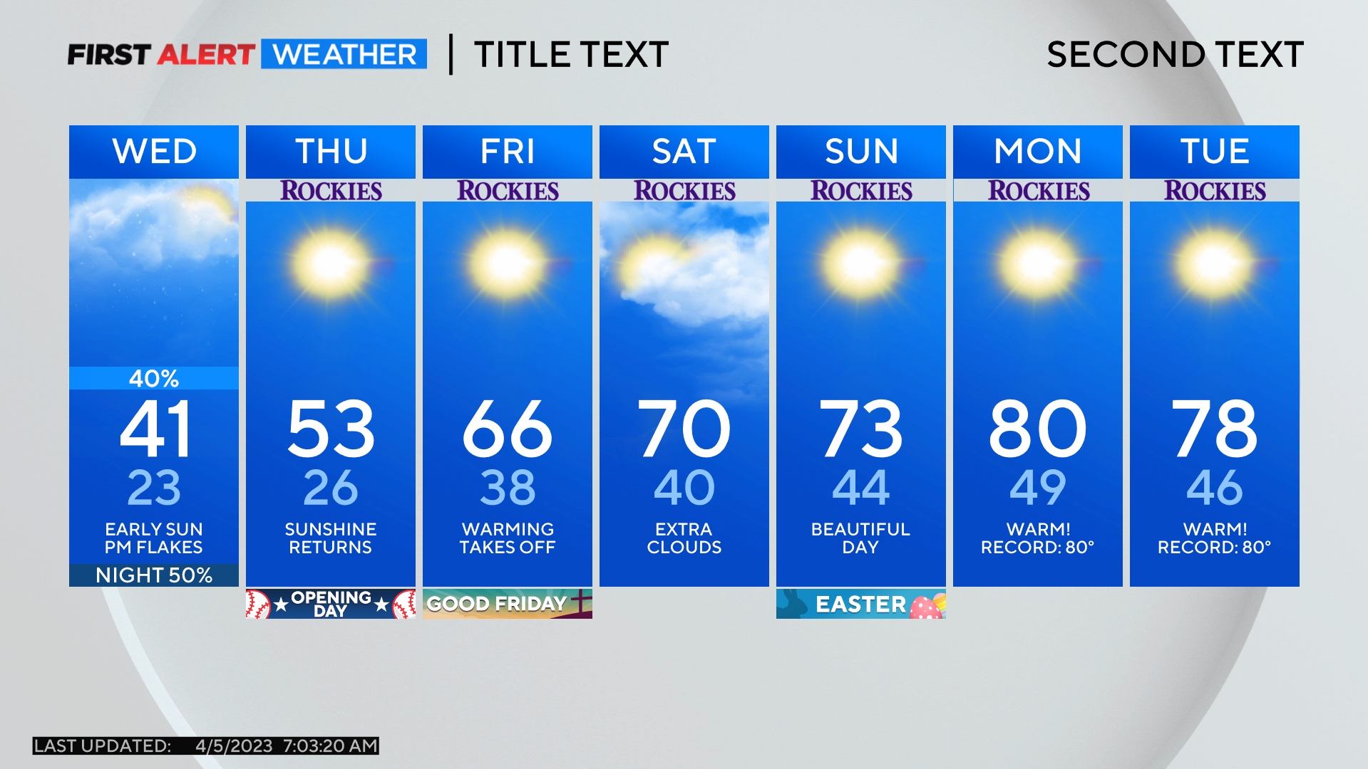
For Denver and the Front Range, snow is also in the forecast but amounts will be far less compared to the mountains. For most neighborhoods around Denver, Boulder, and Fort Collins, there should be no more than 1-2 inches of snow with isolated higher amounts up to 3-4 inches. Snow will start as early as Wednesday afternoon but most of the accumulation will wait until Wednesday evening.
All of the snow in the metro area is expected to end before Thursday morning drive before very cold temperatures become entrenched for the entire day on Thursday. Temperatures will not climb above freezing until Friday afternoon.