Colorado storm to bring rain, mountain snow next week

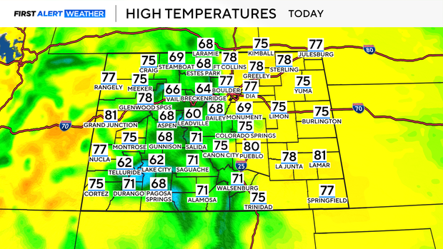
Expect a beautiful Saturday across the state as high pressure builds in, bringing mostly sunny skies and above-normal temperatures. Highs will climb into the 70s along the plains and urban corridor, with 50s and 60s in the foothills and mountains. Winds will remain light, and the air dry, making for a pleasant day across much of Colorado. There's a slight chance of an isolated afternoon shower or weak thunderstorm in the southwestern mountains, but most areas will stay dry. Overnight lows will remain mild, dropping into the 40s for the Denver metro area, with 30s in the higher elevations.
Sunday starts off much like Saturday - dry and warm - but moisture will begin to creep in during the afternoon. Expect breezy southeast winds, especially east of I-25, with gusts up to 40 mph. Scattered showers and a few thunderstorms will begin developing in the mountains by late afternoon, possibly spreading into the I-25 corridor and Palmer Divide during the evening.
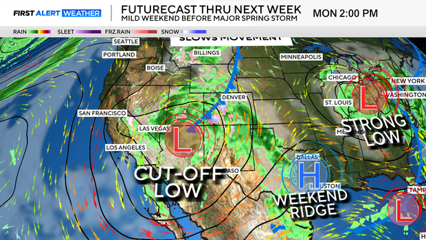
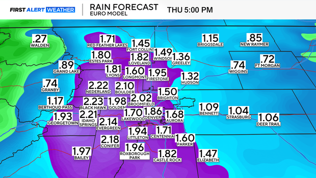
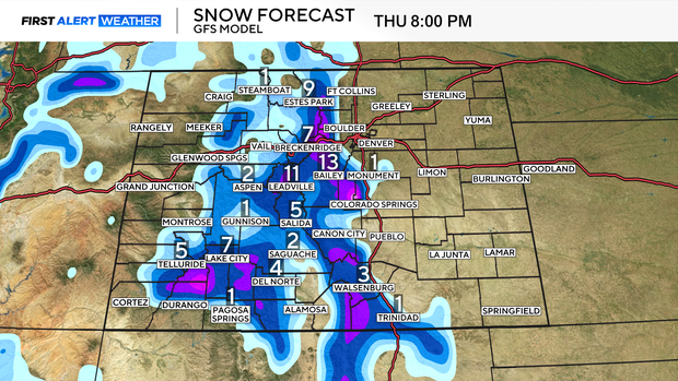
A strong spring storm system arrives Monday and is expected to linger into Wednesday bringing widespread beneficial precipitation for much of the state.
Expect soaking rainfall across the plains and foothills, where 1-2 inches of rain are possible through Wednesday.
In the high country, snow levels will begin above 9,500-10,000 feet on Monday but could lower to around 8,000 feet by Tuesday night.
Precipitation will gradually taper off Wednesday, with a slow warming trend beginning Thursday and continuing into next weekend. Expect highs to climb back above normal by Friday.