Unsettled weather moves into Colorado for the first week of April
After last week's warm, quiet, summer-like weather, we are settling into an unsettled week of weather across the state.
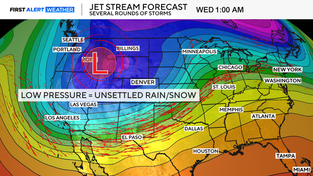
A dip in our jet stream brings the changes that will kick off across the state on Monday night for the high country.
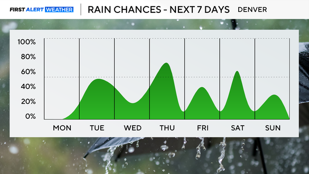
Nearly each day this week presents rain chances, with the best chance of impactful weather carrying us into the weekend.
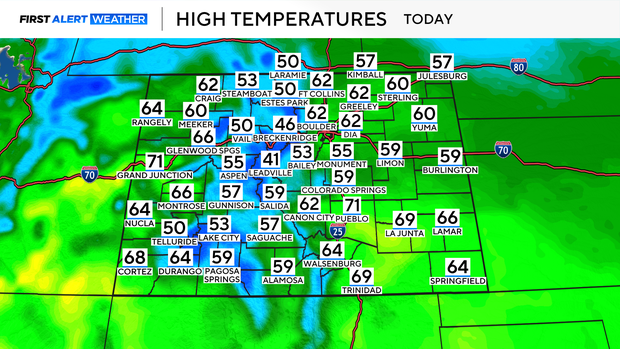
Monday will bring the nicest weather of the week, as high temperatures climb into the low 60s across the Denver metro area under a partly sunny sky.
Most of the day will stay dry for the majority of the state, but by Monday night changes roll into the mountains.
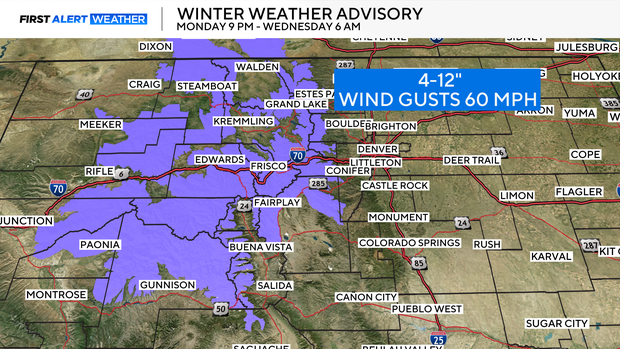
Winter Weather Advisories will go into place for the central and northern mountains beginning late Monday.
For most areas 4-10" of snow is expected, with some mountain areas picking up as much as 12" of snow.
Winds could also gust as high as 60 mph at times above the tree line.
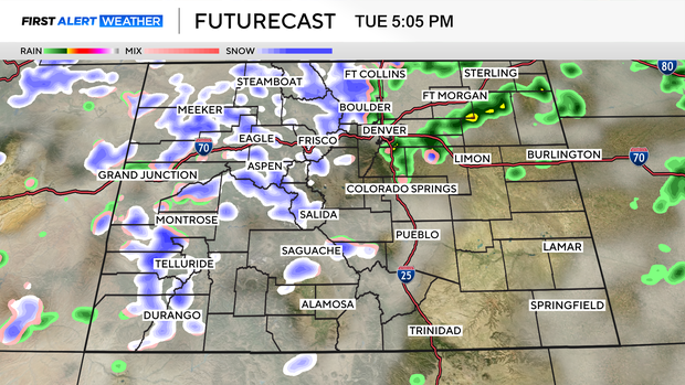
By Tuesday rain chances trickle down into the lower elevations. Tuesday morning comes with a chance of some showers, with more scattered showers and storms expected Tuesday afternoon for the Denver area.
Temperatures will begin to decline on Tuesday, with highs only in the mid-50s.
Winds will also increase, gusting as high as 25 mph at times.
Overnight a rain/snow mix will move through for some, leaving little to no accumulation behind.
Wednesday morning into the early afternoon will likely be quiet and clear to start before more rain chances build by the afternoon hours.
The off-and-on showers and storms will continue through the rest of the week, but by Friday night, a transition from rain to snow could lead to measurable snow for the Denver metro area.