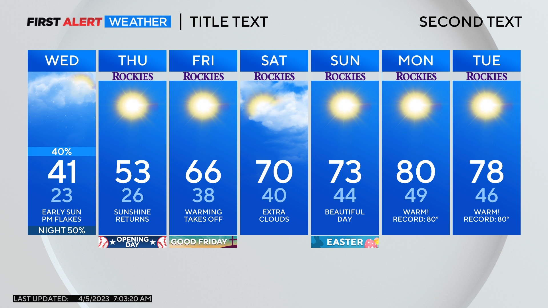
Summer snow possible atop 14ers on Wednesday, rain showers for the metro area
A quick moving storm system crossing Colorado on Wednesday will bring rain to many parts of the state. Light snow may also fall over the highest peaks and far above pass level.
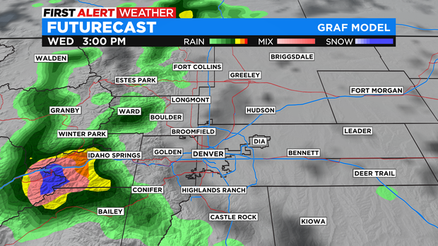
Rain on the western slope Wednesday morning will gradually move east over the mountains through the early afternoon. Most mountain towns including Silverthorne, Vail, and Winter Park will have periods of rain and a chance for a couple heavy downpours.
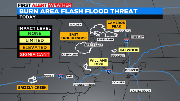
The threat for flash flooding over the burn scars is lower compared to earlier in the summer but there is a still an elevated threat for the scars left behind from wildfires like Cameron Peak, East Troublesome, and Grizzly Creek.
For Denver and the Front Range, the best chance for rain will be after 2 p.m. and before 7 p.m. on Wednesday although showers are possible earlier and later.
Any snow that falls in Colorado on Wednesday will be very high (above 13,500 feet) and any accumulation on the highest peaks in would be extremely limited. Late summer snow is not unusual in Colorado and is most common over the 14ers. Snow would certainly stay above mountain passes like Loveland and Berthoud and would have no impact along I-70 including near the Eisenhower Tunnel.
Another good chance for showers and a few thunderstorms will develop in the mountains on Thursday with about a 40% chance for rain around Denver, Boulder, and Fort Collins. Any lingering showers on Friday will be very isolated and the weekend should be completely dry statewide.