Summer heat returns to Colorado to finish off August
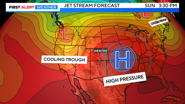
Get ready for a warm Wednesday! High pressure over the southwestern part of the country will be bringing in warm, dry air in westerly-southwest flow. This will also be a downslope pattern for the Front Range. That means warmer temperatures by as much as 10 to 12 degrees above the highs from Tuesday.
Front Range highs should rise into the 90s at the lower elevations with 80s and 70s in the Foothills.
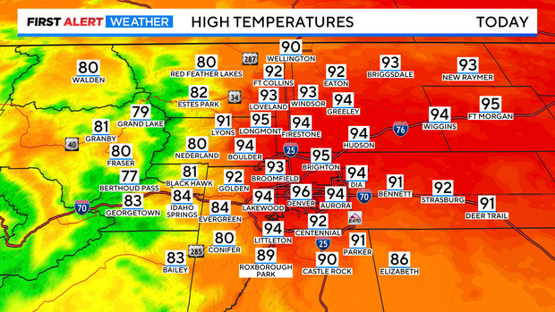
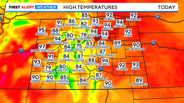
Statewide the bigger heat will be on the Western Slope with mid to upper 90s. We are looking at 70s and 80s in the mountains with 90s and high 80s for the eastern plains.
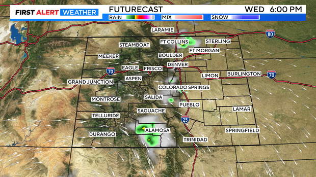
Skies will be sunny for most of the day. There is a little more moisture over the Rockies for Wednesday. This may be enough for a few very isolated thunderstorms to try and get going late afternoon. These will mostly be gusty with the best chance for rain with storms in northern Weld County over into the northeastern corner of the state as the evening goes on.
Thursday will be another hot one with mostly sunny skies. In fact, the 90s for the Denver metro area will hold on thru Saturday.
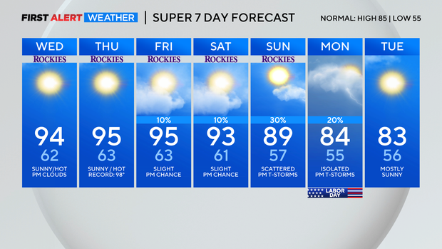
There is a chance for afternoon thunderstorms on Labor day with cooler temps dropping into the low 80s.