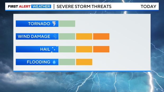
Strong to severe thunderstorms expected Friday afternoon, large hail and damaging wind gusts are possible
Another round of strong to severe thunderstorms will move from the high country to the urban corridor starting in the early afternoon hours on Friday. The storms will be capable of producing large hail and damaging wind gusts, in addition to heavy rain and frequent lightning. Therefore Friday afternoon has been declared a First Alert Weather Day.
The timing of the thunderstorms in the Denver, Boulder, and Fort Collins areas should be slightly earlier compared to Thursday. The best chance for storms will be after 1 p.m. and before 6 p.m. although a few additional showers or thunderstorms could develop later in the evening.
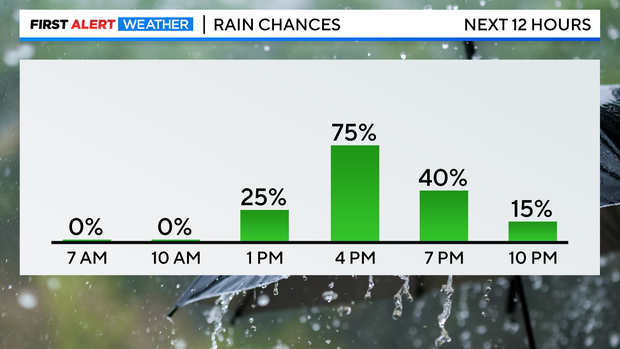
The greatest threat from the thunderstorms will be hail at least 1 inch diameter and wind gusts of at least 60 mph. The tornado threat on Friday is low but slightly higher than zero. And while the thunderstorms will be capable of producing heavy rain, they should be moving quick enough to prevent a widespread threat for flooding.
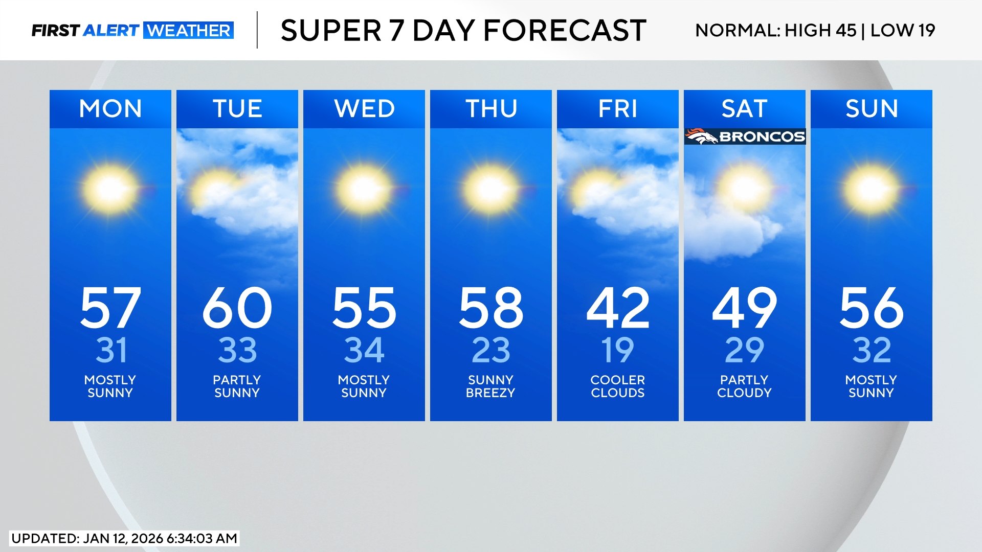
Looking ahead to the holiday weekend, the chance for afternoon and/or evening thunderstorms drops to 30% on Saturday and Sunday (compared to 60% on Friday). Then a somewhat better chance for late day thunderstorms develops again on Monday. The overall threat for severe weather over the weekend is lower compared to Friday.