Weekend weather: Storms return to Colorado Saturday and 90-degree heat is on the horizon

A round of strong thunderstorms is expected to develop across parts of Colorado Saturday afternoon, continuing an active weather pattern that's brought heavy rain, localized flooding, and frequent lightning to many areas in recent days.
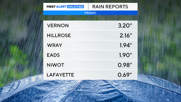
Saturday began with lingering clouds and cool, damp conditions across portions of the Front Range, especially following Friday night's intense storms that soaked northeast Colorado.
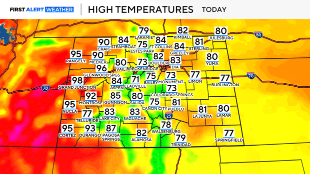
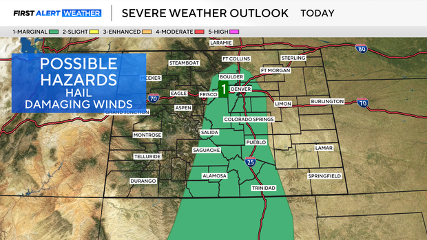
As drier air briefly filters in this morning, scattered afternoon thunderstorms are again in the forecast — particularly south of I-70, where the atmosphere remains unstable. While widespread severe weather is not expected, some storms could turn severe producing locally heavy rain, gusty winds, and hail.
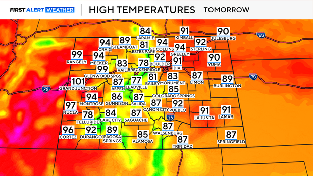
As the weekend progresses, storm coverage will decrease slightly on Sunday and Monday, but daily afternoon showers and storms will remain possible, especially over the mountains. Meanwhile, temperatures are on the rise. After a brief cooldown Saturday, much of the eastern plains and metro Denver will return to the low to mid 90s starting Sunday, a trend expected to continue through Monday.