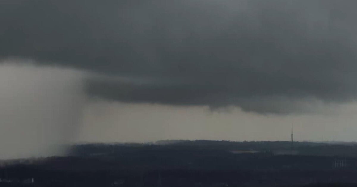
Storms move in on Wednesday before Colorado heats up for the weekend

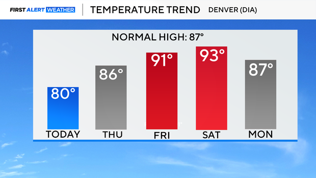
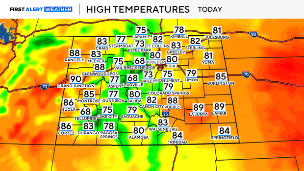
Another round of scattered storms are expected to pop up Wednesday — before the we settles into a drier, hotter stretch through the weekend. Wednesday daytime highs will be in the low 80s for the Front Range with 60s and 70s in the mountains.
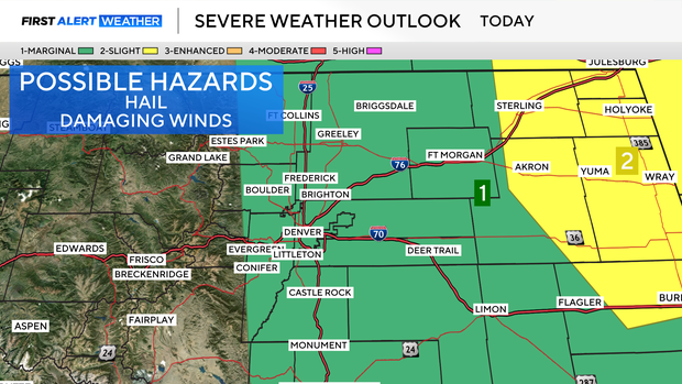
There's an chance for isolated severe storms, especially in the northeastern corner of the state. The Denver metro area and northern Colorado are under a level 1 - marginal risk for severe storms this afternoon. The storms will fire up in the mountains and spread into the plains, tapping into more instability as they move east into the Plains. Damaging winds of 60 to 70 mph and large hail are possible in the strongest cells. Some of these storms could also produce heavy rain, which could lead to localized flooding.
Starting Thursday, Colorado will shift gears. A ridge of high pressure building across the southern U.S. will usher in dry, stable air, dialing back rain chances significantly. Daytime highs will climb into the low to mid-90s across much of the state by Friday and Saturday — a sharp turn toward summer heat.