Spring warmth Thursday in Colorado before snow and cold return Friday

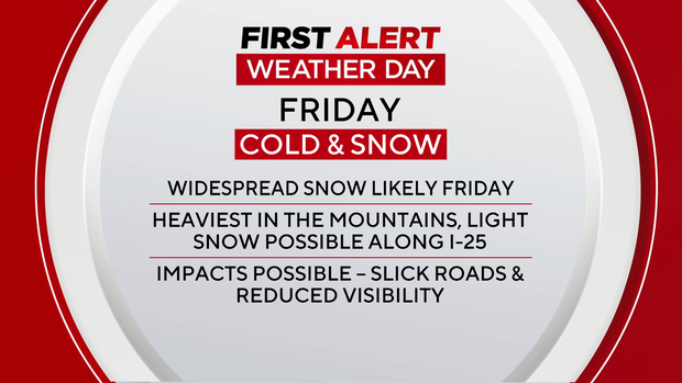
A quick swing in Colorado's weather will bring springlike warmth on Thursday before a colder storm delivers snow to parts of the state on Friday. Because of the expected snow and colder temperatures, Friday has been declared a First Alert Weather Day.
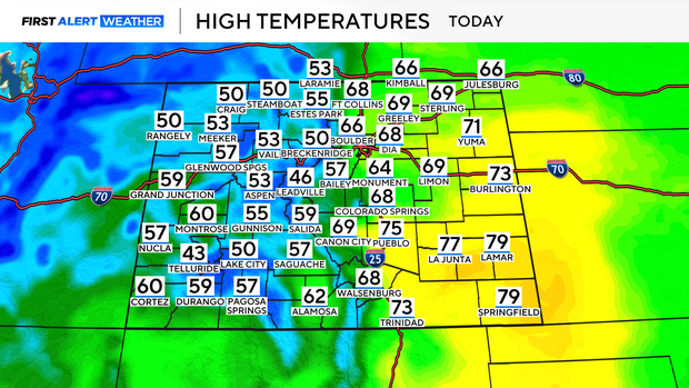
Thursday, temperatures will climb into the mid to upper 60s across the plains, including Denver, giving the region one more mild day before a major shift in the weather.
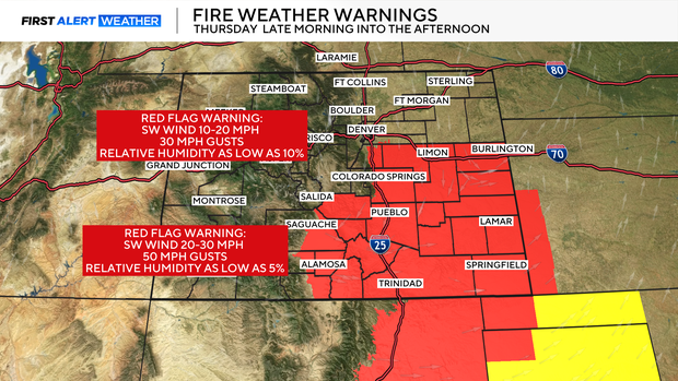
However, the warm conditions will come with gusty winds and very dry air, creating critical fire weather conditions on Thursday afternoon. The highest risk will be across the Palmer Divide and parts of eastern Colorado, including Lincoln County, where humidity could drop into the 10–15% range, and wind gusts may reach 25 to 30 mph. A Red Flag Warning is in effect for those areas from noon to 6 p.m. Thursday.
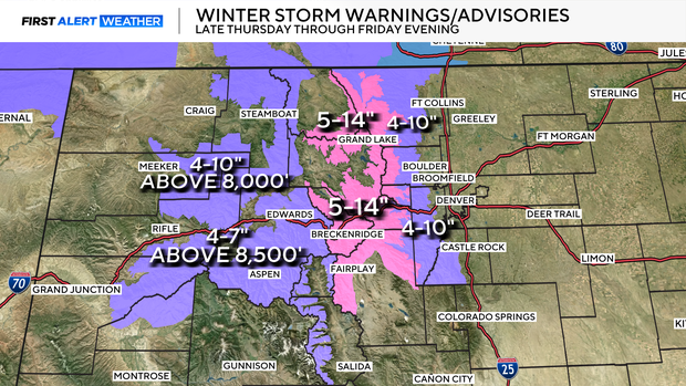
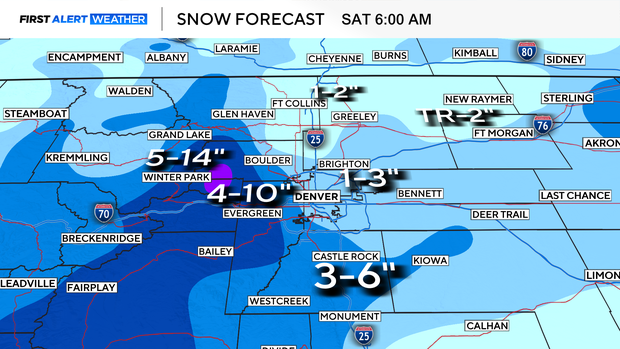
Snow will begin in the mountains and foothills late Thursday night, where moderate to locally heavy snow is expected through Friday. Some mountain areas along and east of the Continental Divide could see significant accumulation, and travel may become difficult due to blowing and drifting snow. A Winter Storm Warning is in effect late Thursday night through Friday evening for 6 to 14 inches of snow possible, with the heaviest accumulations generally from Berthoud Pass northward. A Winter Weather Advisory is in effect from Thursday night through Friday evening for the Southern Front Range Foothills, where 4 to 10 inches of new snow is expected in communities including Evergreen, Nederland, Idaho Springs, and Bailey.
By Friday morning, snow is expected to expand across the plains. 2 to 4 inches of snow could fall in the Denver metro area. The setup may favor slightly higher totals south of Denver toward the Palmer Divide and across the foothills.
Along the I-25 corridor, snow will likely be slushy, and moderate travel impacts are possible, especially during the Friday morning and evening commutes.
Along with the snow, temperatures will turn colder on Friday, with daytime highs only reaching the upper 30s across the Denver metro area.
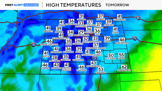
Snow should taper off Friday evening. Drier air will move into the state Saturday, bringing calmer conditions and temperatures closer to seasonal averages. By Sunday, downslope winds will help temperatures warm again, with highs returning to the 60s across the plains.


