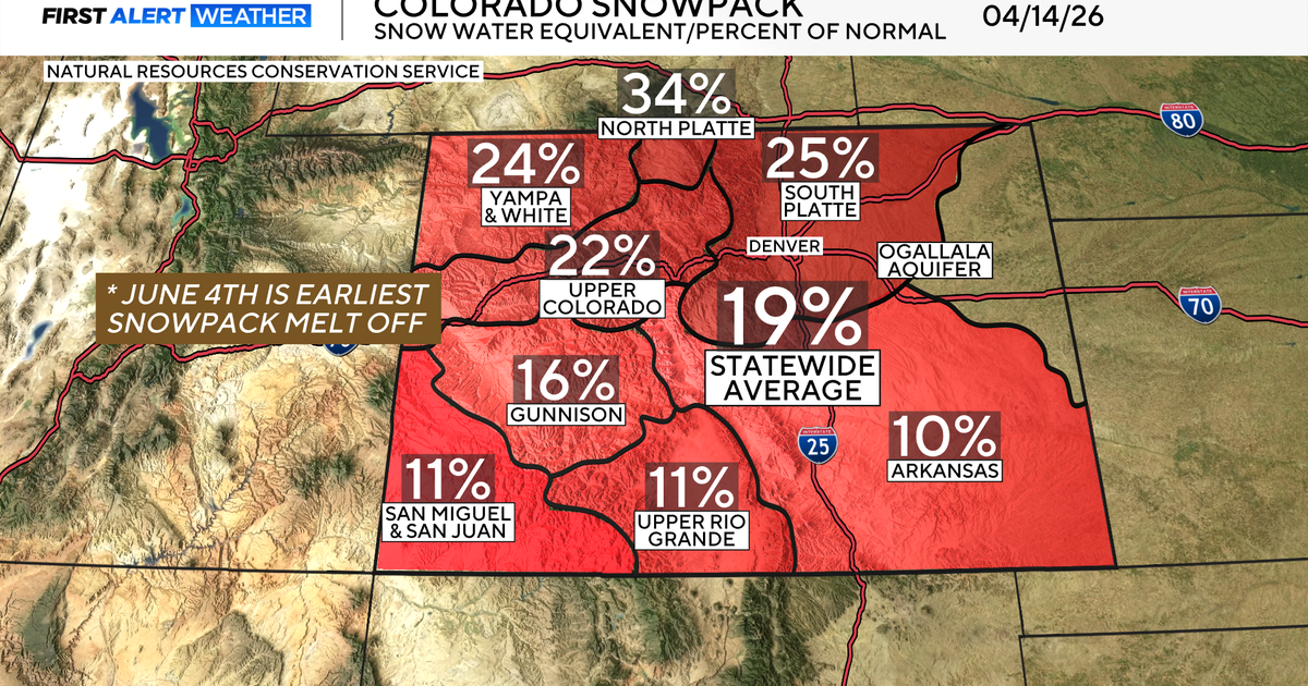
Snow On The Way For Almost All Of Colorado
DENVER (CBS4) - A storm battering southern California with rain and snow this week will track directly across Colorado this weekend. Snow is likely virtually statewide starting Friday but accumulation will be much higher in some areas compared to others.
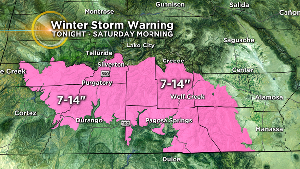
Because the storm is entering Colorado from the southwest, the San Juan Mountains will likely experience the heaviest snow in the state. A WINTER STORM WARNING starts at 11 p.m. Thursday and continues through 5 a.m. Saturday for areas such as Wolf Creek Pass, Silverton Mountain, and Purgatory. This region of the state will see at least 7 to 14 inches of snow.
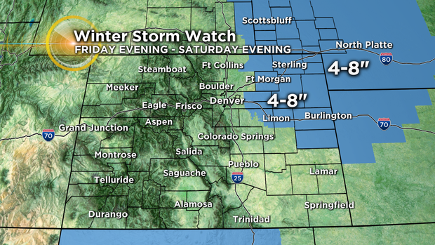
Closer to Denver, a WINTER STORM WATCH has been posted from Friday evening through Saturday evening for the northeast plains of Colorado. No part of the watch includes the metro area. Instead it's for locations such as Limon, Burlington, Fort Morgan, and Sterling where 4 to 8 inches of snow is likely during about a 24 hour period. Travel could become very difficult east of the metro area on I-76 and I-70.
Although no watches, warnings, or advisories have been issued for the Denver, Boulder, and Fort Collins areas, snow showers are still likely along the Front Range mainly Friday night into Saturday. However, the track of the storm is not favorable for much accumulation in the metro area. Most neighborhoods will see under 4 inches and some area may not see more than a trace of snow. Should the storm track change, the forecast obviously will need to be revised but that does not seem likely at this time.
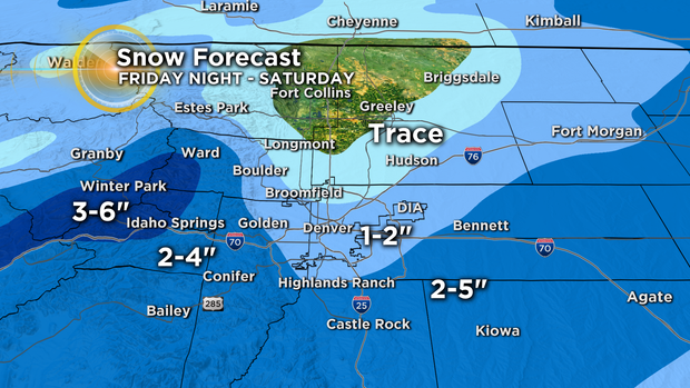
Meanwhile, snow is also likely along the I-70 mountain corridor by Friday night with snow showers continuing well into Saturday. At this time it does like look more than 3-6 inches for ski areas like Winter Park, Breckenridge, Loveland, Copper, and Vail.
Sunny skies will return on Sunday but temperatures will stay chilly. Highs will be in the 30s for the final Broncos game of the year Sunday afternoon.