Snow finally back in the forecast for Denver

If you've found yourself wondering where Denver's snow is this winter, you wouldn't be alone. It has been very dry and warm along the Front Range, and the first week of January has followed the trend.
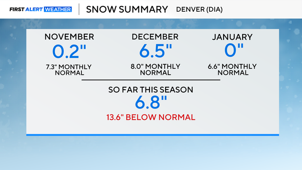
So far this season, only 6.8" of snow has fallen at Denver International Airport, when on average the airport receives 20.4" of snow by the end of December.
Normally, in January, 6.6" will fall at DIA, and we are on track to begin ticking away at that by Thursday.
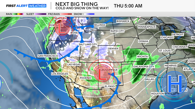
Two upper-level disturbances will play a role in the upcoming storm.
The first moves into northern Baja California later today, while a second arrives from the Pacific Northwest.
Then by Friday, cold temperatures arrive as more snow falls across the state, gradually clearing from North to South by Friday evening.
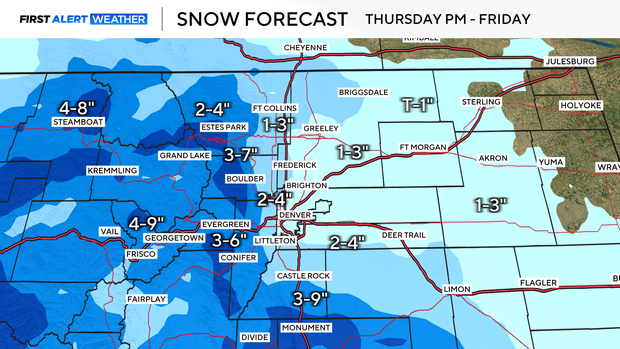
Where the storm sets up, and how quickly it arrives, will determine just how much snow will fall along the Front Range. Right now, Denver is on track to receive between 2-4" of snow.
Upslope flow will increase totals for the Foothills and the Palmer Divide.
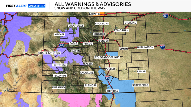
Winter Weather Advisories are in place for parts of the high country through Friday morning.
As much as 12" of snow could fall in the Elk Head and Park Mountains, Grand and Battlement Mesas, and West Elk and Sawatch Mountains.
Winter Storm Watches are in place for parts of Northern El Paso County, and Southern Colorado's Wet Mountains, where 5-11" of snow could fall.

Snow will come to an end on Friday as sunshine and dry weather return through the weekend.