Accumulating snow is back in the forecast for Denver

Accumulating snow is back in the forecast for Denver. Yes, you read that correctly.
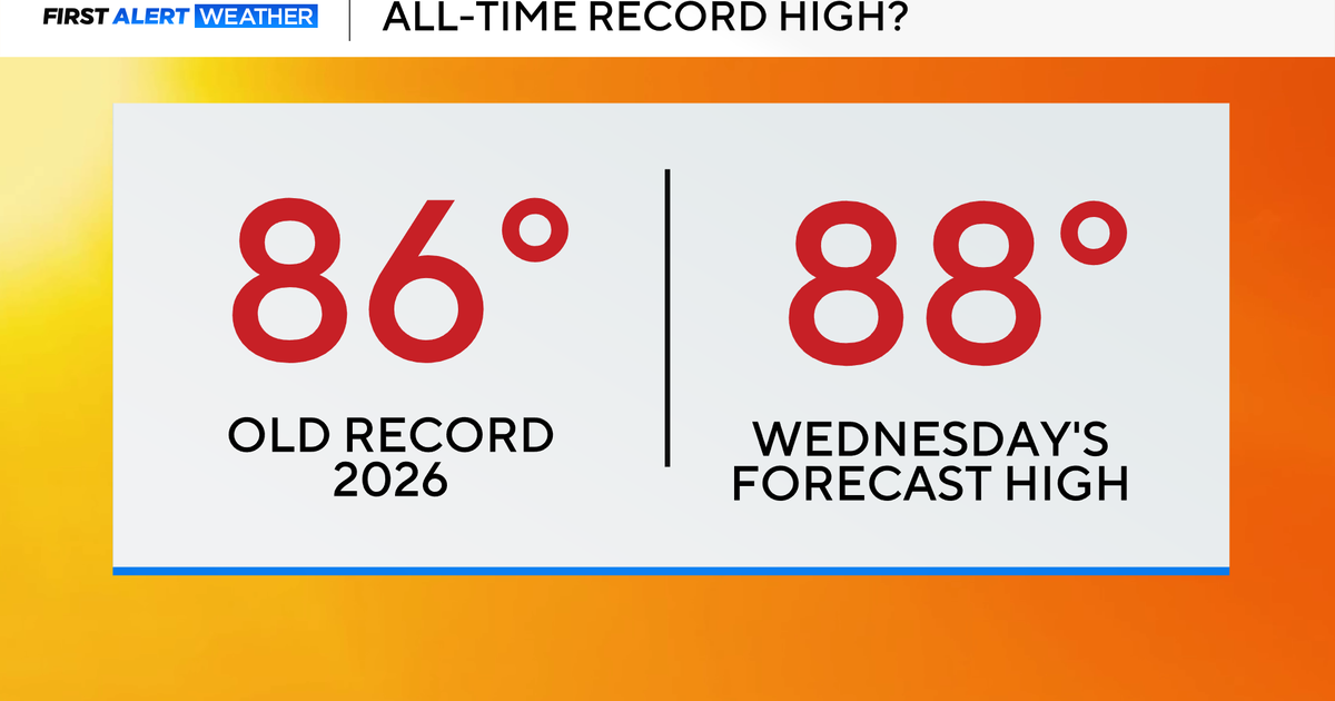
After days of record-breaking warmth, a brief return to winter is expected — right in the heart of the season.
Snow develops late Wednesday night across the Western Slope and the Continental Divide. Snow levels will be lower during the day on Thursday, with snow spreading east and reaching the Denver metro area and the far eastern plains by Thursday afternoon.
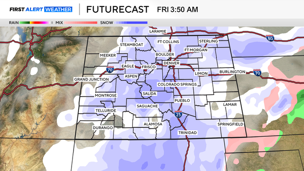
Light to moderate snow continues Thursday night into early Friday. This is when the Denver metro area is expected to see the bulk of the accumulation.
This is a fast-moving system. Snow ends from northwest to southeast between late Friday morning and early Friday afternoon, roughly from 9 a.m. through 3 p.m. That narrow window will limit overall totals.
One factor working in favor of accumulation is timing. Snow falls mainly overnight, when temperatures drop into the teens and 20s. Colder temperatures mean lighter, fluffier snow, allowing accumulations to add up more efficiently.
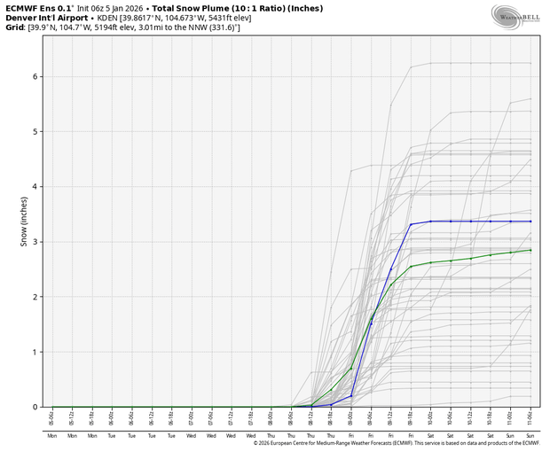
Snow-to-liquid ratio refers to how much snow falls for every inch of liquid water. A typical ratio is 10:1 — about 10 inches of snow per inch of liquid.
This storm will feature much colder temperatures, pushing ratios closer to 15:1 or even 20:1. Around 0.30 inches of liquid is expected. At a 10:1 ratio, that would produce about 3 inches of snow. With colder temperatures and higher ratios, the same amount of moisture could result in closer to 5–6 inches of snow.
The storm is a bit far out to release a snow map just yet, but stay tuned as we monitor trends over the next few days.