Record heat this weekend in Colorado, storm chances increase next week

Saturday and Sunday are First Alert Weather Days as Colorado heads into one of the hottest weekends of the summer.
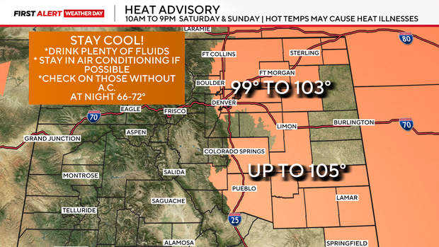
Temperatures will climb to near or above 100 degrees across much of the Front Range and eastern plains, creating dangerous heat conditions. A Heat Advisory is in effect Saturday and Sunday for the I-25 Corridor.
While the heat takes center stage this weekend, isolated to scattered afternoon thunderstorms will still develop, especially in the mountains, before a more active pattern returns early next week with increasing chances for heavy rain.
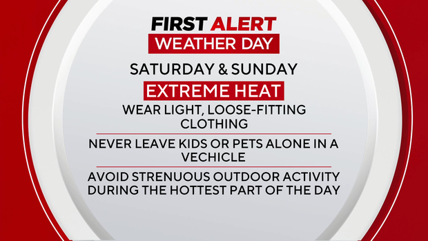
A strong ridge of high pressure parked over the central Rockies will keep temperatures soaring through Sunday.
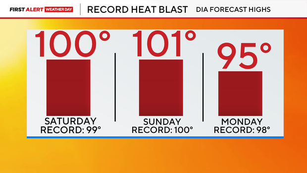
Highs Saturday will climb into the upper 90s to near 100 degrees across the Denver metro area. Sunday will be even hotter, with temperatures on the eastern plains reaching 100 to 105 degrees. Denver could also challenge daily record high temperatures both Saturday and Sunday.
Despite the hot weather, enough moisture remains in place for scattered thunderstorms each afternoon and evening. Storms will be most widespread over the Front Range mountains and foothills, with more isolated activity along the I-25 corridor. Most storms will produce gusty winds and brief rain, but a few could bring locally heavy downpours due to slow-moving cells.
Beginning Monday, monsoonal moisture will increase across Colorado as the ridge shifts slightly south. Temperatures will remain above average, but afternoon thunderstorms will become more numerous, with the potential for locally heavy rainfall and isolated flash flooding through the middle of the week.
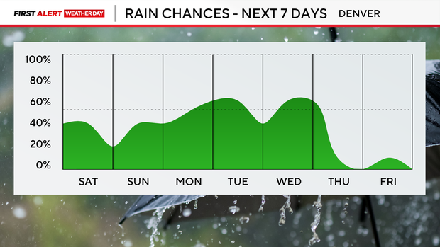
Temperatures should ease slightly during the middle of next week, although highs will remain above seasonal averages. Storm chances will stay elevated through Wednesday before gradually decreasing later in the week as somewhat drier air moves back into Colorado.


