From record heat to accumulating snow in Denver

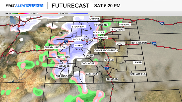
From record heat to accumulating snow across Colorado. Highs will reach about 59 degrees on Saturday before a strong cold front moves through around 10 p.m. Saturday night. Temperatures will tumble, with highs only near 29 degrees on Sunday.
That front will also bring accumulating snow to much of the state. Snow develops across the high country early Saturday morning, then intensifies through the evening hours. Travel could become tricky at mountain pass level and along the I-70 corridor by the Saturday evening commute.
Saturday night into Sunday morning, snow levels drop quickly. Accumulations are possible from Fort Collins to Boulder, Denver, Castle Rock, and Colorado Springs, extending all the way to Colorado's southern border.
Storm totals of 4 to 8 inches are expected across the high country, with locally higher amounts up to 14 inches at mountain pass level in the northern mountains and the highest peaks.
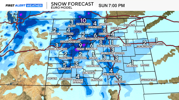
Up to 5 inches is possible in the foothills, with around 4 inches across the Denver metro.
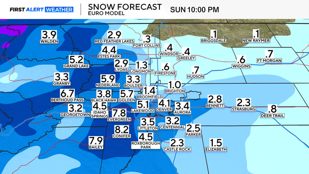
Keep in mind, with temperatures near 59 degrees on Saturday, some snow will melt initially. That could lead to slushy, wet accumulations, especially early in the event.