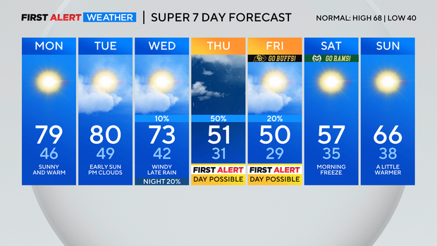
After a mild start to the week in Colorado, a cold front blows through in the middle of the week
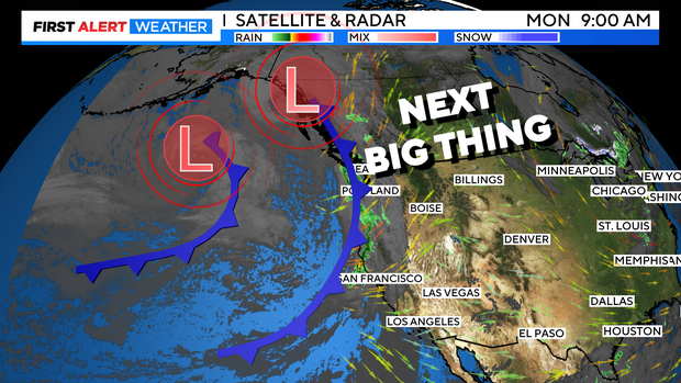
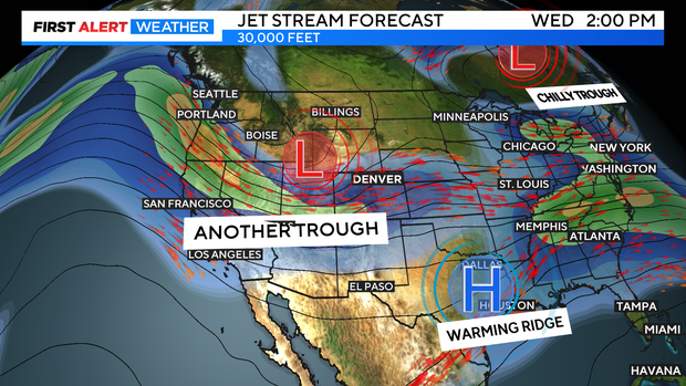
Another mild start to the work-week is underway! But, we are watching for the next Big Thing to arrive on Wednesday which is a cold front bringing back wind, rain and snow to Colorado.
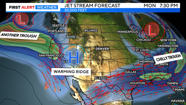
Skies over the state will be mostly sunny for Monday to kick off the week. A broad ridge of high pressure covering the Rocky Mountain Region.
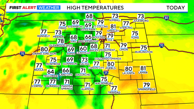
This will make for a mild few days with temperatures in Denver near 80 with 70s and 80s over the eastern plains and western slope. Mountains will be in the 50s and 60s.
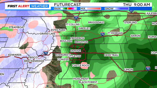
The next Big Thing Arrives on Wednesday with a cold front. Stronger winds will be picking up and the Front Range can expect rain late in the day on Wednesday afternoon. At the same time rain mixed with snow will be starting up in the High Country.
There is a good chance for several inches of snow in the northern and central mountains Wednesday night into Thursday morning. Preliminary models are subject to change but, are showing some areas may see as much as 3 to 8 inches of snowfall. Road conditions in the mountains on Thursday morning may be slick over the higher mountain passes.
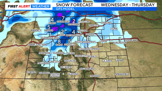
There is also a chance for snow along the Palmer Divide up into northeastern Colorado. At this time those areas will see a rain snow mix with small accumulations expected. There is an small chance there may a few flakes of snow mixed with rain in Aurora and Castle Rock down to Monument.
The clouds and the moisture should clear out by Friday morning. This will allow low temperatures to drop to the coldest levels of the season so far. The Denver Metro area may see the first freeze of the season on Friday morning and/or Saturday morning.