Quick shot of snow and colder temperatures Saturday in Denver

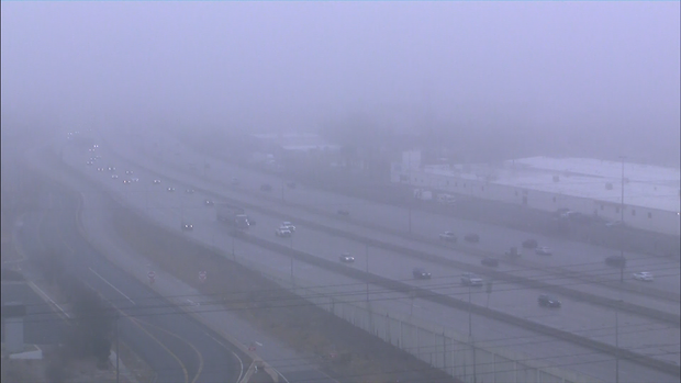
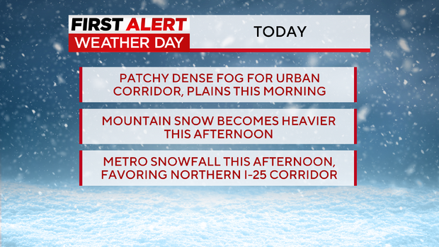
Foggy conditions Saturday morning will give way to a chance for light snow for the Denver metro area Saturday afternoon. A Dense Fog Advisory is in place through Saturday morning with visibility reduced to under a quarter a mile in some locations.
A First Alert Weather Day has been issued for Saturday for snow showers in the mountains and Denver metro.
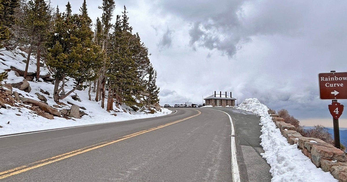
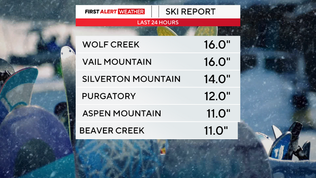
The Colorado mountains have picked up feet of snow in many mountain locations:
Most of the Front Range will pick up a dusting to an inch of snow, but some heavy bands of snow are possible, mainly north and south of the metro area with 2 to 4 inches of accumulation possible in places like Fort Collins, Firestone and the Palmer Divide.
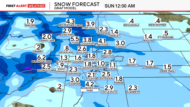
On Saturday, daytime highs will be below normal in the 30s for the I-25 corridor. The snow showers will come to an end tonight with gradual clearing by Sunday morning. In the mountains, the snow will be moderate to heavy at times Saturday afternoon with Winter Weather Advisory and Winter storm Warnings in effect through Saturday night. Expect difficult mountain travel with with gusts causing blowing and drifting snow.
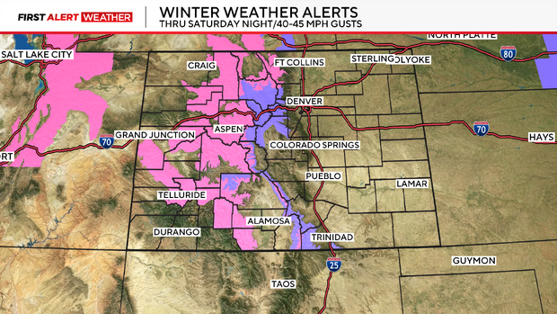
An Avalanche Warning is in place through Saturday evening.

Sunday there will be lingering light snow showers in the mountains with dry conditions for the Denver metro area. The next storm system arrives Monday as well as an arctic cold front that will drop daytime highs into the teens Tuesday and Wednesday.