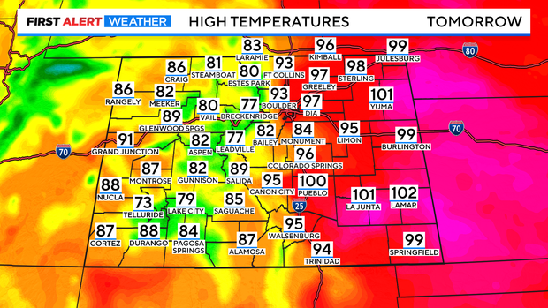
Near record heat moving from August to September
Another strong southwestern ridge of high pressure is feeding hot and dry desert air right into the central Rockies. That along with downslope winds will heat up highs across the eastern plains into near record territory!
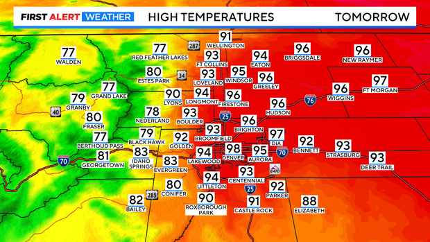
Wednesday kicked off the end of August heatwave with a high of 97 degrees. That was one degree away from the record high for that day.
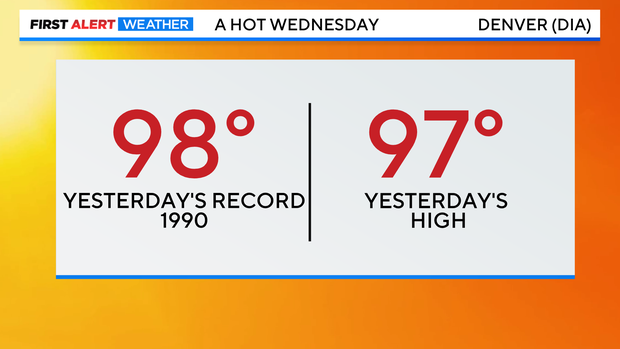
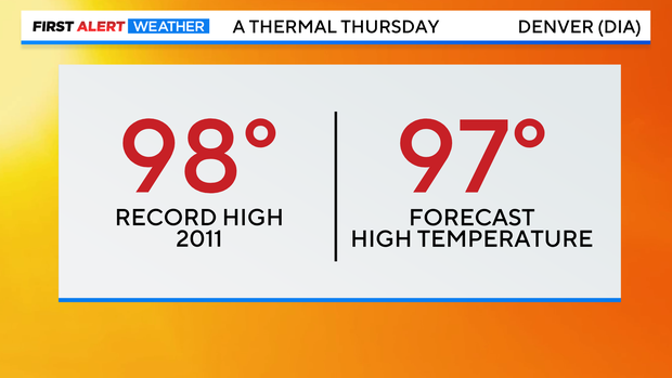
Now for Thursday in Denver, the record is also 98 degrees and with the hot ridge combo our forecast high is 97 degrees. Very close to the record this afternoon.
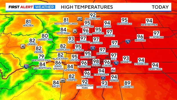
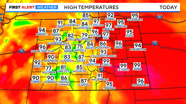
Statewide the big heat is over the eastern plains with highs in the 90s to near 100 degrees. Mountains will top out in the 70s and 80s with more 90s on the western slope.
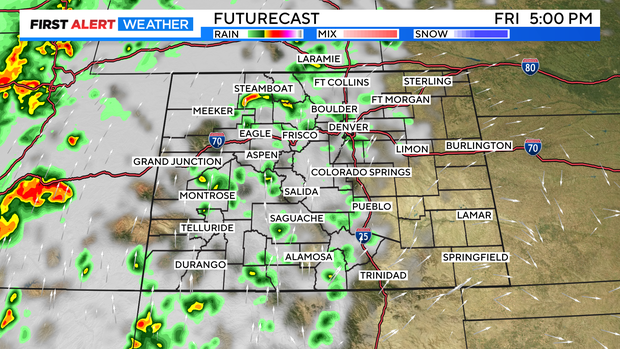
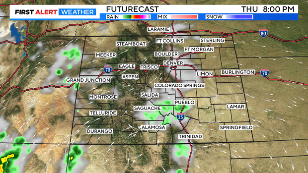
There will be a few afternoon cumulus clouds building over Denver and the Front Range between 4pm and 7pm. These will briefly kick up gusty winds but, no rain is expected.
Friday will be another sizzler with more 90s to 100 popping east of the Front Range Foothills.
There is a little better chance for a few scattered storms in the mountains Friday afternoon. Even Denver and the northern Front Range may see a few isolated late day t-storms to help cool things down.