Hurricane-force winds whip Colorado's Front Range; more mountain snow on the way from a second storm this week
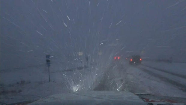
The second of three storm systems training over the Rockies this week blasts through Colorado Wednesday night into Thursday morning. The combination of more heavy mountain snow and hurricane-force winds along the Front Range are teaming up for another First Alert Weather Day.
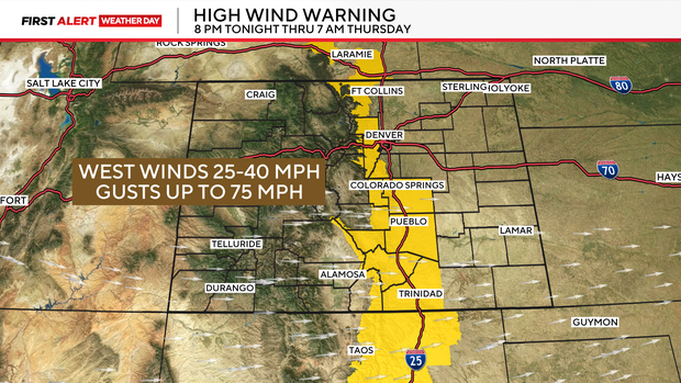
There is a high wind warning for areas in and near the northern Front Range foothills from 8 p.m. Wednesday through 7 a.m. Thursday. Downtown Denver is not included but places like Arvada, Lakewood, Longmont, Golden, Estes Park, Boulder, Evergreen Georgetown and Bailey are. Some areas may see a few wind gusts as high as 75 mph (74 mph and higher is classified as hurricane-force winds).
Behind the Thursday morning cold front, temperatures across Colorado will start to get much colder. It will be in the 40s for the Denver metro area on Thursday.
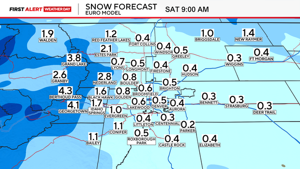
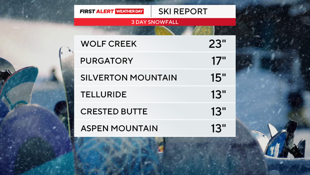
After seeing over a foot of snow in some mountain areas already this week, there is more snow coming between now and the weekend ahead.
A few more inches of snow will fall over most mountain areas through early Thursday morning, with warnings and advisories for additional snow still in place.
The third storm this week will swing through Colorado on Friday. This will bring in more snow for the mountains along with strong winds, more snow and colder temperatures.
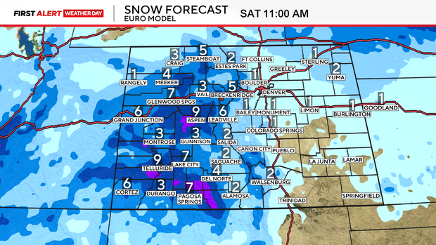
Several more inches of snow will fall over most of the state's mountain areas Friday through early Saturday morning. This time around, there may be just enough moisture for Denver and eastern Colorado to get some light snow to finish the week. Amounts for the Denver metro area will likely be less than an inch for most.