Mild weather ahead of the next storm system

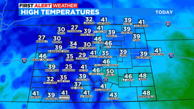
Enjoy the sunny and dry conditions across Colorado today with near normal temperatures in the metro area. Daytime highs will be in the 40s along the front range.
Our weather changes late tomorrow with another winter storm moving into the state. The mountains will see snow by sunset on Wednesday and around that same time we could also start seeing rain or light snow along the urban corridor.
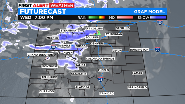
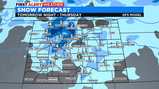
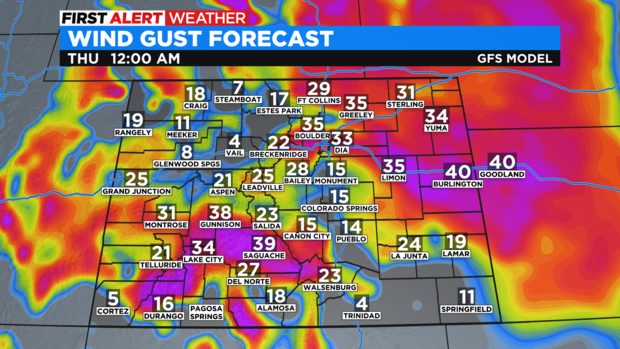
We expect nothing more than a few snow showers in the metro area Wednesday evening producing little to no snow accumulation for Denver. Some of us in the metro area may see less than half an inch. The wind with this storm will originate from the north which means upslope enhancement is possible along the Palmer Divide. We could also see 1 to 2 inches in portions of Douglas and Elbert Counties. In the mountains we could pick up 2 to 6 inches of snow from Wednesday night through Thursday.
We may not get much snow in Denver, but you will feel the wind with gusts up to 40 mph Wednesday night and Thursday. Wind chill temperatures will be in the single digits and could drop below zero.
The cold and snow won't last long. Sunny and relatively mild weather will return for Friday before a bigger warmup on Saturday with daytime highs in mid 50s.
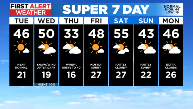
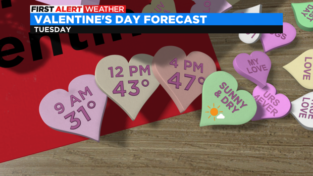
Looking ahead to Valentine's Day, the weather will be mild and sunny with temperatures in the mid 40s for the front range.