Major winter storm for the Colorado mountains Saturday

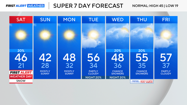
Saturday is the tale of two cities, except we are talking about two halves of the state. The mountains are getting hammered with snow, which is why Saturday is a First Alert Weather Day.
Winter storm advisories and winter storm warnings are in effect until 11 p.m. Saturday. By the time this storm ends, the mountains will see anywhere from 6 to 24 inches of fresh snow. Rabbit Ears Pass could top out closer to 30 inches of snow.
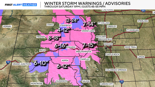
Be prepared for snowy and icy roads if you are travelling to the mountains on Saturday. Not only do we have moderate to heavy snowfall, but the winds are also strong. Gusts could reach up to 50 to 60 mph over the higher mountain passes. That can lead to near white-out conditions at times. Make sure you are prepared for the drive. Of course, once you get to the mountains, the skiing and boarding will be fantastic!
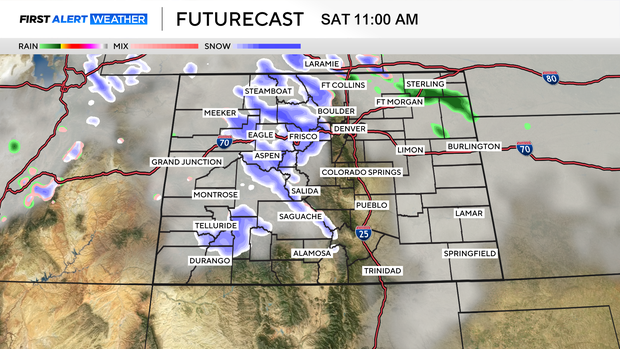
The Front Range will see completely different weather on Saturday. Yes, we could see a rain shower or two and maybe even a flurry; however, the majority of the Denver metro area will remain dry. Folks in Larimer and Weld counties could see some rain and snow, and the eastern plains, north of I-70, will likely see some more rain and snow through the day Saturday. The eastern plains could see some snow through the night Saturday into Sunday morning.
As far as temperatures, expect mid to upper 40s across the Front Range Saturday, with 30s in the mountains. Starting Monday, our temperatures will warm above average for this time of year and stay there for the next 10 days.
There is a slight chance for some rain and snow on Wednesday and Thursday, but it's not looking great, which means the metro area will be pretty dry for the foreseeable future.