High Fire Danger in Colorado prompts a First Alert Weather Day for Monday

Strong gusty winds built overnight, sometimes up to 80 mph in places like Boulder. With strong winds expected throughout the day, Red Flag Warnings have been issued for the I-25 corridor and into the plains, including the Denver metro area.
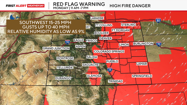
Most winds for the lower elevations will gust as high as 40 mph, but the foothills could see gusts over 60 mph. Relative humidity will also drop as low as 9%. With the dry and windy conditions, rapid fire spread is possible.
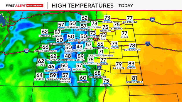
High temperatures will also climb well above average. The 70s and 80s are possible for parts of Eastern Colorado with the 40s and 50s expected in the mountains.
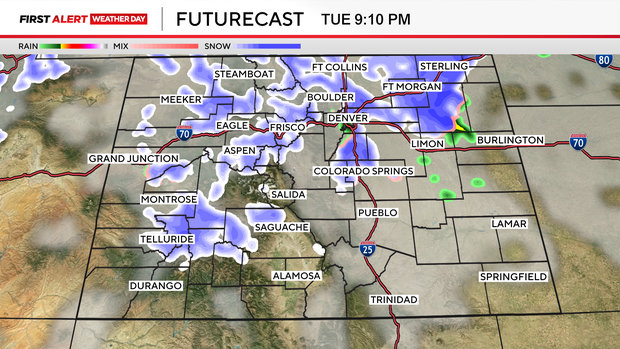
By Tuesday, a cold front will sweep across the state, bringing a chance for rain and snow. The mountains will likely begin to see that snow by the mid-afternoon, while the lower elevations won't see any precipitation until the evening commute timeframe.
Initially, rain and snow will fall, but overnight temperatures cool quickly, turning precipitation over to snow.
At this time very little accumulation is anticipated for the Denver metro area, while parts of Eastern Colorado could see a little accumulation. Eastern
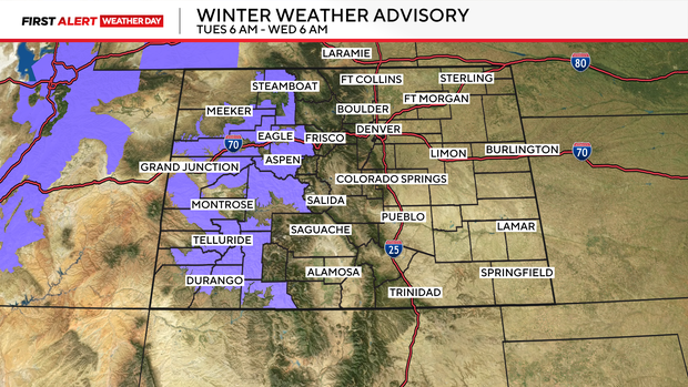
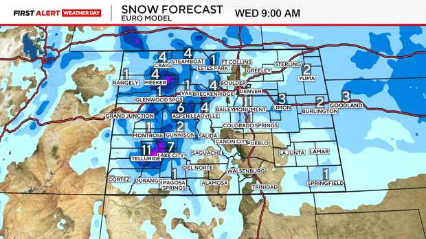
Winter Weather Advisories will go into effect for parts of the high-country beginning Tuesday morning. Up to 12" of snow could fall in some mountain areas, with winds expected to gust up to 45 mph.