First Alert Weather Day Sunday: Strong storms possible before warmer, drier weather returns

Sunday is a First Alert Weather Day as scattered showers and thunderstorms are expected to develop across Colorado this afternoon and evening. A few storms could become strong to severe, bringing the potential for large hail, strong winds and heavy rainfall.
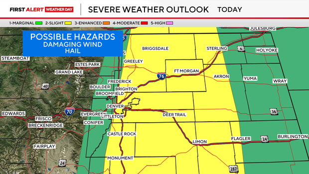
Storm coverage will be lower than we've seen over the past several days, but the storms that do develop could still produce locally heavy rain, which could lead to localized flooding, especially in areas where soils are already saturated from recent rainfall.
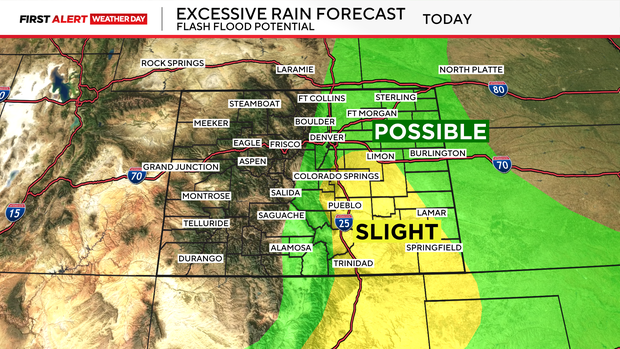
The recent stretch of wet weather has delivered some impressive rainfall totals across Colorado.
Saturday's rain reports included:

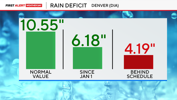
That rain is helping, but Denver is still running a significant precipitation deficit for the year. Through Saturday, Denver International Airport has recorded 6.18 inches of precipitation since January 1. The normal amount by this point in the year is 10.55 inches, leaving Denver 4.19 inches behind schedule. So, while the recent rain has been beneficial, it hasn't been enough to erase the rainfall deficit.
Monday and Tuesday will be warmer and drier, with temperatures returning closer to seasonal averages and much lower rain chances. A brief cooldown and increase in storm chances are possible Wednesday before high pressure builds back into the region.
By Thursday and Friday, a warmer and drier pattern takes over, with highs expected to reach the mid-80s to mid-90s across the plains.


