First Alert Weather: Cold And Snow Blast Thru Front Range
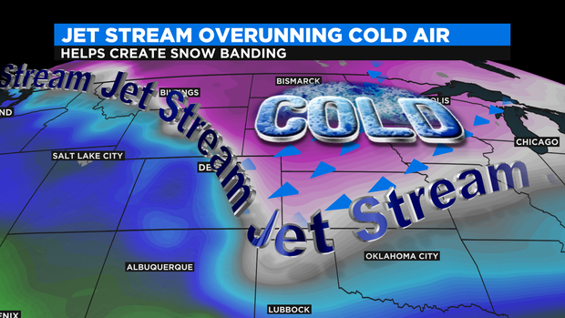
DENVER(CBS)- A strong jet stream overrunning cold Arctic air rushing in over the eastern plains fired up bands of snow during the Wednesday afternoon rush.
The heavy bands of snow show up well on the First Alert high-res radar. Areas under the bands of snow (shaded in blue) received quick bursts of snow.
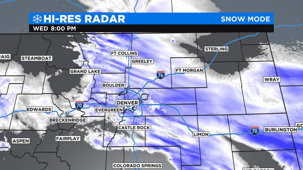
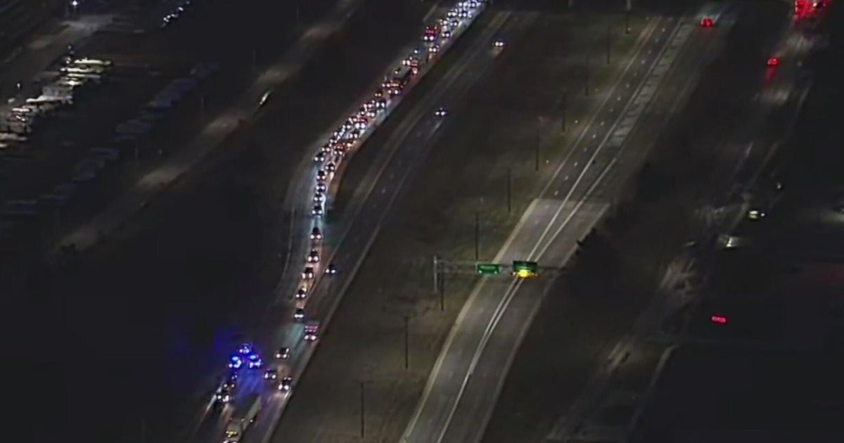
The roads were cold enough that icy conditions happened as quickly as the snow began falling. Creating numerous accidents from the mountains to the plains.
A big range on snow amounts from the high country down across the plains. Some areas as of this writing are approaching one to two feet in the mountains with more adding up by Thursday.
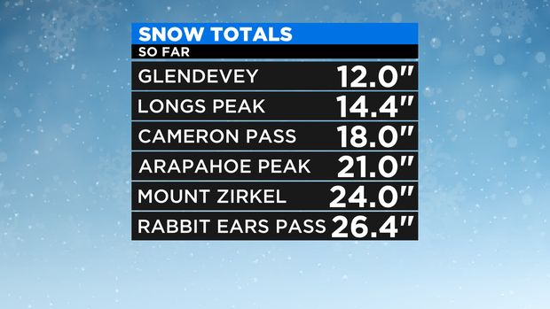
The metro area has seen significant snow as well with more falling thru 3am on Thursday.
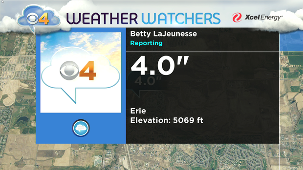
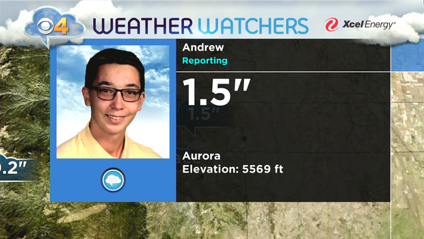
Weather Watcher Reports could be more by Thursday morning.
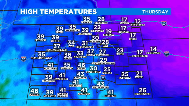
After the snow the Arctic cold takes a bitter bite over the Front Range and Eastern Plains. Overnight lows will dip down into the single digits to below zero across the Front Range and Denver metro area.
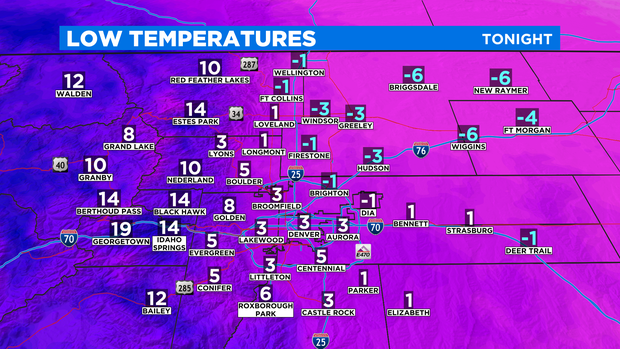
Mountain temperatures will be warmer than the eastern part of the state. Dense cold air has a tough time getting into the higher elevations when it backs in from the northeast.
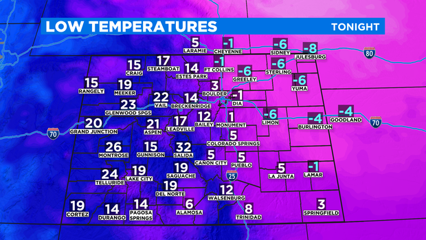
On Thursday, highs over the eastern half of Colorado will not make it above freezing. While, the mountains and west will be warmer with 30s and low 40s!