From fire danger to a springtime snowmaker, it's a classic Colorado spring pattern this week
It's a classic Colorado spring pattern this week, starting with high fire danger, then swinging into rain and even snow chances by the end of the week.
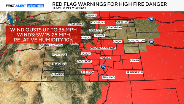
Warm temperatures, low humidity, and gusty winds are combining to create elevated to critical fire danger across eastern Colorado on Monday.
Red Flag conditions warnings will be in place across parts of Colorado from 11 AM to 8 PM on Monday, where winds could gust up to 35 mph, and humidity drops to 10%.
By Tuesday, conditions will change, with notably cooler weather and increased precipitation across the state.
Snow will move into the high country early Tuesday morning, before that moisture reaches the lower elevations. Rain chances increase in Denver after 12 p.m., with a rumble of thunder possible going into the evening.
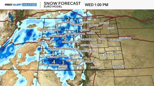
With this week's first round of moisture, the mountains could pick up a few inches of snow, so slick travel over the passes is possible.
Wednesday and Thursday bring a brief return to milder, drier weather with highs rebounding into the upper 60s and 70s. It'll feel more spring-like again, but it doesn't last long.
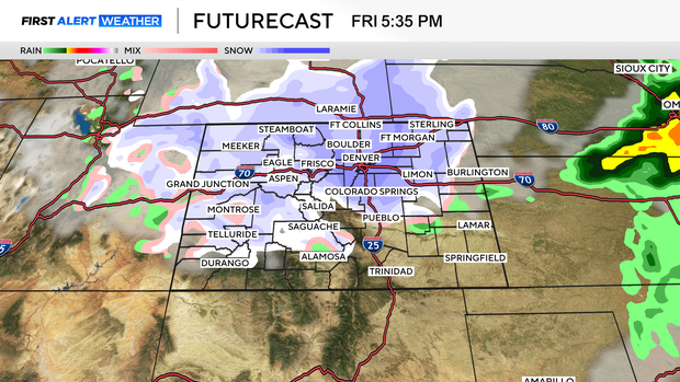
Another stronger system arrives late week, bringing a sharper drop in temperatures, potential snow for the Denver area, and more widespread mountain snow chances.
The exact timing and accumulation are still uncertain, but this system has the potential to bring another round of impactful spring weather to parts of Colorado.