Extreme cold and snow coming to Colorado in a few days

Were it not for the wind on Wednesday, conditions would be rather nice outside in Colorado. High temperatures will be climbing into the upper 30s and low 40s across the Denver metro area and Front Range. However, that does come with some strong, gusty winds that will blow throughout the day.
Winds could gust at times up to 45 miles per hour, with winds sustained out of the northwest at 15-25 miles per hour.
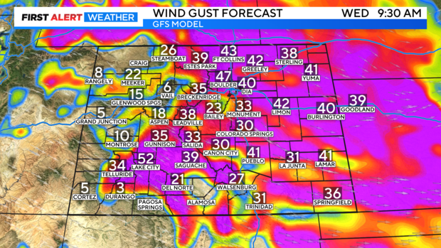
While the strongest wind gusts will gradually taper off late Wednesday, breezy conditions will still be present Thursday and Friday.
Thursday also comes a chance at some light snow in the Denver metro area, Front Range, and Eastern Plains. Snow will begin to become more widespread in the mountains overnight Wednesday and reach the lower elevations by Thursday early afternoon.
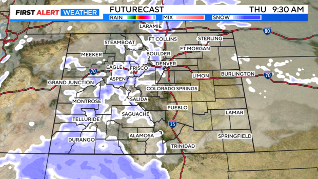
The mountains will receive several inches of additional snow, but in the lower elevations, accumulations aren't as impressive. A trace to 2" of snow is expected for the plains and the foothills on Thursday.
With breezy conditions expected in the high country through the weekend, blowing snow will be a concern for travelers. Snow-covered roads, with snow drifts, have already been reported as of Wednesday morning.
More heavy mountain snow is possible through the weekend, as wind continues to stay strong.
The big weather story arrives by the weekend in the form of a surge of Arctic air! A cold polar airmass will advance southward beginning Friday plummeting temperatures to dangerous levels by the weekend. This will be the coldest air mass of the season as temperatures will struggle to get out of the single digits. Overnight lows will drop below freezing, resulting in dangerous wind chills throughout the weekend.
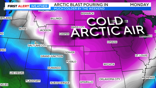
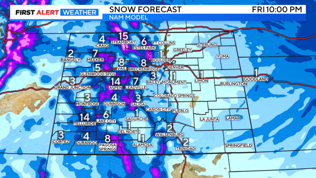
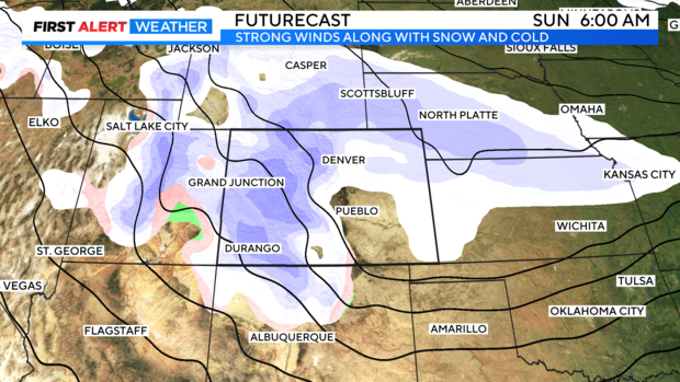
On top of the blast of Arctic air, more snow will be moving in. The mountains will see heavy snow this weekend, which will arrive in several waves, the heaviest expected Saturday into Sunday. Snow totals could come in the form of feet for some, as opposed to inches. However, wind speeds will remain strong through the weekend resulting in, at times dangerous, travel conditions.
Snow is expected to spread into the lower elevations for the weekend as well.
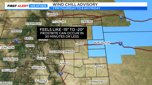
Wind Chill Advisories and Watches have already gone into effect for the Eastern Plains.
Thursday night through Friday morning, portions of east central and northeast Colorado are under a Wind Chill Advisory. Temperatures are expected to plummet, and as they do so feels like temperatures dive. Wind chills as low as 15 to 20 below zero are expected.
By Friday temperatures continue to drop, and the Advisory turns into a Wind Chill Watch for the same areas, that is in place through the weekend. Wind chills are expected to drop as cold as 25 to 35 below zero.
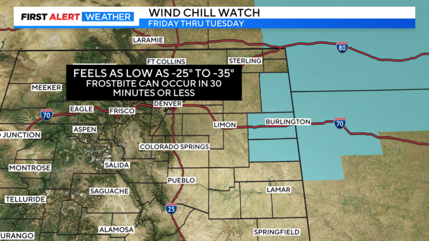
These cold wind chills have the capability of causing frostbite on exposed skin in as little as 30 minutes.
As of now, it looks like this mass of Arctic air will retreat by Tuesday, allowing temperatures to warm closer to freezing. We will be thawing out Wednesday, as temperatures return much closer to normal.


