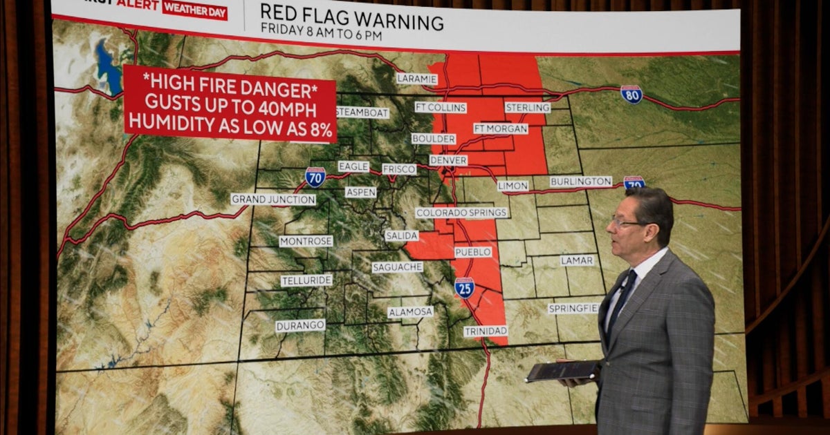
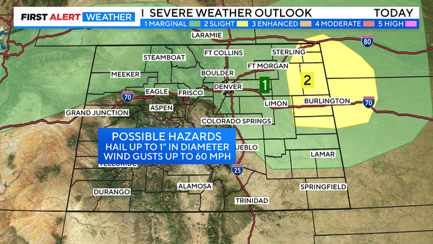
Chance for hail storms from Denver into Colorado's eastern plains
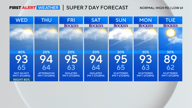
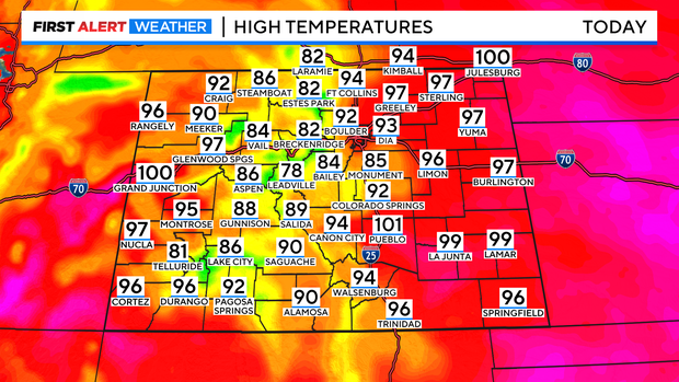
We are still locked into the 90s but, temperatures should be a few degrees cooler for Wednesday. The hot high pressure ridge that has been sizzling temps is moving farther east and flattening out a bit. This will bring in a little less heat and keep monsoon moisture flowing in.
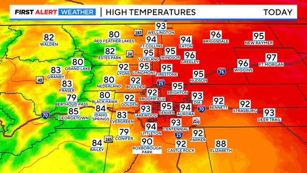
Highs will still be hot with 90s and low 100s across the eastern plains and western slope. But, in the east there will be a slight cool down. For example, Denver was 98 degrees on Tuesday and Today the forecast high is 93.
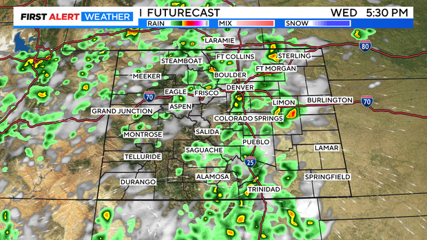
There will be another round of late day showers and thunderstorms firing up from the mountains into the plains. In fact, there is a better chance for t-storms coming in for Wednesday afternoon and early evening.
There is a chance for severe storms from northern Colorado, the Denver metro area and the eastern plains out to the Kansas and Nebraska state lines. The biggest threat is for large 1 inch diameter hail and 60 mph winds. There is slight chance for storms capable of producing a tornado east of Limon out to Burlington.
Mid 90s will be locked in for the Denver metro area thru the weekend with a chance of late day storms popping each day.