Denver Weather: Few Storms Today, Colder With Rain To Snow Tomorrow
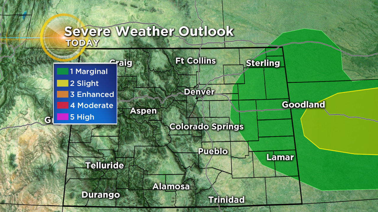
DENVER (CBS4) - A dynamic late April weather system will change Colorado's weather in a big way over the next 24 hours. The first part of this change is a strong cold front that will race through the state kicking up scattered showers and thunderstorms. A few of those could turn strong to severe on the eastern plains Sunday afternoon.
Behind the front colder air will filter in setting the stage to see a chilly rain that will change to snow at some point during the day on Monday. This air mass will combine with an approaching area of low pressure that is carrying Pacific moisture from the southwest.
There is the potential to see heavy, wet snow accumulate during the day and night on Monday in the Front Range Mountains and adjacent foothills where a Winter Storm Watch has been issued. A watch means there is still some uncertainty in the exact timing and details of the forecast.
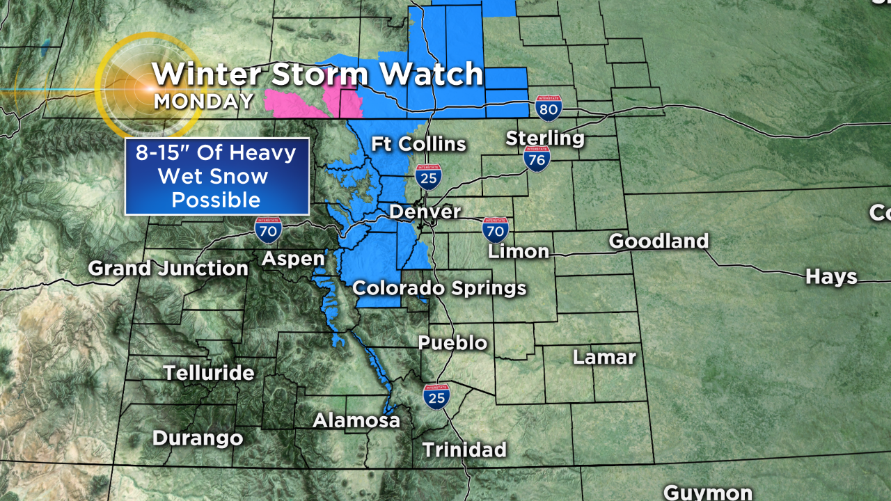
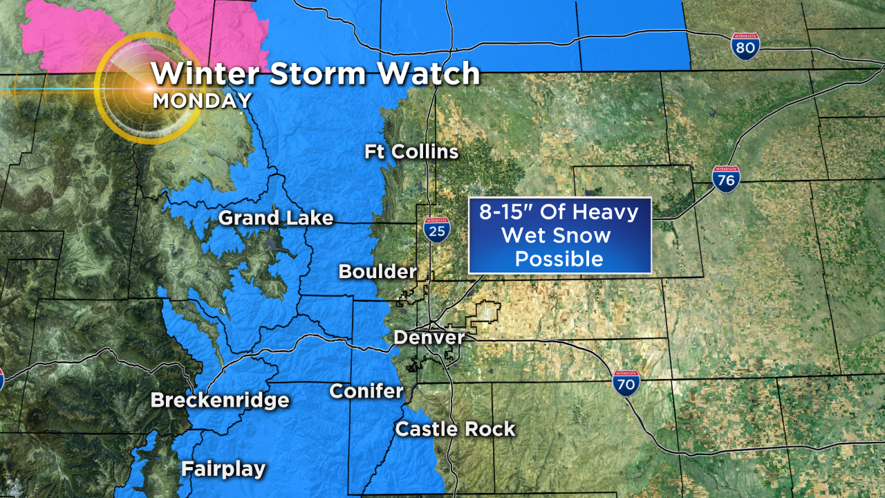
Some snow is possible in Denver and along the Interstate 25 urban corridor, as well as on the adjacent plains, but accumulation should be limited to a few inches (or less) on the grassy areas, unless the bulk of the heaviest snow arrives after sunset on Monday. If that happens then we could see a bit more of an impact to travel as well as higher totals.
Either way plan on a cold and wet start to your week. Be sure to check back with CBS4 often for updates on the incoming storm.