Denver Weather: Snow On The Way, Travel Impacts Expected Thursday
DENVER (CBS4) - With schools out and most Coloradans doing far less travel than normal, a winter storm coming later this week will likely have far less impact than normal. But for those who still need to travel in Colorado, there should be enough snow to cause difficulties.
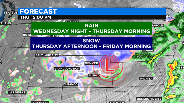
The storm will move from California to Colorado on Tuesday and Wednesday. Initially temperatures will be warm enough that all precipitation will be rain for areas below about 7,000 feet including the entire Denver metro area. Rain is expected from Wednesday night through Thursday morning. Then the rain will transition into snow Thursday afternoon and will continue into very early Friday.
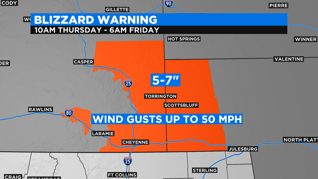
The snow will be "spring style" meaning heavy, wet, and slushy. As of Tuesday morning there are no watches, warnings, or advisories for the snow in Colorado but a Blizzard Warning had already been posted for western Nebraska and southeast Wyoming including Cheyenne. These areas will see 5 to 7 inches of snow along with wind gusts to 50 mph which will cause whiteout conditions along portions of Interstate 80 and Interstate 25 in these states.
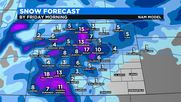
In terms of snow accumulation for the Denver metro area, the weather models currently vary from about 4 to 8+ inches by Friday morning which seems like a reasonable snow forecast at this time. Of all the models, the "RPM" model is probably doing the best job with the snow forecast showing 4 to 8 inches along the urban corridor.
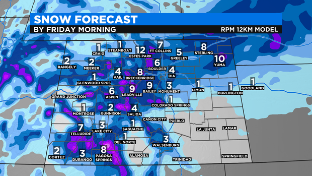
The "NAM" model is probably being too aggressive with snow in the higher foothills and Summit County (any totals over a foot should be very isolated) but may be more accurate with snow in Weld County. These model has only 1 inch in Greeley which also seems reasonable.
A second piece of energy in the atmosphere before the main storm system will also cause additional light snow on Friday that should spread from the mountains to the urban corridor during the day on Friday. Any additional accumulation will be minor.
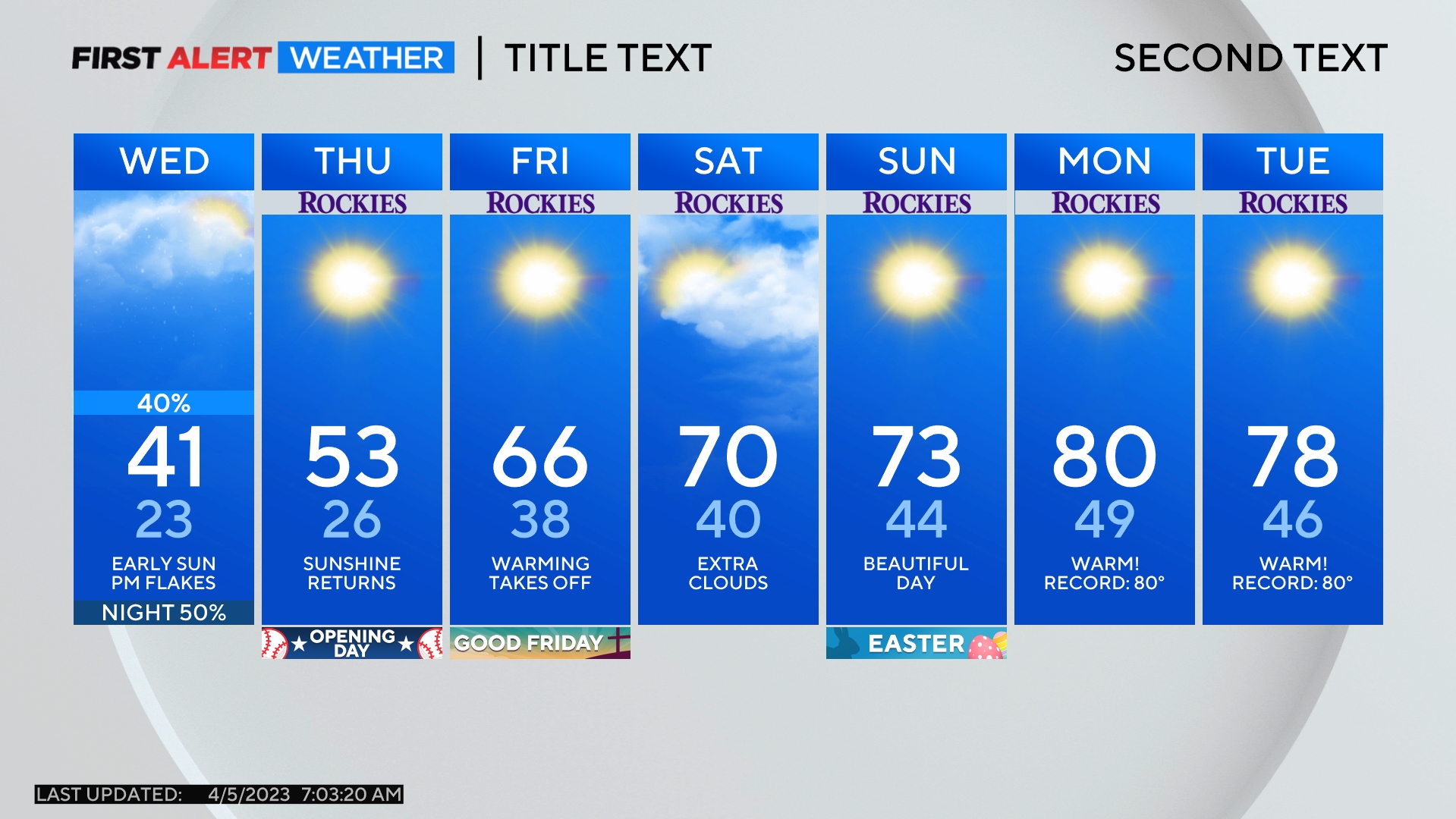
In addition to the snow at the end of the week, it will turn much colder with highs in the 40s on Thursday and 30s on Friday.