Denver Weather: Snow Is Ending, But Two More Below Freezing Days Remain
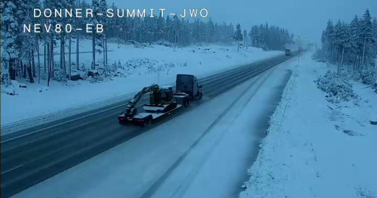
DENVER (CBS4) - Enough snow fell across the Denver metro area Wednesday night for this month to rank among the snowiest February's on record. No additional snow accumulation is expected in the metro area but the very cold air will linger for a couple more days.
The snow that fell early Thursday morning was enough to create icy and snowpacked roads and very slow travel conditions on almost all roads in the metro area. The rest of the day is expected to be dry but cold.
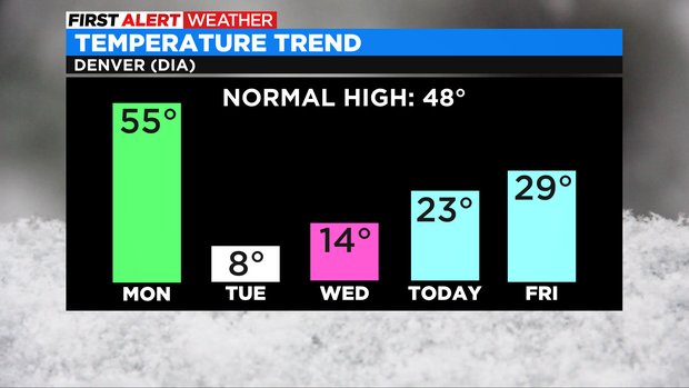
Cold weather is something everyone who lives on Colorado's Front Range has become accustomed to in recent days. After initially falling below freezing around lunchtime on Monday, temperatures have been in the deep freeze ever since. The first above freezing temperature in Denver is not expected until at least 10 a.m. Saturday.
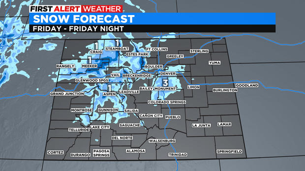
By Thursday afternoon, there should be very little if any snow left in Colorado. Then a weak storm that will pass over the state Friday into Friday night will bring a few light snow showers mainly to the mountains. By late in the afternoon, a few flurries will be possible in the Denver and Boulder areas and there could be minor accumulation mainly south of C-470 during the evening hours on Friday. A few spots on the Palmer Divide could get 1-2 inches.
Because of extra clouds associated with the Friday system, temperatures will stay below freezing in the metro area for one more day. Then a a long stretch of warmer weather will start Saturday and will culminate on Wednesday and Thursday next week with temperatures in the 60s. Denver could even hit 70 degrees next Thursday (the record of March 3 is 76 degrees which is out of reach).