Denver Weather: Snow Expected Late Monday But 60-70 Degree Temp Drop Will Be Main Headline
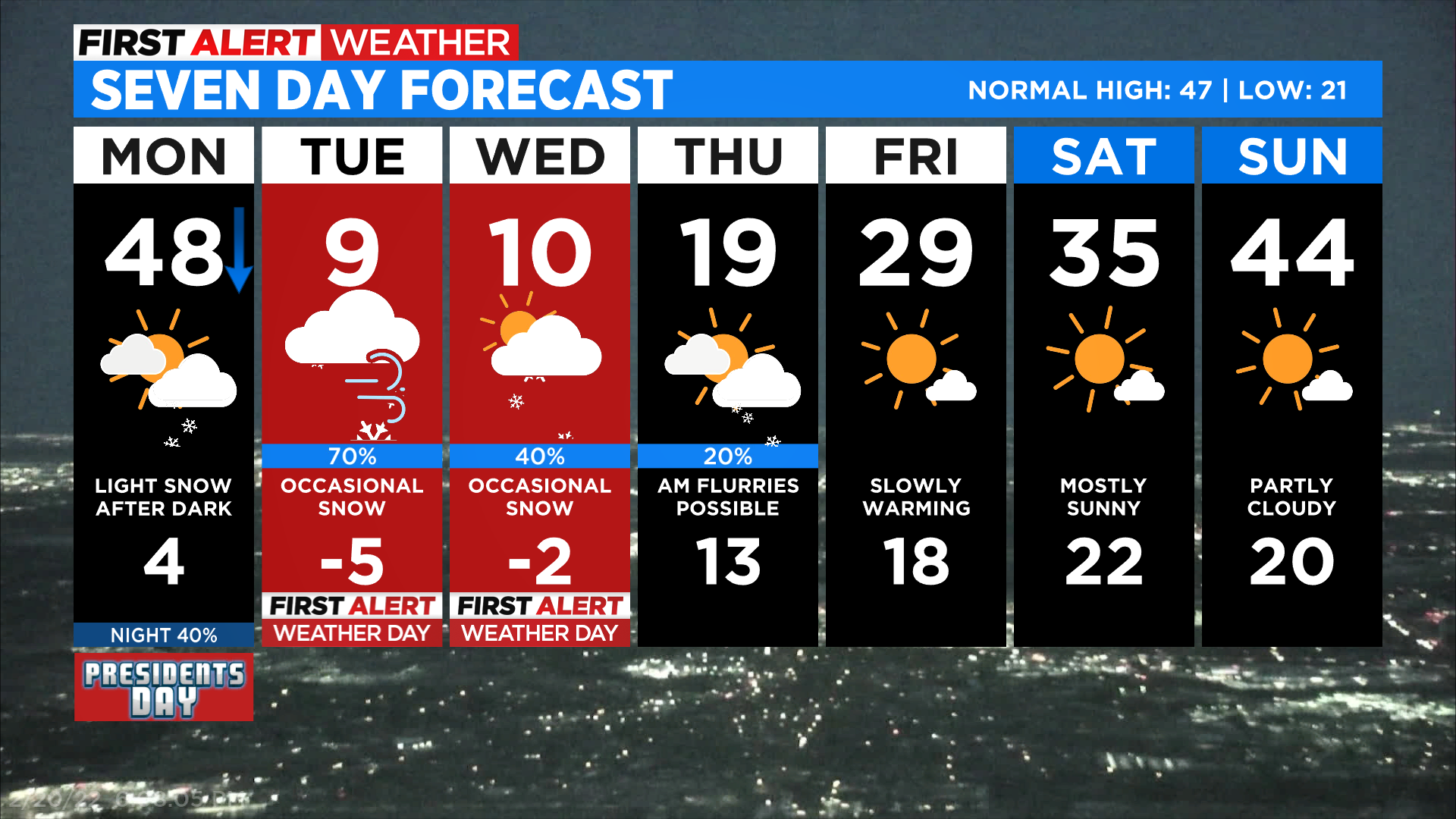
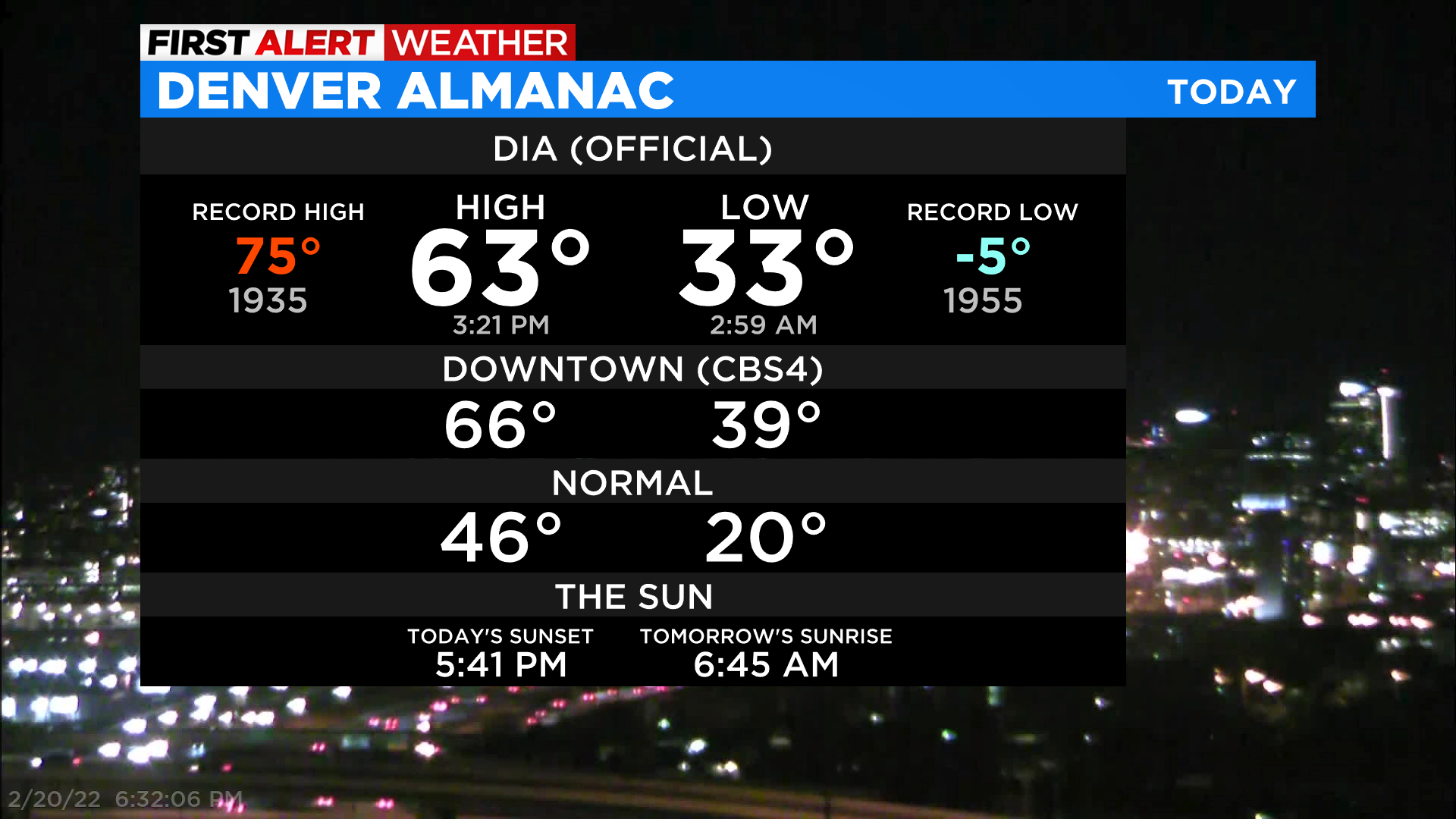
DENVER (CBS4) - A powerful arctic cold front will move into Colorado on Monday, reaching Denver sometime between the late morning and early afternoon. After a high of 63 degrees on Sunday at the airport and 66 degrees at CBS4, temperatures will fall anywhere from 60 and 70 degrees by the morning hours on Tuesday and Wednesday.
We are expecting snow in Denver and have declared a First Alert Weather Day on both Tuesday and Wednesday for the potential to see travel impacts around the city. We may even see some pockets of snow develop around or after sunset on Monday and some minor travel impacts are possible, but right now, it looks like the bulk of Denver's snow will fall between Tuesday and Wednesday.
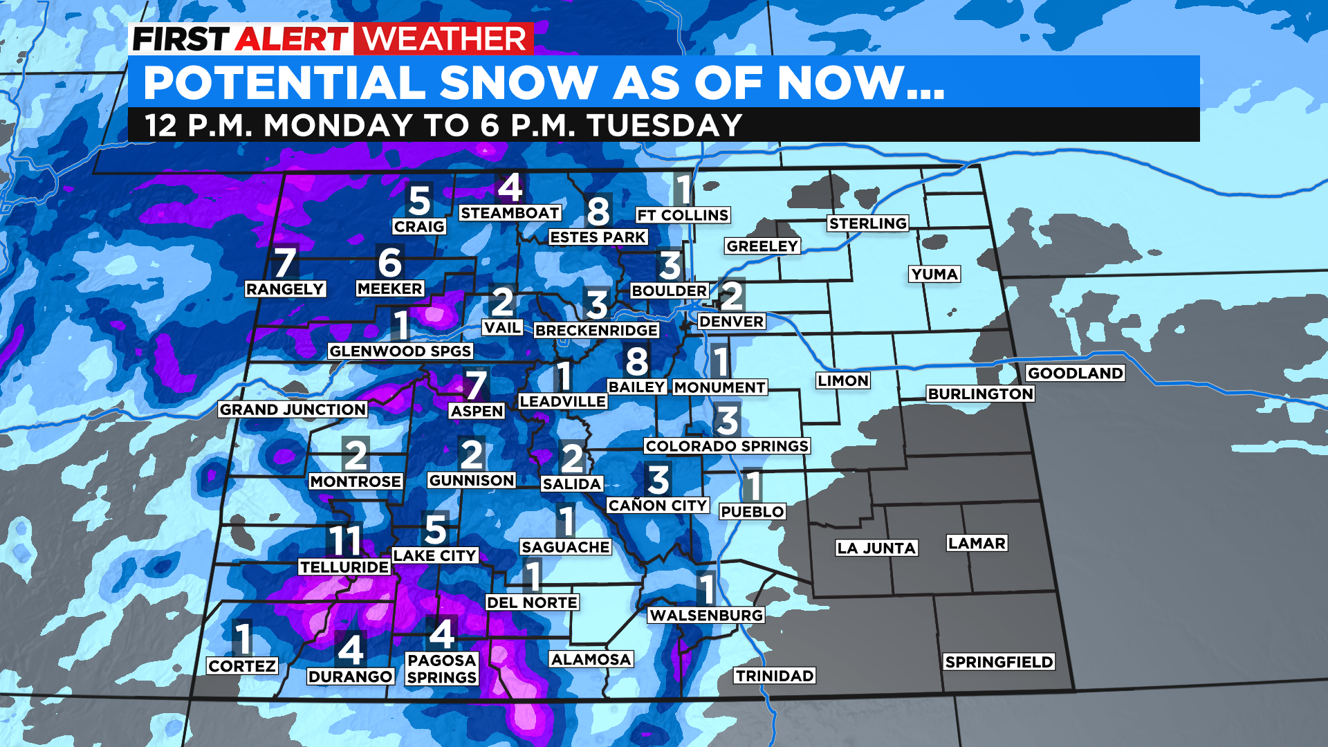
The following snow total map is for the first round of snow associated with this weather change. There will be a second round of snow starting late Tuesday into Wednesday and it will bring additional accumulation to many areas.
A gradual clearing trend is expected by the time we reach Thursday with a slow rise in temperatures. It looks like Denver will climb back above freezing for the last few days of February but melting from this storm system will be a slow process compared to what we often see in the Mile High City.