Denver Weather: Snow and cold is set to return on Wednesday, accumulation should be minimal
After a couple days with milder temperatures and a lot of melting snow, a fresh batch of snow is coming on Wednesday along with noticeably colder weather.
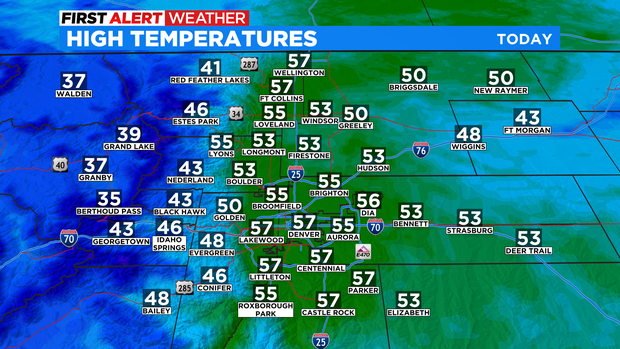
High temperatures reached the 50s around Denver, Boulder, and Fort Collins on Monday and the same is expected on Tuesday. The warmer weather along with enough sunshine has caused improving conditions on many snowpacked roads. Most of the snow is from a storm that hit just after Christmas and has not been able to melt due to colder than normal temperatures and mostly cloudy skies.
It will also stay dry along the Front Range and across the Eastern Plains through Tuesday night while at the same time snow continues to spread over the mountains and across the Western Slope.
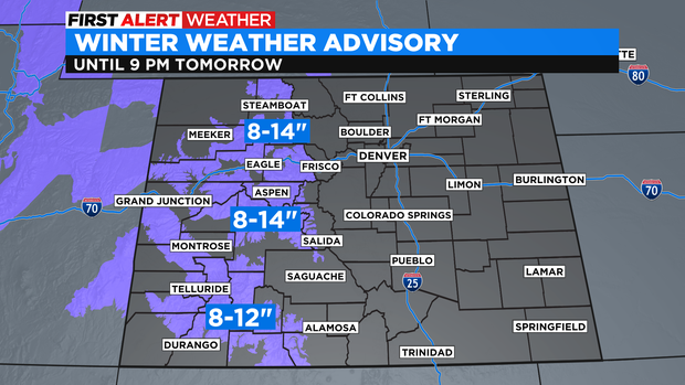
Mountain areas west of Vail Pass are under a Winter Weather Advisory through Wednesday evening for more a foot of snow in some areas. The advisory including the mountains around Rabbit Ears Pass, Monarch Pass, Wolf Creek Pass, The Flat Tops, and higher terrain around Aspen, Vail, Crested Butte, and Telluride.
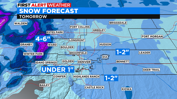
The snow will reach the foothills of Jefferson, Boulder, and Larimer Counties by early morning Wednesday and will then spread into the Denver, Boulder, and Fort Collins areas before Noon on Wednesday. Total accumulation is expected to be under 1 inch for most areas along the urban corridor. A few areas mainly east of Interstate 25 could get up to 2 inches of snow.
It will also be colder on Wednesday with high temperatures mainly in the 30s in the metro area.