Denver Weather: Record Cold Continues For Another 24 Hours Before A Slow Thaw Begins
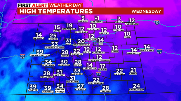
DENVER (CBS4) - It was cold enough to set another record in Denver Wednesday when the city officially dropped to -7 degrees. The arctic air won't leave quickly, but gradual warming will start in the days ahead. Until then, it's another First Alert Weather Day on Wednesday due to cold and snow.
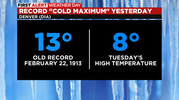
The record broken Wednesday morning had been in the history books for 123 years. The previous record was -4 degrees set on February 23, 1899. It's the second cold weather record in as many days for Denver. The high temperature in the city on Tuesday was only 8 degree which shattered the old "coldest maximum" temperature which was 13 degrees set on February 22, 1913.
Looking forward, afternoon temperatures on Wednesday will be slightly higher compared to Tuesday but still extremely cold. The Denver, Boulder, and Fort Collins areas as well the Eastern Plains will only reach the lower teens.
In terms of snow, most of it will stay in the mountains again on Wednesday and Wednesday but occasional light snow showers are still expected in Denver and along the Front Range urban corridor. The metro area could get up to 1 inch of accumulation on Wednesday and another 1-2 inches Wednesday night.
In the mountains, a Winter Storm Warning continue through 11 a.m. Thursday for areas west of Vail Pass for 8-16 inches of additional snow. Similar amounts are expected in the San Juan and Sangre de Cristo mountains in southern region of the state. The Colorado Springs area is also under a Winter Storm Warning but accumulation will be much less compared to the mountains.
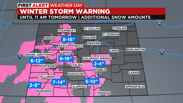
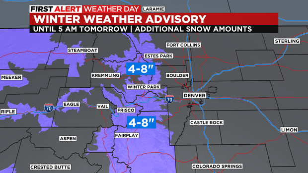
For mountain areas east of Vail Pass including I-70 between Copper Mountain and Georgetown, Highway 285 west of Kenosha Pass, and US 40 over Berthoud Pass and into Winter Park, there is a Winter Weather Advisory until 5 a.m. on Thursday. These areas will get 4-8 inches of additional snow including for the ski areas in Summit County.
Snow will end almost statewide Thursday afternoon but a few additional snow showers will be possible mainly in the mountains through Friday night. It's possible Denver and the Front Range could see flurries or very light snow showers on Friday but no accumulation is expected.
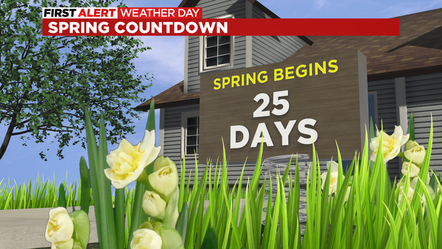
In case you're curious, spring is just 25 days away!
It won't feel like spring anytime in the next week, but it will turn much warmer early next week with high temperatures possibly reaching 60 degrees in Denver on Tuesday.