Denver Weather: Chilly Rain, Strong T-Storms And Even Snow Expected Sunday Night In Colorado
DENVER (CBS4) - Clouds will be on the increase throughout the day on Sunday and the wind speeds will pick up out of the southwest. This is all out ahead of a storm approaching Colorado. It was located around Salt Lake City on Sunday morning.
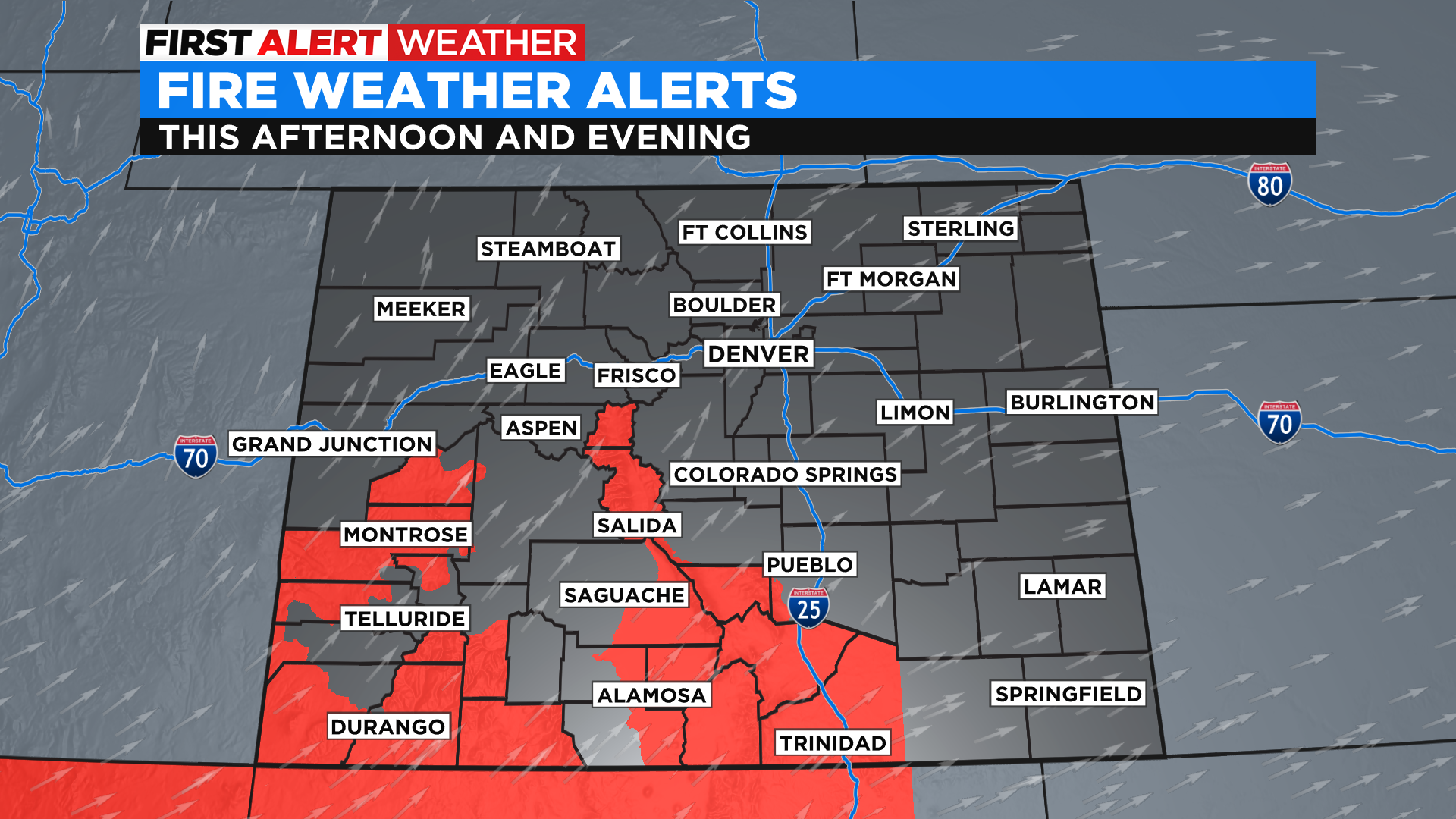
While the wind won't be as strong as we saw with the last storm it will still help create critical fire danger in many areas. The National Weather Service has issued Red Flag Warnings for a large part of central and southern Colorado.
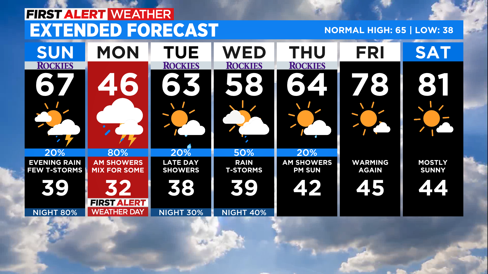
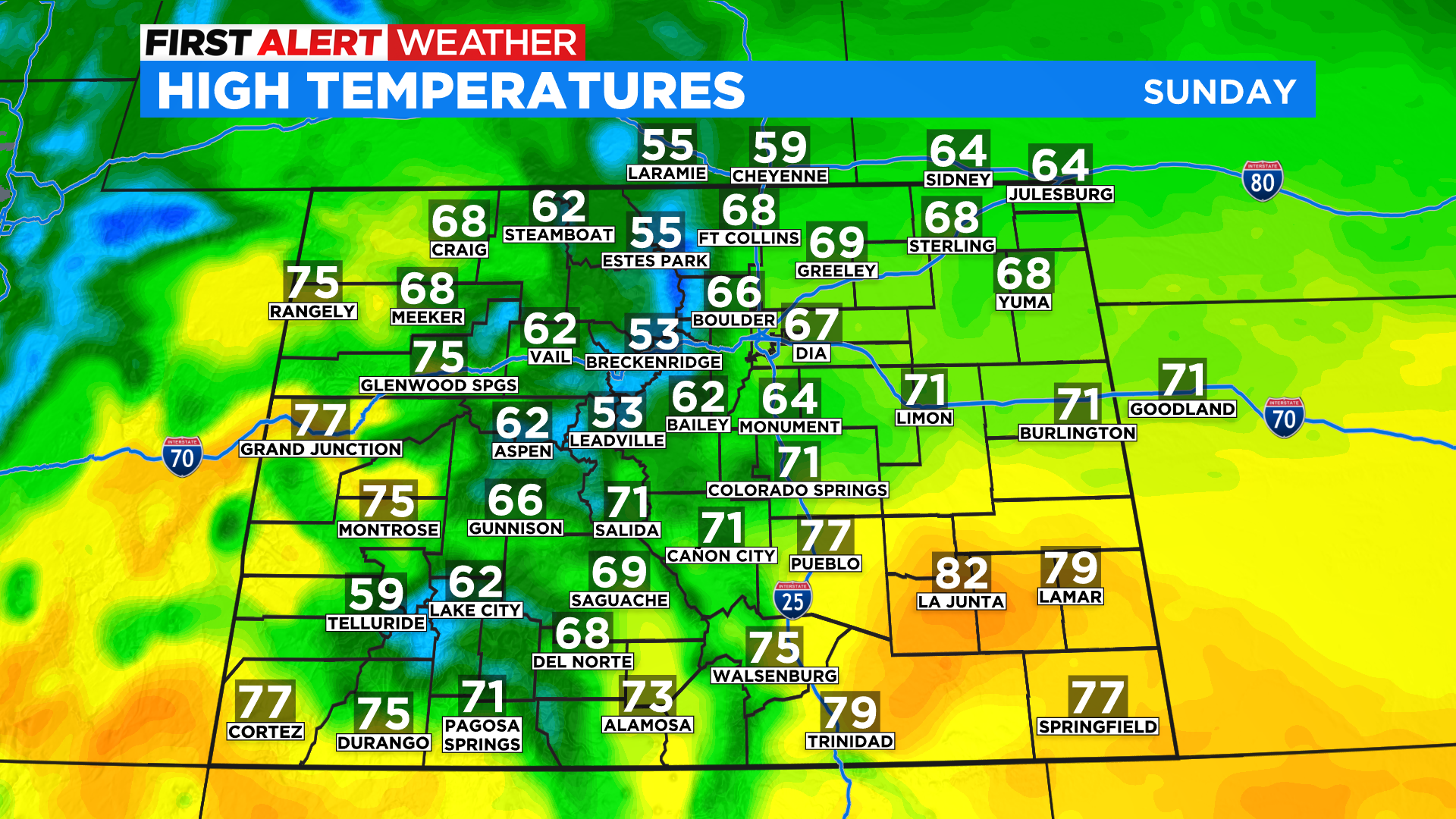
A warm southerly flow of air ahead of the storm will push highs into the 50s and 60s statewide with 70s and even a few lower 80s possible on the plains and western slope. Temperatures will be much cooler for many areas tomorrow with most of northeast Colorado not getting out of the 40s on Monday.
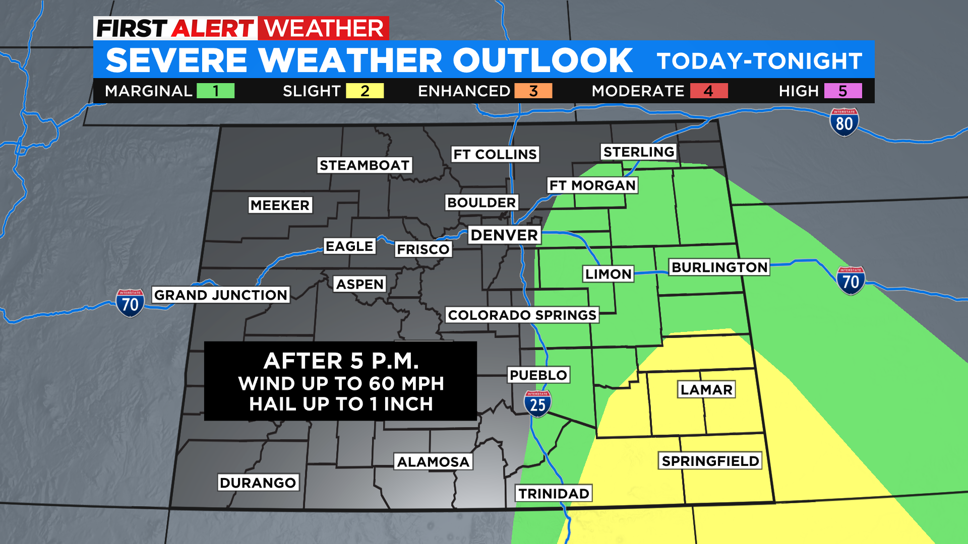
With the warm air and increasing moisture on the eastern plains we will see some thunderstorms develop Sunday evening. A few of those could be strong to severe, especially on the southeast plains. Large hail would be the primary hazard from any storms that reach severe limits.
Rain and snow will develop in the mountains Sunday afternoon and spread east into Denver overnight. We are looking for a wet and chilly morning commute Monday. In fact, as colder air filters into northeast Colorado, the rain could mix with and change to snow in some areas, especially to the north and east of Denver.
Another storm will enter the forecast by the middle of the week ahead. The pattern for the next few days will be unsettled with periods of cloud cover, below normal temperatures and a few different chances for rain.