Denver Weather: Breezy And Cooler, Then Few Mild Days Ahead Of Next Winter Blast
DENVER (CBS4)- A cold front moved through Colorado overnight with slightly cooler air and some gusty wind. It will stay breezy to windy at times today behind it, especially for those east of Interstate 25 and in some of the higher elevations west of Denver.
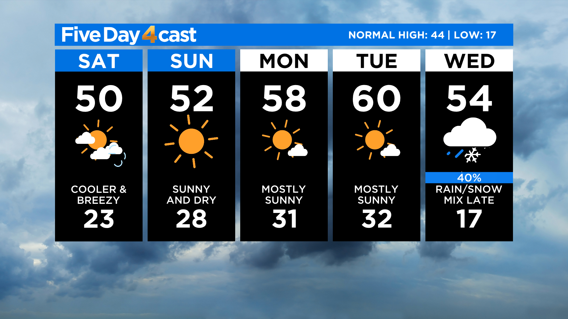
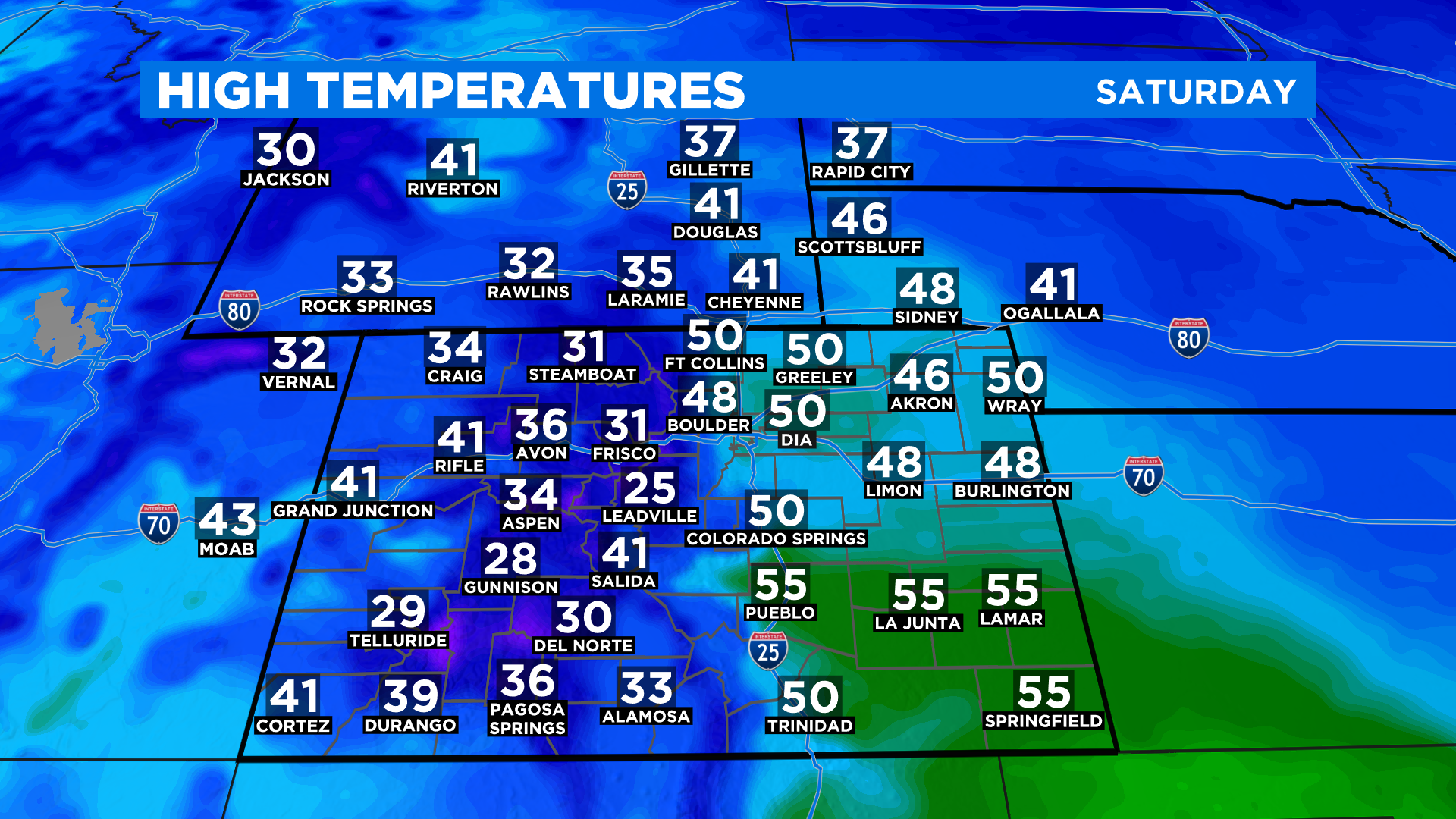
Temperatures will be up to 10 degrees cooler this afternoon with highs in the 40s and 50s east with 30s and 40s west. We'll see 20s and 30s in the mountains.
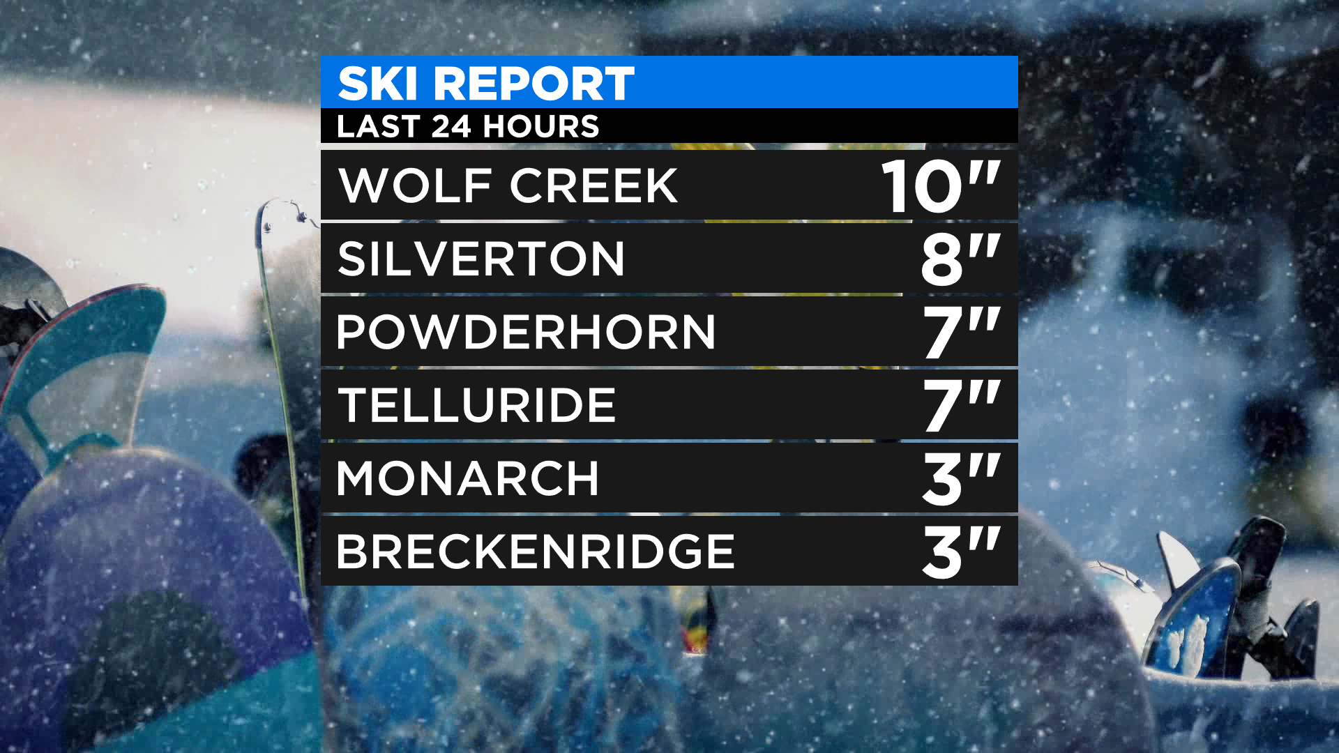
Light snow showers will be possible in the mountains through the early afternoon hours. Last night 1-4 inches fell at many ski areas with some 5-10 inch totals in the San Juan Mountains. The rest of the state should be dry today outside of a few morning flurries or sprinkles on the northeast plains near the cold front.
A clearing trend is expected by tonight as a ridge of high pressure builds into the state from the west. It will start a warming trend that will carry us through Tuesday when the high in Denver could reach 60 degrees again.
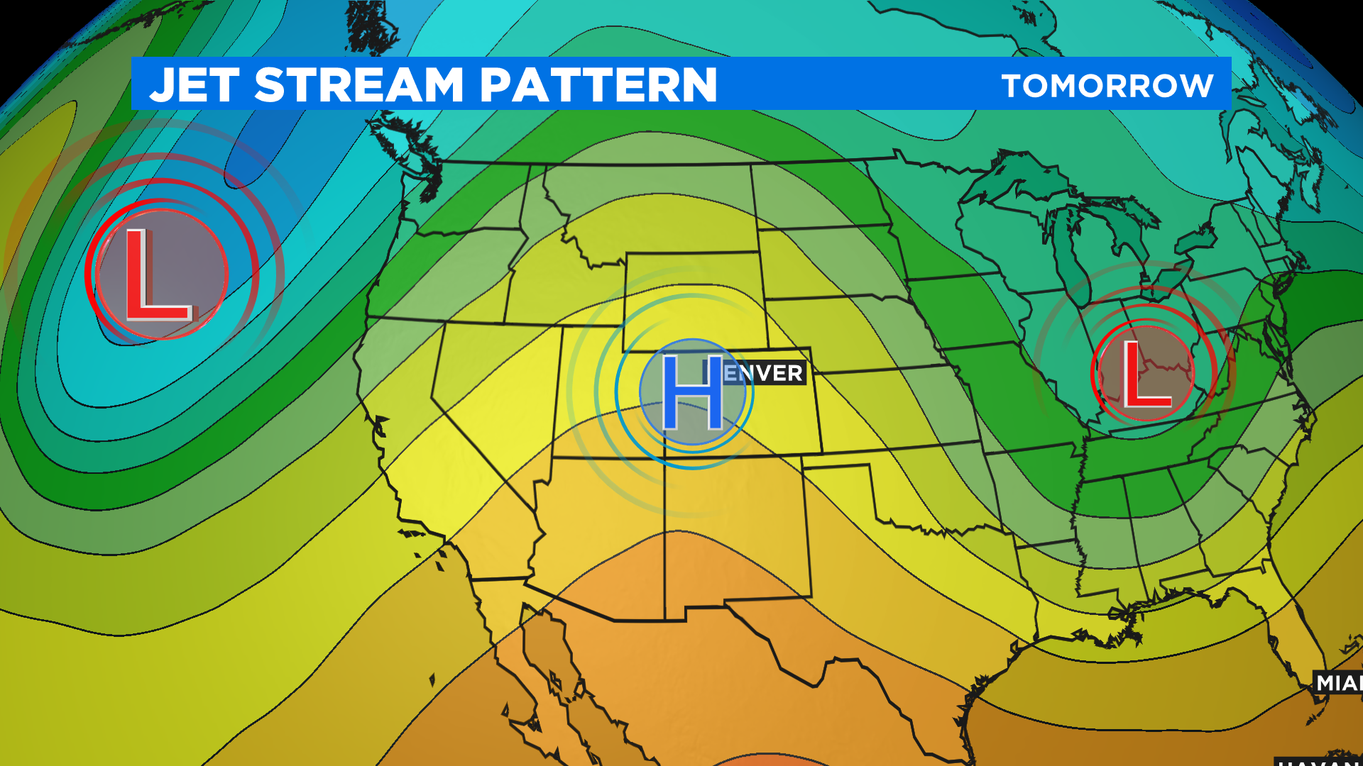
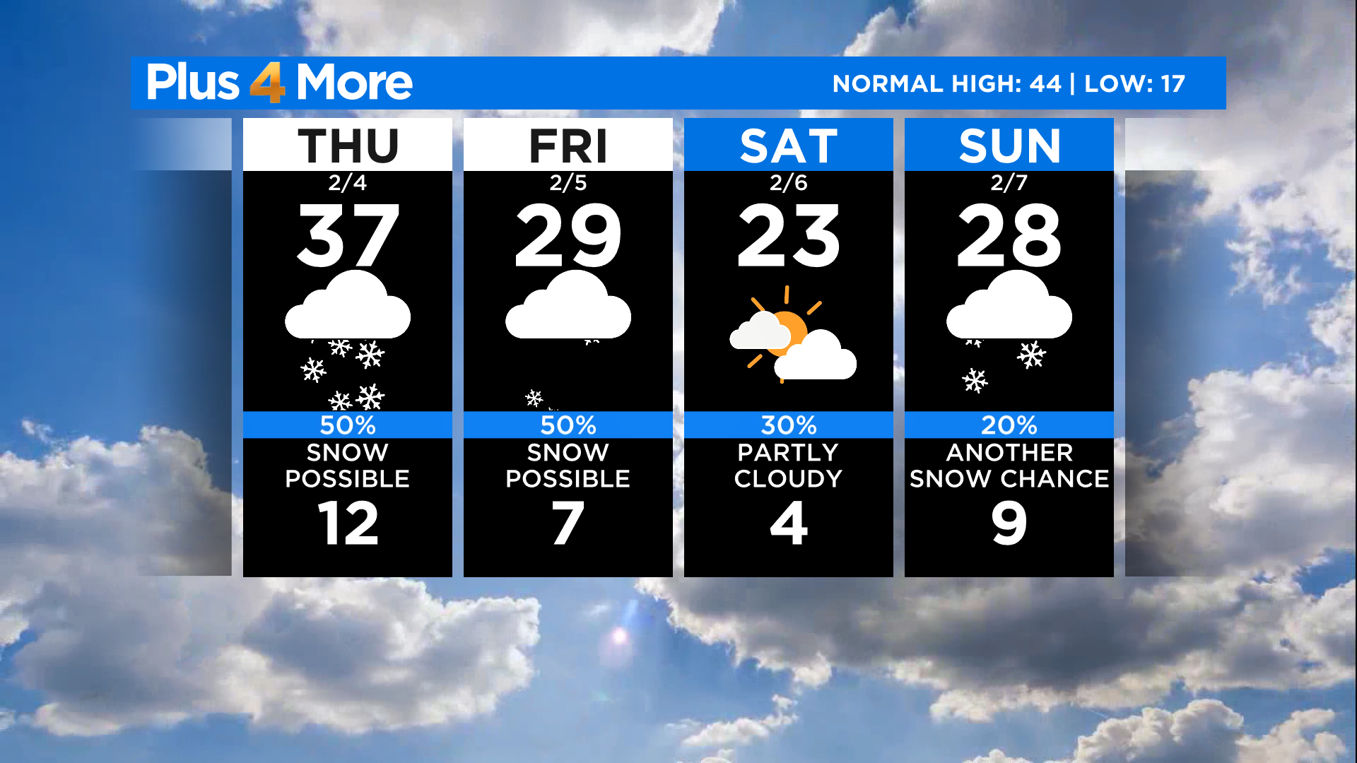
Looking ahead we anticipate a pretty big pattern change by the middle of next week. Wednesday looks like it will be a transition day with the potential for a strong cold front to cross the state.
It will bring much colder weather along with a chance for rain and snow. Then starting Thursday we expect several days with much colder weather and occasional chances for snow. Stay tuned!