Denver Weather: A Pleasant Spring Weekend Before A Wet Stretch Next Week
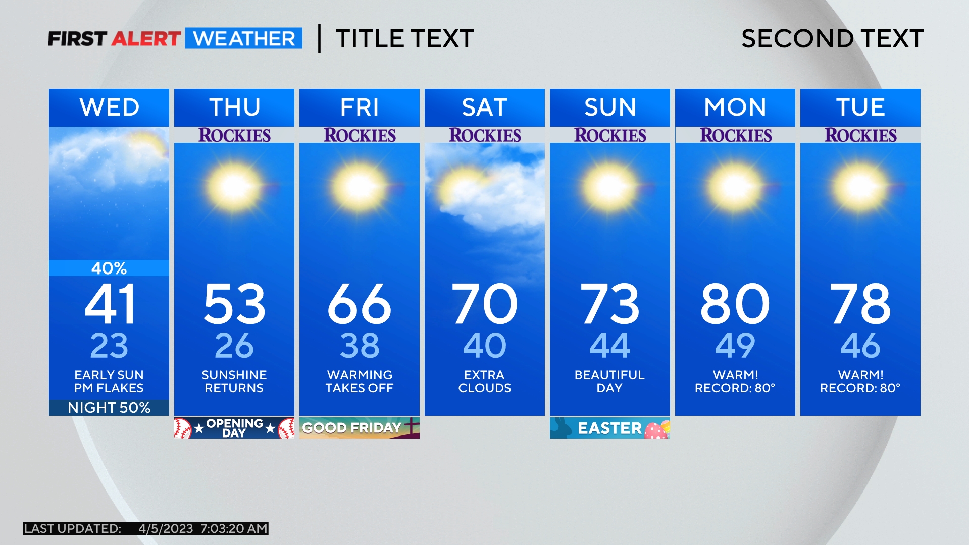
DENVER (CBS4) - Denver and the Front Range will experience windy and much cooler weather on Friday before returning to near 70 degrees this weekend. Then a chilly and wet weather pattern will develop for much of next week.
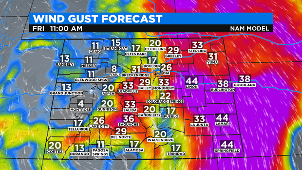
Northerly winds on Friday will gust near 35 mph around Denver, Boulder, and Fort Collins. The strongest wind of the day will likely occur during the late morning and early afternoon.
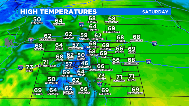
It will also be at least 15 degrees cooler in most areas along the urban corridor on Friday thanks to the cold front that arrived Thursday night. Saturday will be warmer again with high temperatures returning to the upper 60s to around 70 degrees at lower elevations.
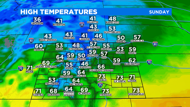
Then another cold front will arrive Sunday morning causing high temperatures to fall into the 50s again for Denver and the Front Range. There will be virtually no moisture in Colorado when the front arrives so no rain or snow is expected anywhere in the state this weekend.
It's a different story next week.
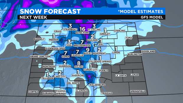
A large and powerful storm system should setup near Colorado starting Monday night and will likely linger in the region through at least Thursday night. That means at least three consecutive days with a good chance for rain and snow. At this time, it appears the majority of the precipitation in the Denver metro area next week will be rain instead of snow. Therefore any snow accumulation at lower elevations should be limited.
Meanwhile, Colorado's northern mountains (north of I-70) have the potential to get more than a foot of snow next week and most mountain areas north of Highway 50 should get significant snow.
Temperatures will also stay colder than normal statewide for the entire week.