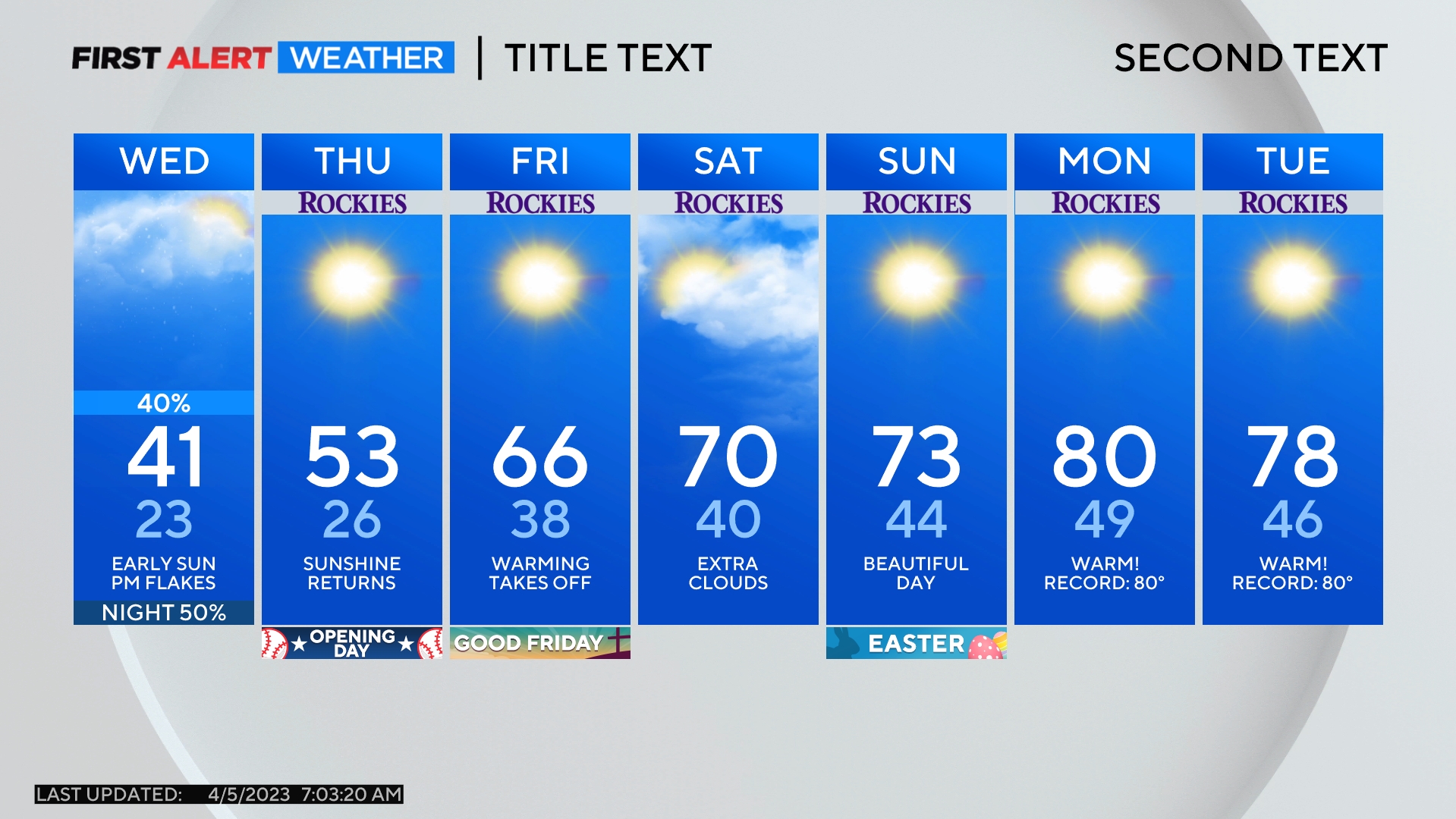
Denver Weather: A Few Afternoon Rain Showers, Severe Storms East
DENVER (CBS4) - As a fast moving storm passes over Colorado on Monday, it will generate mountain snow, afternoon rain showers along the Front Range, and a few thunderstorms that could turn borderline severe on the state's Eastern Plains.
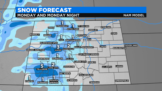
Snow in the mountains is expected to be minor with total accumulation through Monday night generally staying under 4 inches. A few areas in the San Juan Mountains could see a bit more since the storm is coming from the southwest.
Meanwhile, temperatures will be far too warm for snow in the Denver metro area so only rain is expected. Scattered showers will develop in the early afternoon and continue through early evening.
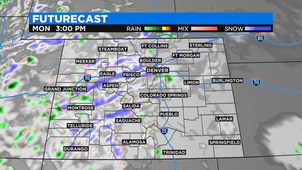
As the showers move east of Denver and the I-25 urban corridor, they will encounter an environment better suited for thunderstorms on the Eastern Plains. Therefore areas to the east - especially east of Limon and Fort Morgan - will likely hear a few rumbles of thunder Monday evening.
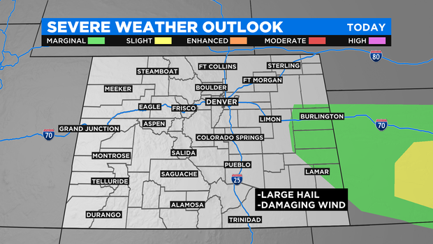
It's also possible a few thunderstorms closer to the Kansas stateline could turn severe with hail up to 1 inch in diameter being the primary concern. Wind up to 60 mph is also possibility but tornado's are very unlikely. Areas such as Burlington, Cheyenne Wells, and Lamar are under a "marginal" threat for severe weather Monday evening.
A shift in the weather pattern will be mainly dry and warmer weather for lower elevations in the state Tuesday, Wednesday, and Thursday. A few snow showers will continue to be possible in the mountains during this time.