Denver Weather: Snow Showers Possible Saturday, Widespread Snow Likely On Sunday
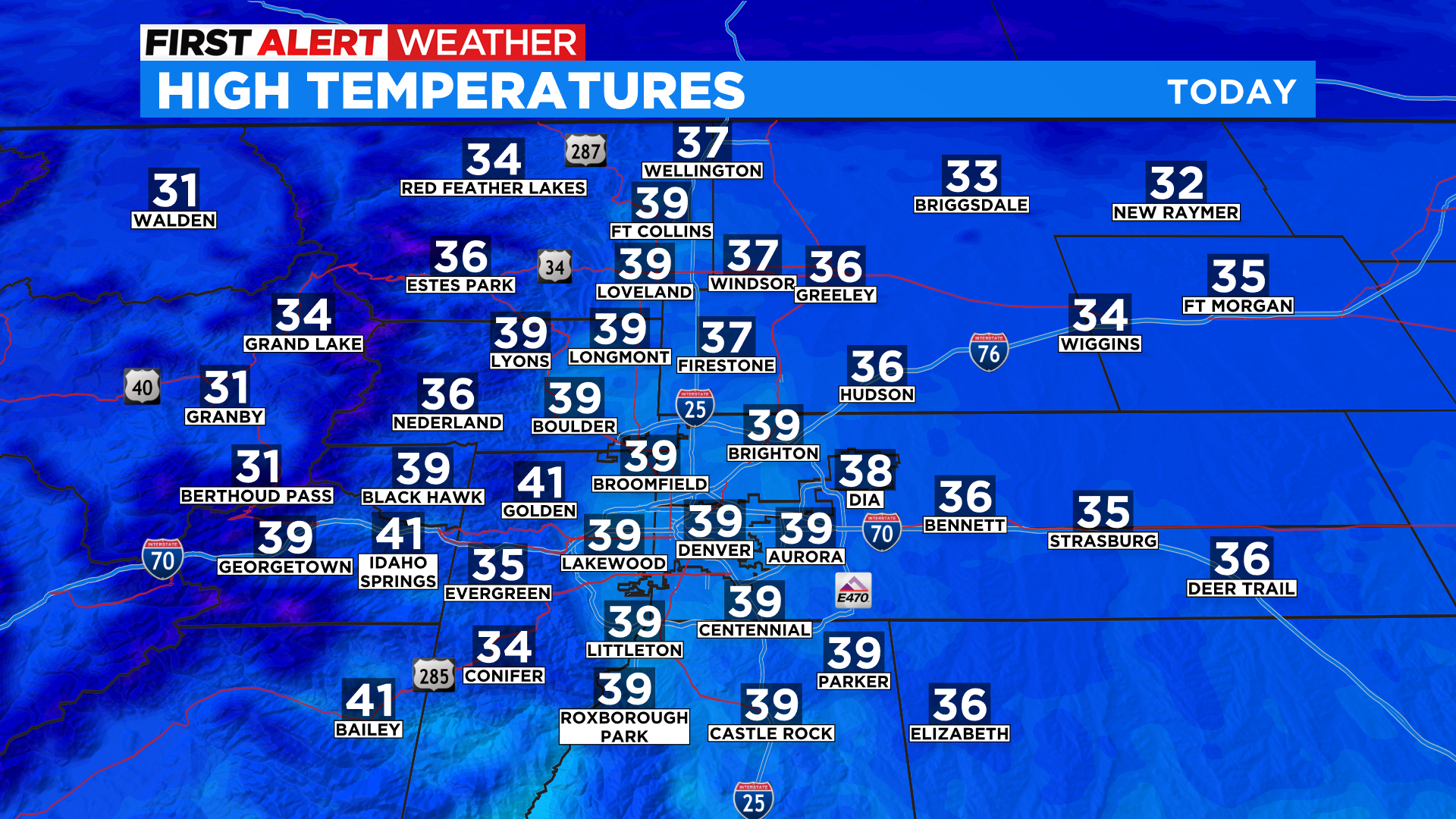
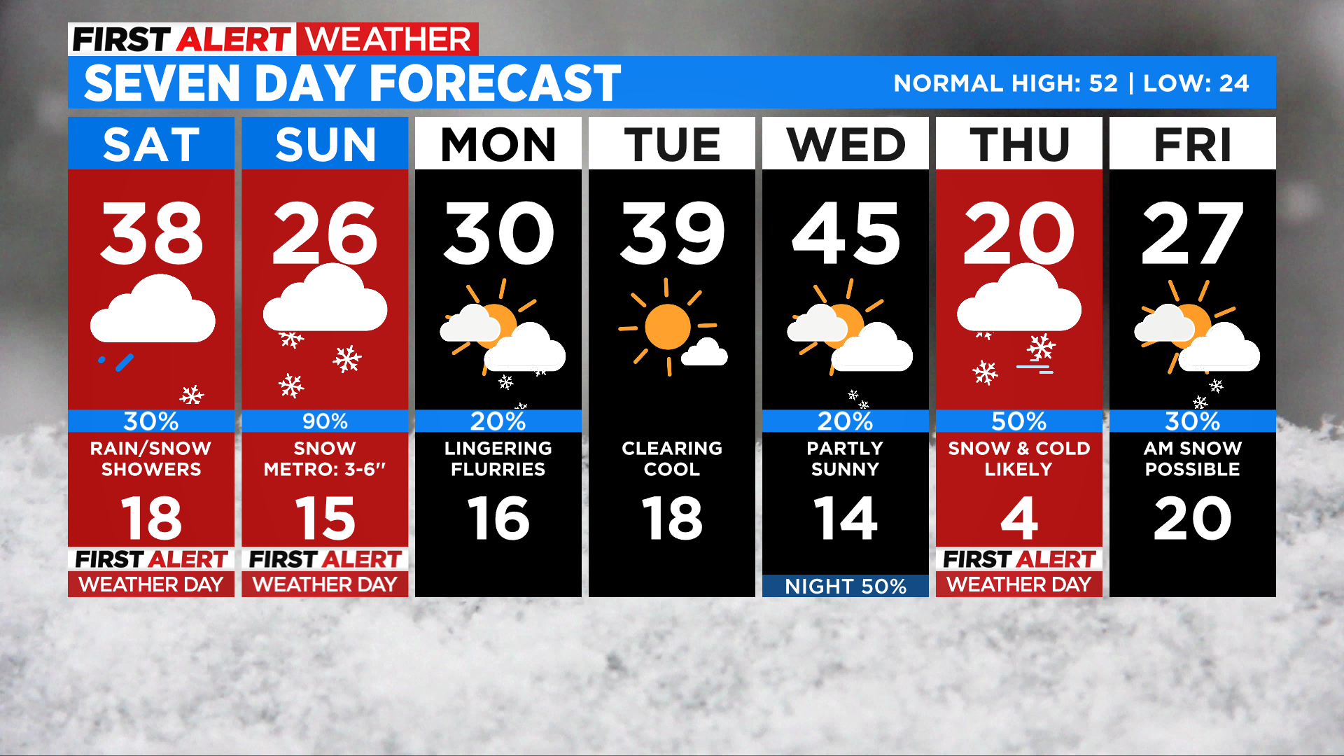
DENVER (CBS4) - Get ready for a much colder weekend with extensive cloud cover and the threat for occasional snow showers on Saturday, which is a First Alert Weather Day. Some places could even see a little rain in the lower elevations. Temperatures around metro Denver will hold in the 30s on Saturday. It will not rain or snow all day and some places may even stay completely dry through the afternoon.
By Sunday even colder air will move into the state along with a second wave of energy from this storm system. That will kick off more widespread snowfall starting Sunday morning with the flakes potentially sticking around until Monday morning in some areas.
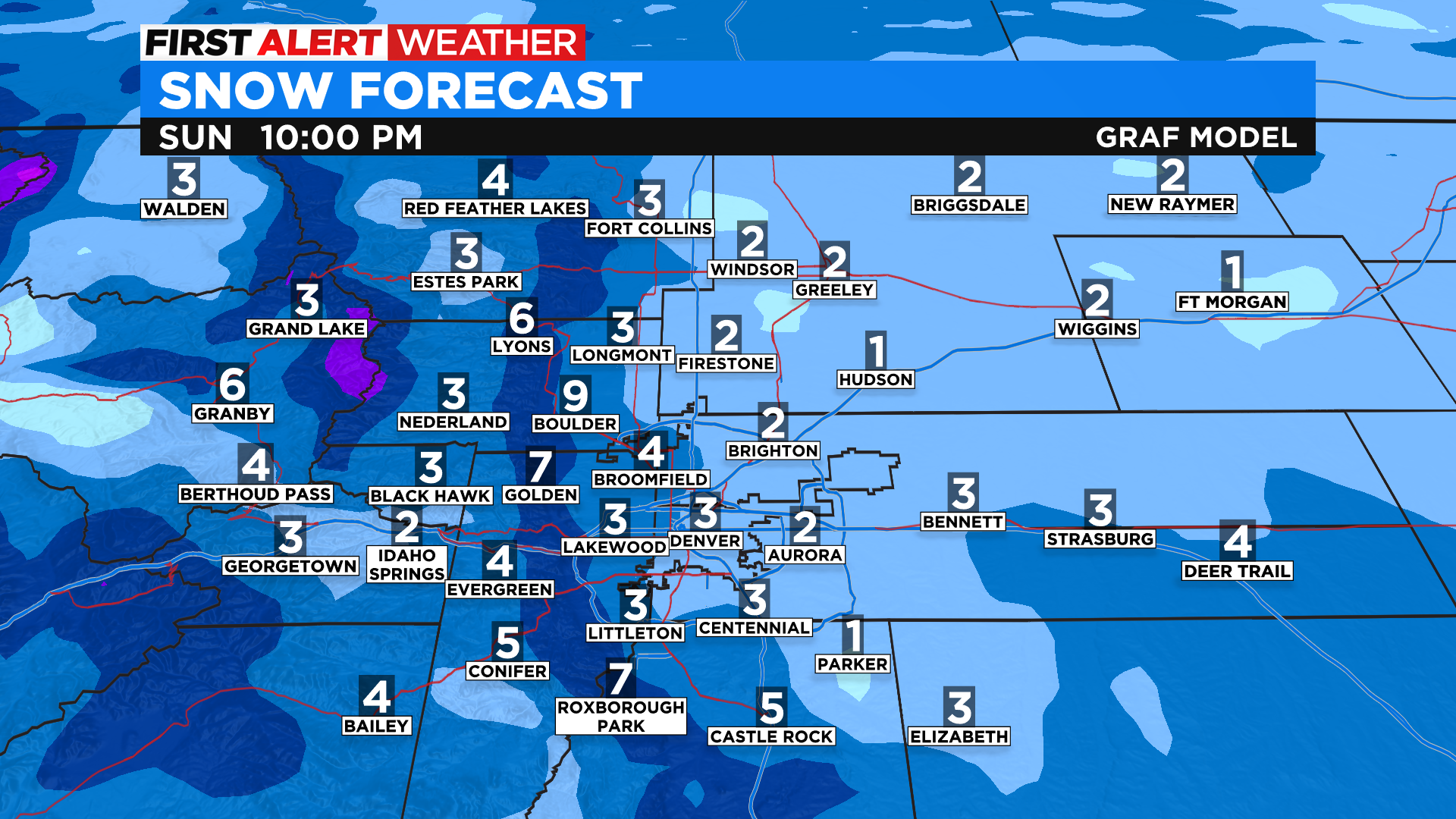
Predicting snow totals this time of year is more complicated than mid-winter due to the longer days and a higher sun angle. But as it stands right now we could end up with 3-6 inches of snow in metro Denver from this storm system. The map above is showing potential totals between now and Sunday night. In most cases all of this will fall on Sunday. We could have lingering snow showers and travel impacts for the Monday morning drive.
Looking ahead another batch of cold and snow is possible starting late Wednesday. Thursday could potentially bring record cold temperatures to the region with the threat for temperatures near or below zero by Thursday night into Friday morning.
The cold weather wasn't enough to stop people from plunging into cold water on Saturday. The Pueblo County Sheriff's Office hosted the Polar Plunge 2022 in Lake Pueblo.


