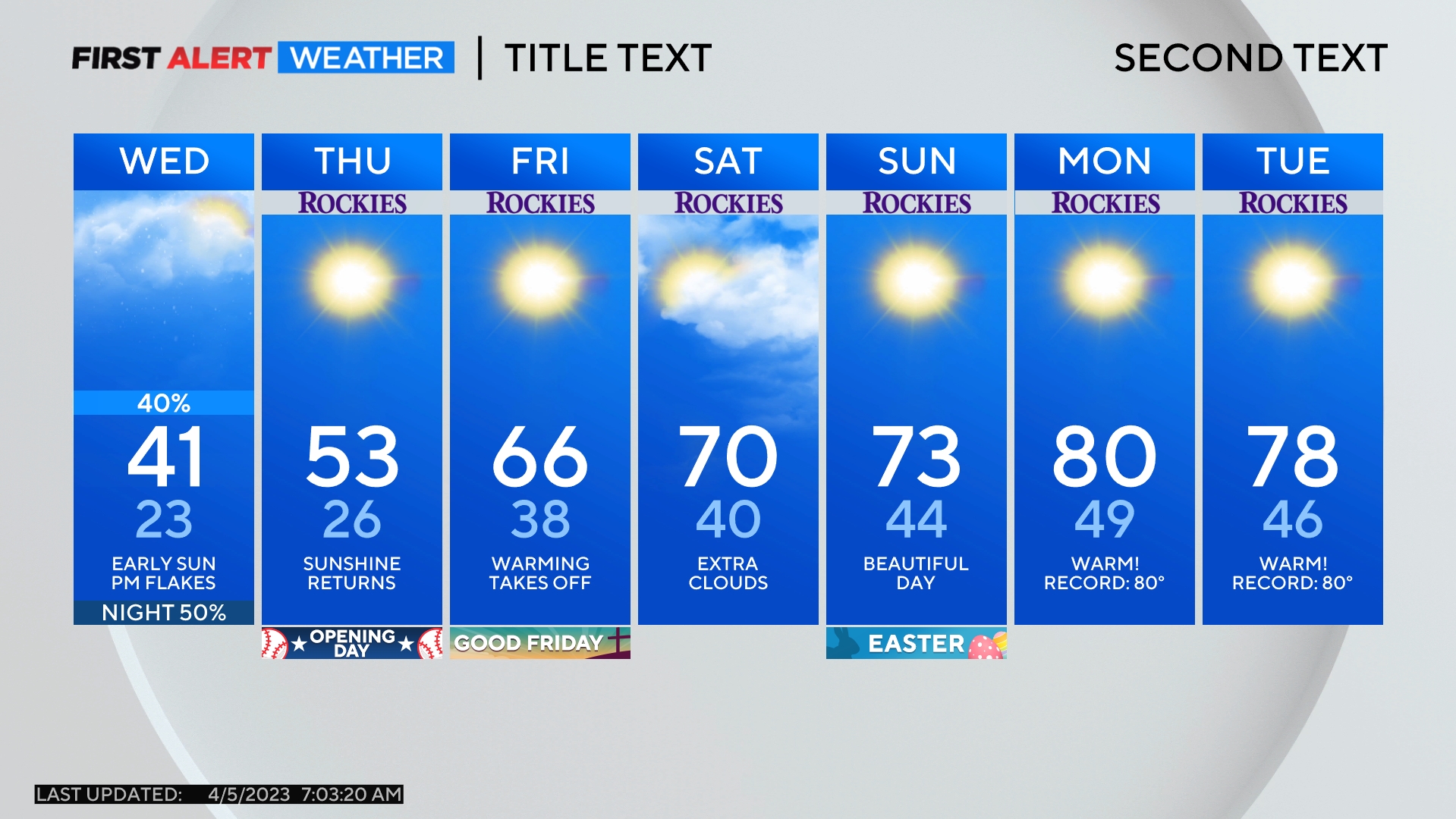
Denver Weather: Snow On The Way, Slick Evening Commute Possible
DENVER (CBS4) - Wednesday will start with areas of thick fog along the Front Front. The fog will give way to snow starting in the afternoon and some roads could be slick for the evening commute.
The fog will cause visibility under 1/4 mile in some areas and significant slowdowns are expected on some roads including the US 36 corridor between Boulder and Westminster and I-70 east of Colorado Boulevard.
The snow will start gradually in the afternoon followed by snow becoming likely after 5 p.m. Snow showers will then continue around Denver, Boulder, and Fort Collins through at least midnight before tapering off before daybreak on Thursday.
Most neighborhoods in the metro area will get no more than 1-2 inches of accumulation while many areas east of I-25 should get less than 1 inch. Meanwhile some areas west of I-25 could get as much as 4 inches of snow particularly near the base of the foothills.
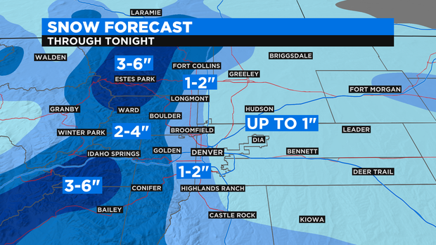
Drivers should plan on a snowy and slick evening commute on Wednesday mainly across the western half of the Denver metro area including around Littleton, Lakewood, Golden, Arvada, and Boulder. Roads could also be slick elsewhere but the worse conditions should be limited to the west side of town.
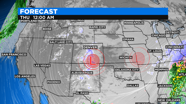
The snow is being caused by a storm system that will setup over southern Colorado Wednesday afternoon. The counter-clockwise flow around the storm will generate the easterly winds and "upslope" along the Front Range. This weather phenomenon usually causes snow and Wednesday should be no exception.
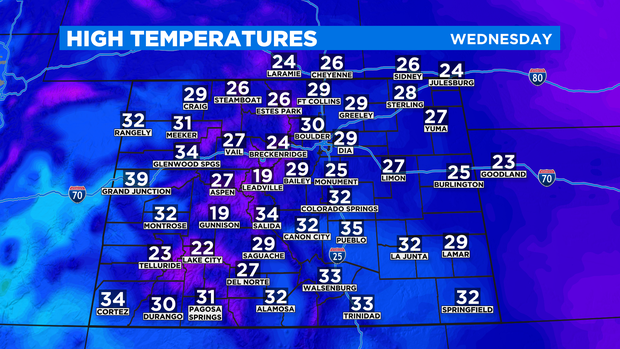
The storm system will also help keep temperatures chilly on Wednesday with highs staying below freezing across most of Colorado.
Snow is also expected in the mountains through Wednesday night with 2-4 inches at most ski areas. The next chance for any snow in the Denver metro area after Wednesday night will wait until Saturday. It doesn't look like much.