Snow and cold blast finishes Colorado workweek with accumulation in mountains and the Denver metro area
The third storm of the week blasts through Colorado on Friday, bringing in much colder temperatures and more snow. This time around not only will the mountains pick up lots snow, but Denver and the Eastern Plains may pick up light snow before the weekend arrives.
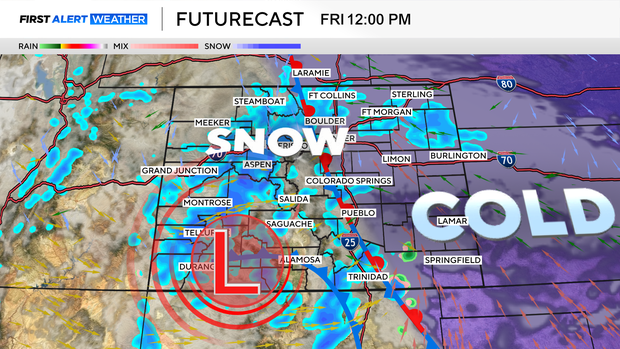
Friday is a First Alert Weather Day as colder air pushing in from the north mixes it up with another Pacific storm bringing in much needed moisture over the region.
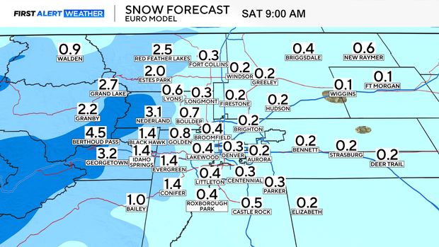
Let's start with the Denver metro area. A surge of cold air will keep high temperatures around the area in the low to middle 30s for the last day of the workweek.
There will be just enough moisture pushing in by late morning to get light snow going here and there. Most areas will see an inch or less of snowfall from the brief blast of wintry weather.
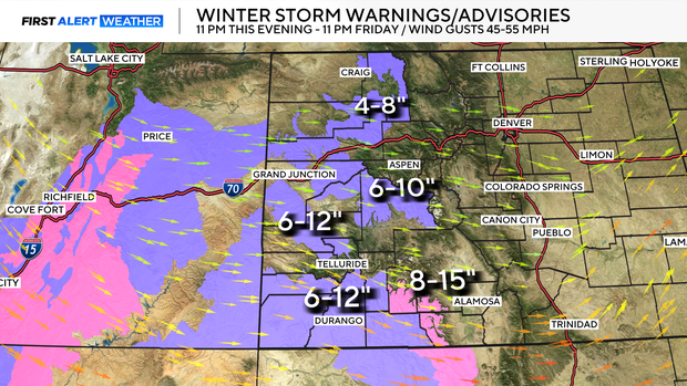
The mountains will see another helping of much-needed snowfall. This will be on top of areas that saw anywhere from 6 inches all the way up to over 2 feet from previous storms this week. Wolf Creek was the big winner with 28 inches of snow -- with more to come Friday.
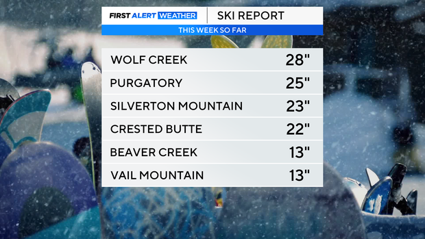
Purgatory ski area got 25 inches, Silverton had 23, Crested Butte had 22 and Beaver Creek and Vail each had 13 inches of new snow.
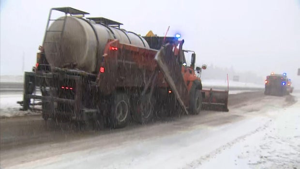
There are winter weather advisories and winter storm warnings for many western mountains through Friday night. Some areas may see up to another foot of snow in the southwest.
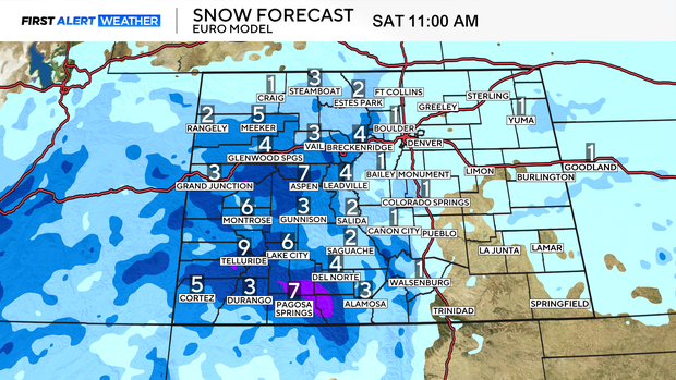
Other mountain areas including areas in and around Summit County will also see fresh snow before we get to Saturday morning.
Colorado's avalanche danger is currently rated high for many mountain areas.