Denver Records A Trace Of Snow From Early Season Winter Storm
DENVER (CBS4) - A fast-moving, but potent early season storm brought a taste of winter to much of the northern and central Rockies, but it wasn't enough to be called the first "measurable" snow of the season in Denver.
To be measurable, snow much total 0.1 inches or greater.
Officially, a trace of snow was observed at Denver International Airport and in some of Denver's higher suburbs.
But in south Boulder, the National Weather Service measured 0.5 inches outside their office.
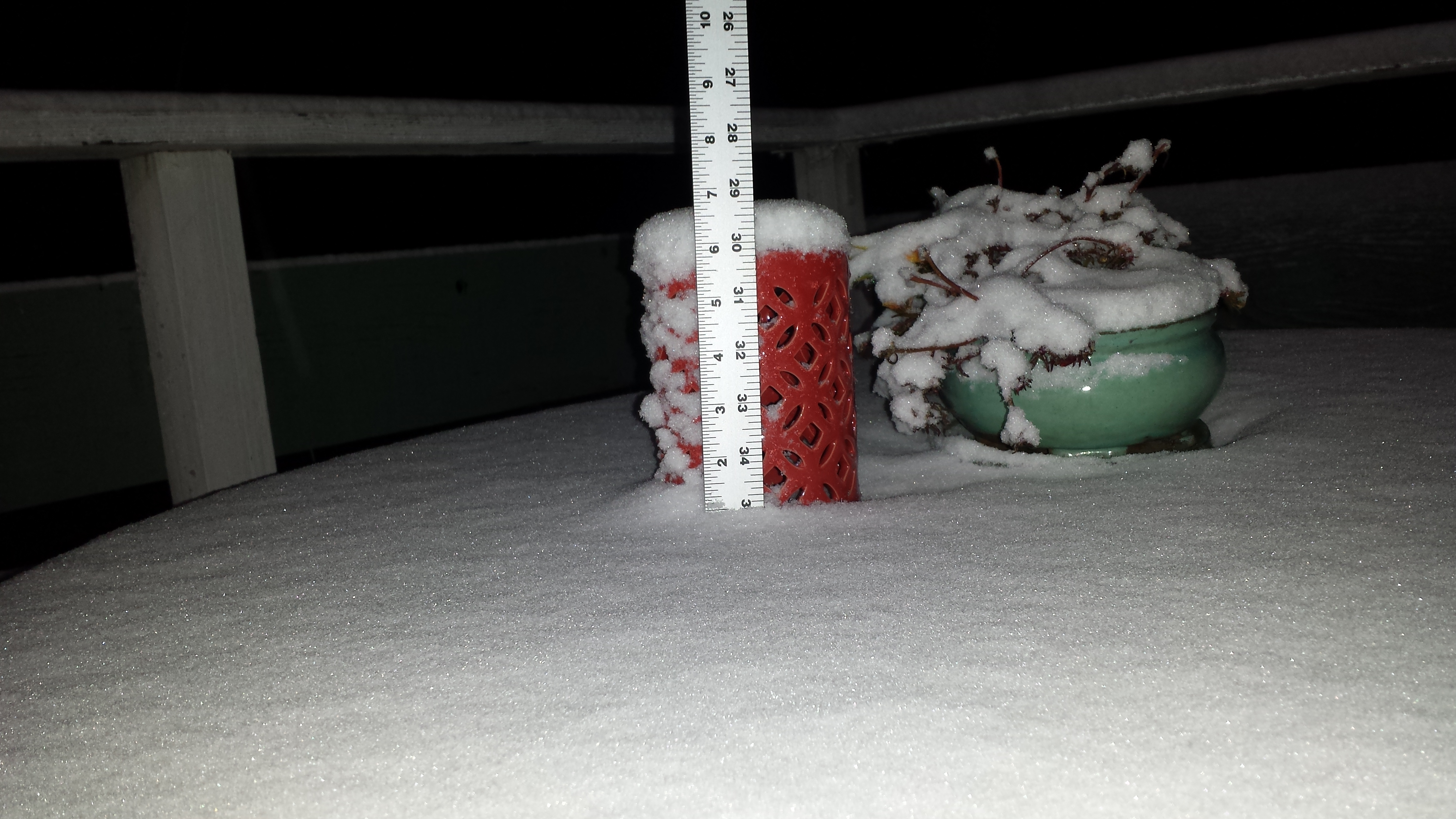 (credit: CBS Weather Watcher John Baich)
In the higher foothills northwest of Denver, CBS4 Weather Watcher John Baich measured 1 inch of snow in Coal Creek Canyon.
Some areas did see a brief burst of snow between 10 p.m. and midnight near the Wyoming state line, but the highest totals from the storm stayed well north of Colorado, with up to 6 inches falling in northern and central Wyoming.
There were several reports of broken tree branches in the town of Buffalo.
Another big story with this storm was the unseasonably cold temperatures it brought from Canada.
Lows Friday morning dipped into the lower and middle 20s across the foothills west of Denver with widespread low 30s in Denver on the Eastern Plains.
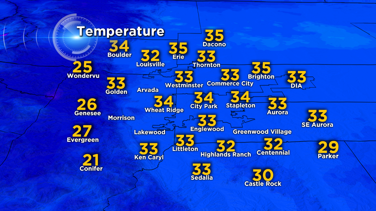 5 a.m. temperatures in the Denver metro area on Friday, September 12. (credit: CBS)
Temperatures will quickly rebound to the 70s on Saturday with low 80s expected in Denver by Sunday.