Denver Weather: 48 Hours Of Cold, Occasional Light Snow Starts Tonight
DENVER (CBS4) - Our active weather weekend continues with another round of cold and snow on the way. As predicted, the first front brought cooler temperatures and a quick burst of snow showers Saturday afternoon. Unfortunately, an intense snow squall near Denver International Airport caused nearly 50 vehicles to crash on Peña Boulevard. The squall left two inches of snow at the airport.

Today's cold front will be much different in that it will bring even colder air with temperatures falling into the single digits and teens for at least 48 hours. We'll also see occasional periods of light snow between Sunday night and Tuesday morning.
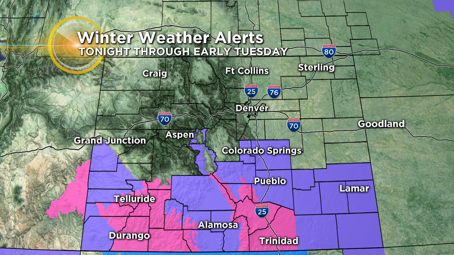
Southern Colorado will take the brunt of the snowfall from this storm with Winter Weather Advisories (purple) and Winter Storm Warnings (pink) in effect starting late Sunday and lasting into the morning hours on Tuesday. As of this posting, there were no advisories in effect for metro Denver, the adjacent foothills or the northeast plains, but that could change as the storm evolves.
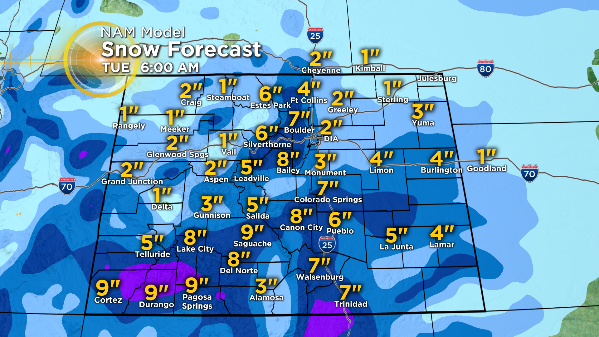
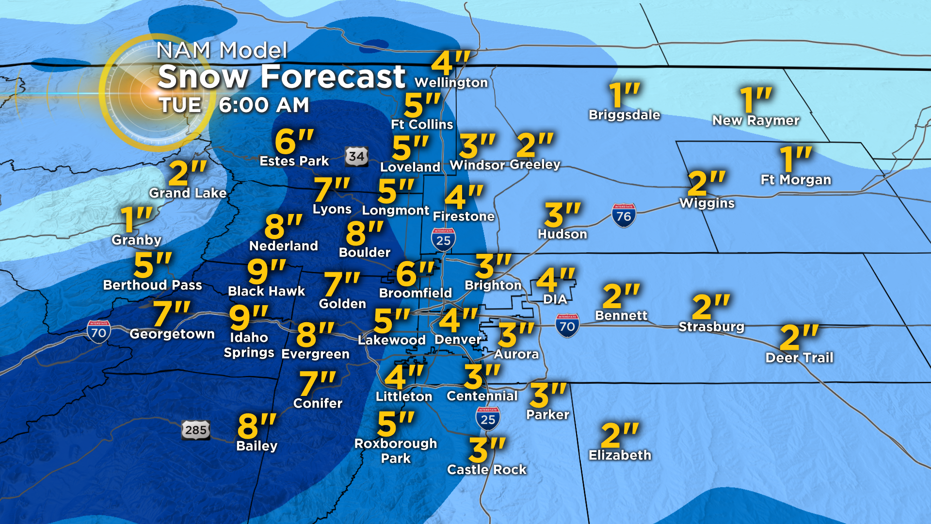
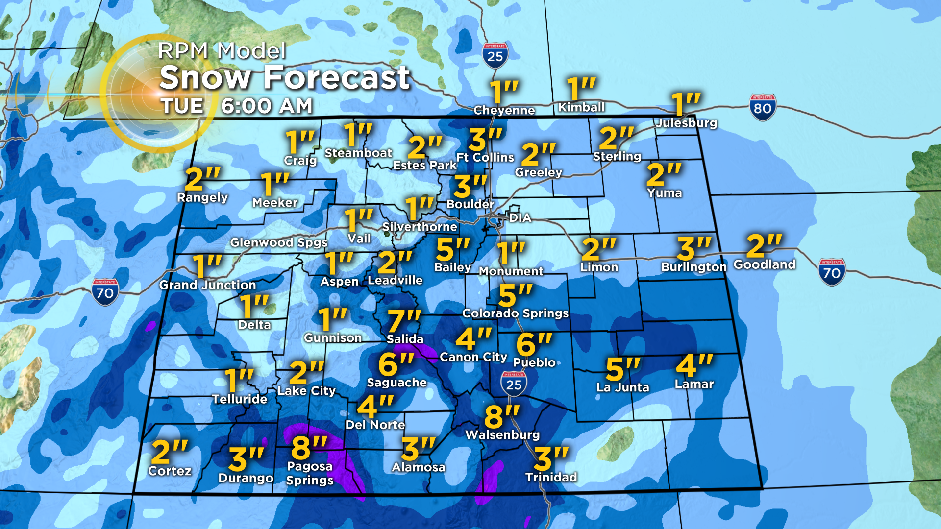
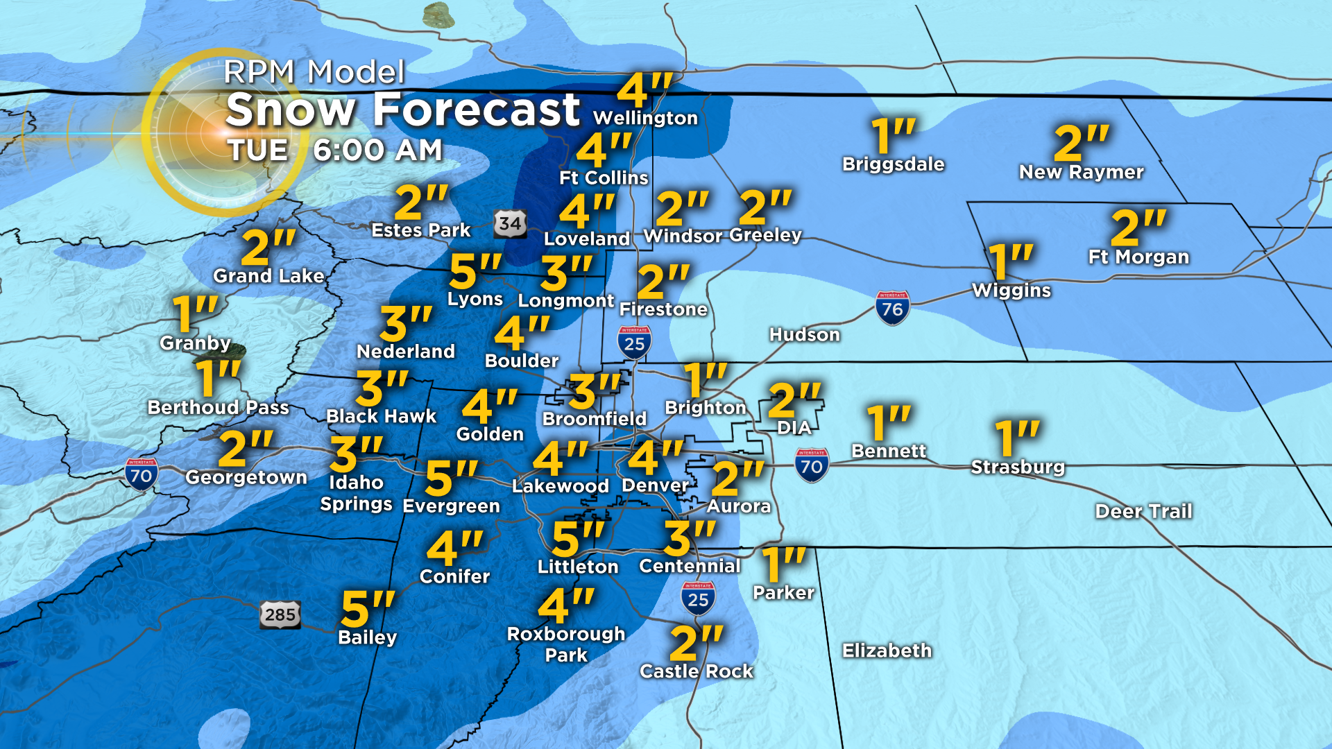
The following maps show anticipated snow totals from the RPM and NAM models which were ran at 6 a.m. Sunday. As the storm evolves the model data will change so we encourage you to check back with CBS4 for updates.
The totals shown in the images below are for the period starting Sunday night and ending Tuesday morning. Main points for this storm include...