Dangerous cold weekend ahead in Denver, arctic blast to bring frigid temperatures and snow to Colorado

It is January in Denver and the National Western Stock Show is in town, which can only mean one thing ... cold and snowy Colorado weather is around the corner.
It is a tradition at this point, and this year will be no different. An arctic blast will bring temperatures 20 to 40 degrees below average and a chance for snow.
An arctic front will arrive Friday evening bringing a surge of cold air and a shift in the winds. Denver is looking at a 72+ hour period beginning Saturday with temperatures in the single digits (maybe some low teens if we are lucky) and below 0 degrees. Wind chills will range from -- 10 degrees to -20 degrees at times.
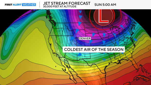
Overnight lows for much of the Front Range will be at or below 0. This will lead to life-threatening wind chills at times.
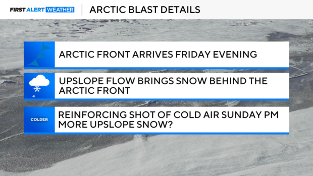
The other aspect to keep an eye on is the chance of upslope snow. The front will shift the winds to a more favorable direction (east) late Friday night. This will lead to dry, fluffy snow beginning Friday and lingering into the day on Saturday.
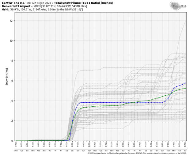
To predict snow totals this far out can be tricky, but we can use a tool called ensembled to give us a spread of outcomes with different atmospheric setups. Both the GFS and ECMWF show anywhere from 2 to 6 inches across Colorado's Front Range. This is a great range to plan around this far ahead of the storm. As we get closer to the system, we will fine-tune the forecast and give specifics in your neighborhood.
It is important to remember any weather impacts are still 120+ hours out, so minor details will continue to change, but the overall picture will remain the same:
- Dangerously cold air for the weekend
- Snow Friday night into Saturday
- Another reinforcement of cold air on Sunday
The First Alert Weather Team will continue to keep you updated all week. Please stay warm.


