Dangerous winds slam Colorado's Front Range; 90 mph gusts possible

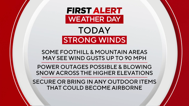
Tuesday is a First Alert Weather Day for high winds across Colorado's foothills, Front Range mountains, and parts of the northern urban corridor. Winds strong enough to cause damage — and already strong enough to trigger High Wind Warnings — will continue through this evening.
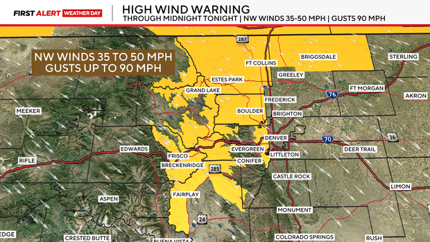
The National Weather Service upgraded its High Wind Watch to a High Wind Warning early Tuesday morning for Fort Collins, Boulder, the western Denver suburbs, and northern Weld County. Wind-prone areas, such as Boulder's western neighborhoods and the Highway 93 corridor, will likely see gusts near 75 mph, with the strongest gusts approaching 90 mph in the higher foothills.
According to the National Weather Service, a peak gust of 81 mph was already recorded at Dakota Hill before sunrise
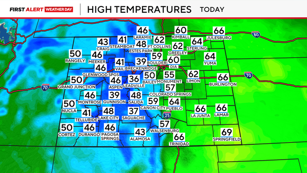
Most Denver metro area communities won't see damaging winds, but gusts between 25 and 35 mph will be common across the Denver metro area. Thanks to the downsloping winds, temperatures will surge into the low 60s on the plains.
Light snow will continue off and on across the northern mountains through Tuesday, becoming steadier Tuesday night. Most areas north of I-70 can expect 1 to 4 inches by Wednesday morning, with an additional 2 to 5 inches possible through Wednesday night.

Unfortunately, this isn't the end of the wind. Forecast models show another setup taking shape Wednesday night into Thursday morning, with gusts along the foothills once again reaching 70 mph, and nearby plains may see gusts around 50 mph.