Dangerous fire situation looming for parts of Colorado's Front Range, as another day of strong winds lies ahead
Dangerous weather conditions in Colorado are expected to team up for a surge in the Front Range fire danger. For most of the day Friday conditions will be favorable for rapid fire spread. Avoid outdoor burning and any activity that may produce a spark. Friday will be a First Alert Weather Day.
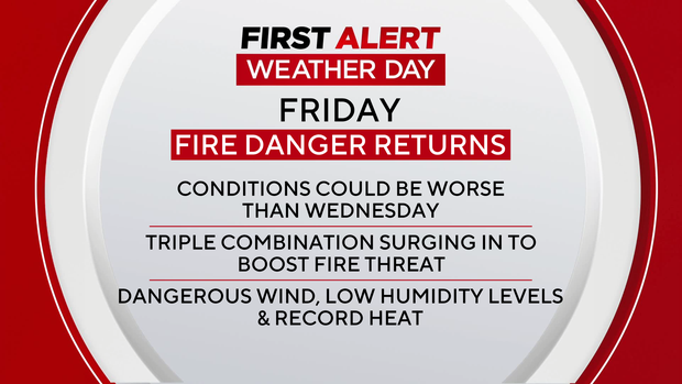
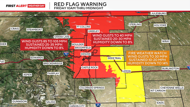
The triple threat of hurricane force winds, record heat and single digit relative humidity will all be in force from 10 a.m. to midnight on Friday. That is when a red flag warning for high fire danger is issued.
For the first time in Colorado, the National Weather Service office in Boulder has issued an extra warning know as "A Particularly Dangerous Situation" for northwest Jefferson and western Boulder counties for possible wind gusts of 85 to 105 mph.
The worst areas will be from Highway 93 up into the higher foothills. That, combined with single digit relative humidity, will make conditions worse that what the state experienced on Wednesday.
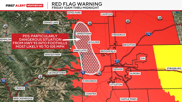
For the northern Front Range, the strongest winds will be west of I-25 into the foothills. Along and east of the I-25 corridor including the Denver metro area, winds may gust up to 40 mph with humidity levels as low as 8%. For that reason, the entire Denver metro area is in the warning area.
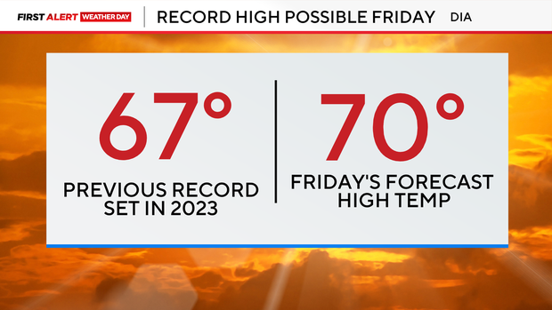
The strong winds will be warming downslope winds for eastern Colorado with highs on Friday shooting up into the 60s and 70s. Denver may have a new record high of 70 degrees. The old record is 67 degrees last set in 2023.
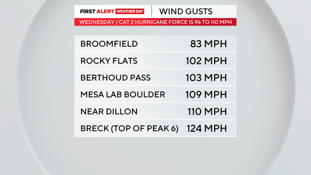
Top wind gusts may likely be stronger than Wednesday. Those gusts were hurricane force in some areas of the foothills and mountains with gusty winds comparable to those of a category 2 or 3 hurricane.