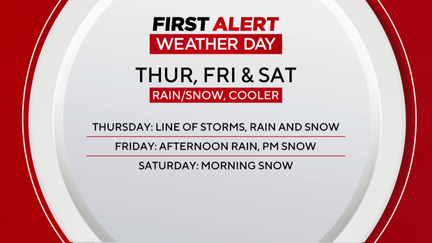
Cooler, unsettled weather across Colorado

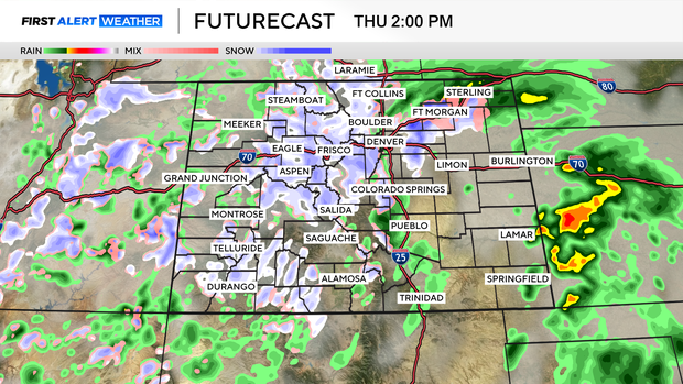
Thursday starts out with a mix of sun and clouds, but by early afternoon rain and snow will spread across Denver and the plains. A few thunderstorms are possible this afternoon and evening. We've issued a First Alert Weather Day for the cool, wet weather.
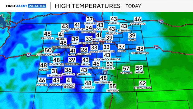
Daytime highs will be close to 20 degrees below normal in the upper 30s and low 40s in the Front Range with 20s and 30s in the mountains.
A trace to an inch of snow is possible for the Denver metro area, with 1-3 inches possible south and west. The foothills and the mountains will pick up between 2-5 inches of snow accumulation by Friday morning.
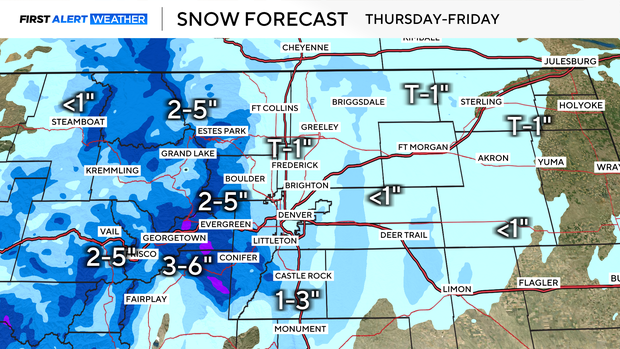
Another round of rain and snow arrives Friday afternoon into Saturday morning. Accumulation is expected to be 1-3 inches for the Denver metro area with higher totals to the south along the Palmer Divide with up to 6 inches possible. If you are heading to the Rockies game it will be chilly with the potential for wet weather, so make sure you dress in layers.
A warming and drying trend returns for the second half of the weekend and into next week with temperatures climbing back into the 60s and 70s.