Cooler temperatures arrive as cold front hits Colorado
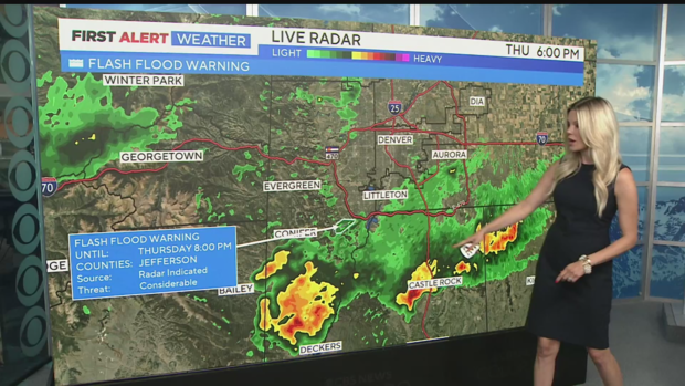
The much-anticipated cooler temperatures arrived earlier on Thursday as a cold front moved into the Front Range and eastern plains. Highs on Thursday didn't reach the 70s in the Denver area, following 15 consecutive days with highs above 90 degrees.
We won't stay this cool for long; however, temperatures aren't expected to soar back to the upper 90s anytime soon. Highs will climb to the mid-70s on Friday, mid-80s on Saturday, and then to the upper 80s and near normal on Sunday.
Rain chances are high statewide again on Friday. Heavy pockets of rain are likely in the southern mountains through most of the day, with a few storms possible in Denver in the early afternoon. Another round of rain may move through in the evening and late at night before clearing out to the eastern plains. In between these two waves, there could be some sunshine breaking through the clouds.
With the possibility of heavy rain, there is a concern for flooding in burn-scar areas. If you live near one of these areas, please remain very weather-aware on Friday.
Storm chances will continue through the weekend. As temperatures rise slightly, the chances for rain will decrease. The rain won't be as widespread, but afternoon storm chances will persist. This pattern is expected to continue through at least the middle of next week.
