Colorado's dry week could end with a big storm bringing heavy rain and mountain snow

Another storm is looming in Colorado's extended forecast, and we've seen this play out before.
The script remains familiar: A surge of Pacific moisture moves into the western United States, a storm system develops, and portions of Colorado could end up with heavy rain and mountain snow for the third week in a row.
Most of Colorado will stay dry through Saturday, Oct. 31, with temperatures gradually warming. A few mountain showers could sneak in late in the week, but the main window is Nov. 1-3.
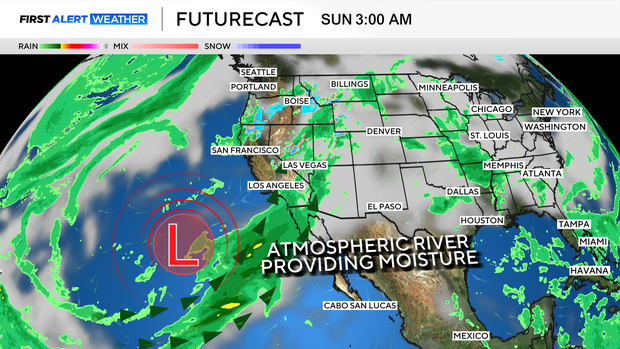
Two ingredients could come together: a lot of moisture and a well-placed storm system. Another surge of Pacific moisture is expected to reach the western United States, potentially associated with an atmospheric river. Meanwhile, a dip in the jet stream could help steer a storm south from the Pacific Northwest towards Colorado.
Just like that, we could be talking about another significant storm for the third week in a row.
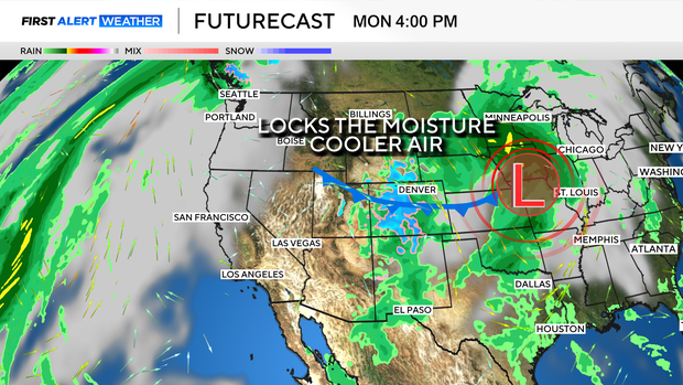
Here is what I find particularly interesting, and you may have noticed if you've been following the forecast closely: all the storms so far have favored southern and southwestern Colorado. And they're dropping tremendous amounts of moisture on these areas.
Remember our winter forecast? Southern Colorado was our highest-confidence region for above-average rain and snow.
That southern focus is in line with the type of pattern we watch during El Niño, when warmer-than-normal ocean water in the tropical Pacific can influence the jet stream and shift where storms tend to travel. Let's be clear: that doesn't mean El Niño caused every recent storm or that northern Colorado is going to miss out all winter.
You know what we always say: Track is key...
Nudge one of these storms a little farther north, and suddenly the Front Range and northern mountains could be looking at much bigger impacts.


