Colorado Weather: Hurricane Force Wind And Heavy Mountain Snow Mid-Week
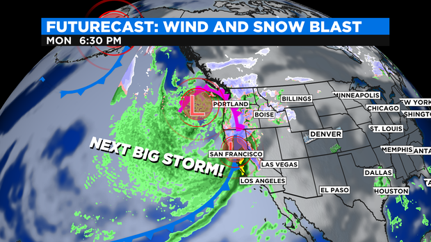
DENVER(CBS4)- A strong winter storm system is getting set to blast thru the Rockies by mid-week! The storm currently is excepted to dump 3 to 6 feet of snow in part of the Sierra Nevada mountains in California along with flooding rains near San Francisco this week.
When the storm arrives in Colorado on Wednesday there will be a combination of snow, rain, strong wind and fire danger all in one day! The Denver metro area may see morning rain on Wednesday with a chance for a rain/snow mix in and near the foothills or areas above 6,000 feet. Little to no accumulation is expected.
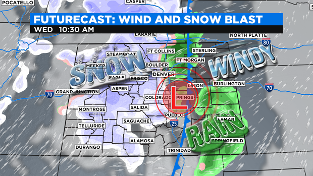
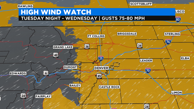
All of eastern Colorado including Denver and the Front Range foothills and mountains have a High Wind Watch in place for Wednesday. Some stronger winds may reach 70 to 80 mph!
The strong winds will briefly increase the Fire Danger for the Front Range on Wednesday before moisture moves in. This also includes areas near the Four Corners for damaging winds.
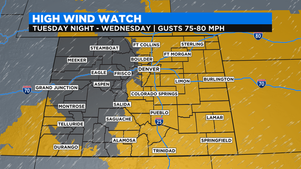
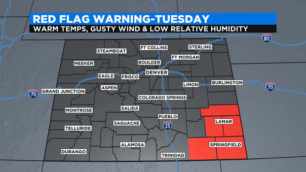
As of this writing, there is a Red Flag Warning for high fire danger for southeastern Colorado. This may be extended into larger areas of the state on Tuesday night into Wednesday as winds get stronger.
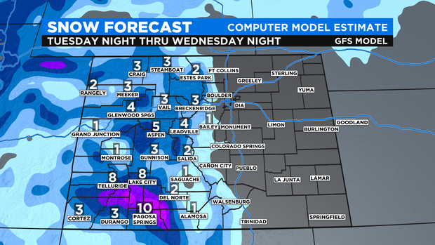
Along with strong, damaging winds the mountains will see a double whammy of wind and snow. The early warnings and advisories posted include parts of the San Juan mountains and Uncompahgre Plateau for 8 to 16 inches in some spots.
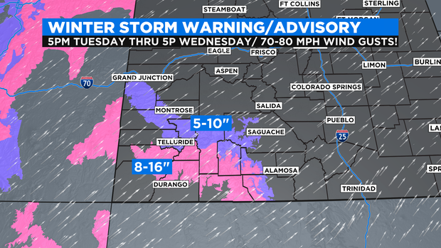
Additional warnings and advisories for the central and northern mountains may be initiated as we get closer to the event. At this time models are indicating about 3 to 6 inches of snow for the central and northern mountains.